more stats
1,181 ft
Distance
14 ft
Climb
-135 ft
Descent
00:03:49
Avg time
-119 ft
Altitude change
1,493 ft
Altitude min
1,614 ft
Altitude max
1,614 ft
Altitude start
1,496 ft
Altitude end
-10.1%
Grade
-37.1%
Grade max
6.3%
Grade min
338 ft
Distance climb
659 ft
Distance down
184 ft
Distance flat
00:03:49
Avg time

Colour Blind Details

  • Activities
    • Mountain Bike
    • E-Bike
  • Riding Area
  • Difficulty Rating
  • Voted Difficulty
    Blue (1 vote)
  • Local Popularity
    90 in Mountain Biking [+]
    • 100 in E-Biking
  • Global Ranking
    #18033 in Mountain Biking [+]
    • #4292 in E-Biking
  • Trail Type
    Singletrack
  • Bike Type
    DH, AM, XC
  • Direction
    Downhill Only
    Popular Direction Shown
  • Trail Visibility
    Always easy to follow
  • eBike Allowed
    Yes up to Class 1
  • TTFs on Trail
    Berm, Jump
  • Land Owner
    MBP

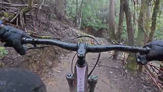
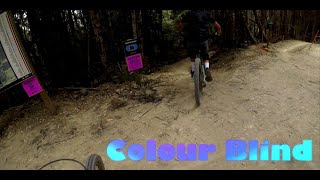
An MBP classic, Colour Blind features seemingly endless berms and rollers. Beginning at our Lower Mountain Trailhead, riders can continue on down a black diamond lower section called 2020, or transfer over to neighbouring green trail Scandinavia.

Bike Park

Local Trail Association
  • trail association logo
  • Please consider joining or donating to the local trail association to support
    trail development & maintenance.
Traditionally Indigenous Territory

Recent Activity on Trail

Past Week
  • 1 rides
  • 4 miles average
6 Months
  • 147 rides
  • 14 miles avg distance
All
  • 1,014 rides
  • Last: Jun 11, 2026
c1c2c3c4
January
February
March
April
May
June
July
August
September
October
November
December
update trails status or condition

Colour Blind Trail Reports

Status:
on Sep 27, 2024
Avg: 4.18 (10 votes)
Your vote: 0

view (8,351)
close
3D
Trail Conditions
  • Unknown
  • Snow Groomed
  • Snow Packed
  • Snow Covered
  • Snow Cover Partial
  • Freeze/thaw Cycle
  • Icy
  • Prevalent Mud
  • Wet
  • Variable
  • Ideal
  • Dry
  • Very Dry
Trail Flow (Ridden Direction)
Trailforks scans users ridelogs to determine the most popular direction each trail is ridden. A good flowing trail network will have most trails flowing in a single direction according to their intension.
The colour categories are based on what percentage of riders are riding a trail in its intended direction.
  • > 96%
  • > 90%
  • > 80%
  • > 70%
  • > 50%
  • < 50%
  • bi-directional trail
  • no data
Trail Last Ridden
Trailforks scans ridelogs to determine the last time a trail was ridden.
  • < 2 days
  • < 1 week
  • < 2 weeks
  • < 1 month
  • < 6 months
  • > 6 months
Trail Ridden Direction
The intended direction a trail should be ridden.
  • Downhill Only
  • Downhill Primary
  • Both Directions
  • Uphill Primary
  • Uphill Only
  • One Direction
Contribute Details
Colors indicate trail is missing specified detail.
  • Description
  • Photos
  • Description & Photos
  • Videos
Trail Popularity ?
Trailforks scans ridelogs to determine which trails are ridden the most in the last 9 months. Trails are compared with nearby trails in the same city region with a possible 25 colour shades. Think of this as a heatmap, more rides = more kinetic energy = warmer colors.
  • most popular
  • popular
  • less popular
  • not popular
ATV/ORV/OHV Filter
Max Vehicle Width
inches
US Cell Coverage
Legend
cell carrier legend

Radar Time
Activity Recordings
Trailforks uses anonymized public activity data. ?
Activity Recordings
Trailforks uses anonymized public activity data. ?
Personal Heatmap
Activity Types
all / none
Options
2
Date range month
Winter Trails
Warning A routing network for winter maps does not exist. Selecting trails using the winter trails layer has been disabled.
Missing Trails
Most Popular
Least Popular
Trails are colored based on popularity. The more popular a trail is, the more red. Less popular trails trend towards green.
Jump Magnitude Heatmap
Heatmap of where riders jump on trails. Zoom in to see individual jumps, click circles to view jump details.
BC Backroad Status

Service Road Atlas is a free to use, community-driven service for viewing and creating reports on the numerous back-country service roads around B.C. and Alberta.

map legend
Slope Aspect
Direction the slope faces
Flat N NE E SE S SW W NW
Trails Deemphasized
Trails are shown in grey.
disable
Only show trails with no bike usage.
Enable
Suggested Layers
Based on selected activity type

    Save the current map location and zoom level as your default home location whenever this page is loaded.

    Save
        Directions to colour-blind trailhead (-42.765360, 146.634520)

        Photos

        3 more »
        434 |
        Jan 16, 2020 @ 2:53pm
        Jan 16, 2020
        356 |
        Feb 10, 2019 @ 9:50pm
        Feb 10, 2019
        254 |
        Feb 10, 2019 @ 9:51pm
        Feb 10, 2019

        Videos

        8 more »
        Maydena Mountain Bike Park - Colour Blind
        3:15 | 61 | Oct 24, 2024 , Maydena
        Maydena Summit to the Bottom
        21:50 | 77 | Jan 31, 2023 , Maydena
        Colour Blind @Maydena Bike Park (Tasmania)​
        2:51 | 192 | Oct 31, 2022 , Maydena
        Maydena Colourblind
        0:52 | 232 | Feb 25, 2022 , Maydena

        Trail Lists

        Routes with this trail

        5.0 30 miles 7,517 ft 35
        a fun weekend of riding. nothing to technical. all fun and flowy.
        4 miles 748 ft 11
        the tas gravity endro at maydena bike park the challenge event.
        4 miles 114 ft 14
        Im just wanting to copy parts of this for my other routes lol

        2 Reviews & Comments


        We hope you've been enjoying Trailforks!

        Create a FREE account to view trail comments and much more.

        • By mjjrTF Pro & contributors
        • #134701 - 1,557 views

        Frequently Asked Questions About Colour Blind

        Where is Colour Blind located?
        Colour Blind is located in Maydena Bike Park, Maydena, Australia. It is part of the Maydena Bike Park trail network. The trailhead is located at coordinates -42.76536, 146.63452.
        How hard is Colour Blind?
        Colour Blind is rated as Blue difficulty. The average grade is 10.1%.
        What is the elevation gain for Colour Blind?
        Colour Blind has 14 ft of elevation gain. The trail has 135 ft of elevation descent. The elevation ranges from 1,493 ft to 1,614 ft.
        Is Colour Blind a point to point trail?
        Yes, Colour Blind is a point to point trail. The direction is Downhill Only. The trail type is singletrack.

        Hit the Trail

        Open in App

        Get this trail on your phone instantly.
        open trail in app

        Download Trail

        Save to wishlist, Garmin & download.
        save the trail

        Find Related Routes

        Find routes and users activities that include this trail.
        find routes for this trail

        You must enter a description before submitting.