more stats
1.1 miles
Distance
233 ft
Climb
-287 ft
Descent
00:18:24
Avg time
-54 ft
Altitude change
2,325 ft
Altitude min
2,613 ft
Altitude max
2,380 ft
Altitude start
2,326 ft
Altitude end
-0.9%
Grade
-22.3%
Grade max
20.1%
Grade min
2,543 ft
Distance climb
2,418 ft
Distance down
860 ft
Distance flat
00:18:24
Avg time

Communication Breakdown Details

  • Activities
    • Mountain Bike
    • Trail Running
  • Riding Area
    Sandy Ridge
    Sandy, Oregon
  • Difficulty Rating
  • Voted Difficulty
    Blue (5 votes)
  • Local Popularity
    80 in Mountain Biking [+]
    • 5 in Trail Running
  • Global Ranking
    #54487 in Mountain Biking [+]
    • #260456 in Trail Running
  • Trail Type
    Singletrack
  • Bike Type
    AM, XC
  • Dogs Allowed
    Yes
  • Land Owner

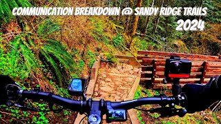
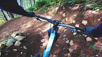
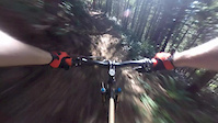
Communication Breakdown starts from a climb up Rock Drop. The first part of the trail is a pedal up through large sweeping berms. The grade is steady but not lung busting.

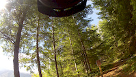
Be sure to stop and enjoy the views from green rock down across the valley.

The descent on Communication Breakdown is well worth the climb. It's almost a continuous stream of berms to the intersection with Quid Pro Flow.

Trail Supporters
Local Trail Association
Traditionally Indigenous Territory

Recent Activity on Trail

Past Week
  • 8 rides
  • 17 miles average
6 Months
  • 120 rides
  • 15 miles avg distance
All
  • 1,223 rides
  • Last: Jun 19, 2026
c1c2c3c4
January
February
March
April
May
June
July
August
September
October
November
December
Status:
on Jun 13, 2026
Ideal
Avg: 4 (27 votes)
Your vote: 0

view (6,892)
close
3D
Trail Conditions
  • Unknown
  • Snow Groomed
  • Snow Packed
  • Snow Covered
  • Snow Cover Partial
  • Freeze/thaw Cycle
  • Icy
  • Prevalent Mud
  • Wet
  • Variable
  • Ideal
  • Dry
  • Very Dry
Trail Flow (Ridden Direction)
Trailforks scans users ridelogs to determine the most popular direction each trail is ridden. A good flowing trail network will have most trails flowing in a single direction according to their intension.
The colour categories are based on what percentage of riders are riding a trail in its intended direction.
  • > 96%
  • > 90%
  • > 80%
  • > 70%
  • > 50%
  • < 50%
  • bi-directional trail
  • no data
Trail Last Ridden
Trailforks scans ridelogs to determine the last time a trail was ridden.
  • < 2 days
  • < 1 week
  • < 2 weeks
  • < 1 month
  • < 6 months
  • > 6 months
Trail Ridden Direction
The intended direction a trail should be ridden.
  • Downhill Only
  • Downhill Primary
  • Both Directions
  • Uphill Primary
  • Uphill Only
  • One Direction
Contribute Details
Colors indicate trail is missing specified detail.
  • Description
  • Photos
  • Description & Photos
  • Videos
Trail Popularity ?
Trailforks scans ridelogs to determine which trails are ridden the most in the last 9 months. Trails are compared with nearby trails in the same city region with a possible 25 colour shades. Think of this as a heatmap, more rides = more kinetic energy = warmer colors.
  • most popular
  • popular
  • less popular
  • not popular
ATV/ORV/OHV Filter
Max Vehicle Width
inches
US Cell Coverage
Legend
cell carrier legend

Radar Time
Activity Recordings
Trailforks uses anonymized public activity data. ?
Activity Recordings
Trailforks uses anonymized public activity data. ?
Personal Heatmap
Activity Types
all / none
Options
2
Date range month
Winter Trails
Warning A routing network for winter maps does not exist. Selecting trails using the winter trails layer has been disabled.
Missing Trails
Most Popular
Least Popular
Trails are colored based on popularity. The more popular a trail is, the more red. Less popular trails trend towards green.
Jump Magnitude Heatmap
Heatmap of where riders jump on trails. Zoom in to see individual jumps, click circles to view jump details.
BC Backroad Status

Service Road Atlas is a free to use, community-driven service for viewing and creating reports on the numerous back-country service roads around B.C. and Alberta.

map legend
Slope Aspect
Direction the slope faces
Flat N NE E SE S SW W NW
Trails Deemphasized
Trails are shown in grey.
disable
Only show trails with no bike usage.
Enable
Suggested Layers
Based on selected activity type

    Save the current map location and zoom level as your default home location whenever this page is loaded.

    Save
        Directions to communication-breakdown trailhead (45.399720, -122.024020)

        Photos

        21 more »
        380 |
        Apr 13, 2017 @ 7:49pm
        Apr 13, 2017
        628 |
        Nov 23, 2013 @ 11:50pm
        Nov 23, 2013
        244 |
        Apr 28, 2019 @ 6:05pm
        Apr 28, 2019
        486 |
        Nov 23, 2013 @ 11:50pm
        Nov 23, 2013

        Videos

        4 more »
        Communication Breakdown 2024
        2:58 | 149 | Jul 18, 2024 , Sandy
        Communication Breakdown
        0:53 | 351 | Nov 14, 2018 , Sandy
        Communication Breakdown - Sandy Ridge
        3:12 | 296 | Sep 21, 2015 , Sandy
        Communication Breakdown
        3:02 | 203 | Sep 10, 2015 , Sandy

        Routes with this trail

        5.0 9 miles 1,761 ft 5 Loop
        Those whoops and hollers in the woods at Sandy Ridge aren’t Bigfoot but your fellow riders expressing...
        13 miles 2,458 ft 7 Loop
        evo Trailgate Sandy Ridge eBike Route 2025
        12 miles 2,330 ft 5 Loop
        Fun tour of the flows and blues.

        3 Reviews & Comments


        We hope you've been enjoying Trailforks!

        Create a FREE account to view trail comments and much more.

        • By jerschwabTF Pro & contributors
        • #32136 - 5,323 views

        Frequently Asked Questions About Communication Breakdown

        Where is Communication Breakdown located?
        Communication Breakdown is located in Sandy Ridge, Sandy, Oregon, United States. It is part of the Sandy Ridge trail network. The trailhead is located at coordinates 45.39972, -122.02402.
        How hard is Communication Breakdown?
        Communication Breakdown is rated as Blue difficulty. The average grade is 0.9%.
        What is the elevation gain for Communication Breakdown?
        Communication Breakdown has 233 ft of elevation gain. The trail has 287 ft of elevation descent. The elevation ranges from 2,325 ft to 2,613 ft.
        How long is Communication Breakdown?
        Communication Breakdown is 1.1 miles long. The trail type is singletrack.

        Hit the Trail

        Open in App

        Get this trail on your phone instantly.
        open trail in app

        Download Trail

        Save to wishlist, Garmin & download.
        save the trail

        Find Related Routes

        Find routes and users activities that include this trail.
        find routes for this trail

        You must enter a description before submitting.