more stats
3,862 ft
Distance
-674 ft
Descent
00:07:52
Avg time
-675 ft
Altitude change
1,004 ft
Altitude min
1,679 ft
Altitude max
1,679 ft
Altitude start
1,004 ft
Altitude end
-17.5%
Grade
-72.5%
Grade max
-1.4%
Grade min
3,862 ft
Distance down
00:07:52
Avg time

Cookies Details

  • Activities
    • Mountain Bike
    • Hike
    • Trail Running
  • Riding Area
    Topanga Creek
    Calabasas, California
  • Difficulty Rating
  • Voted Difficulty
    Black Diamond (1 vote)
  • Global Ranking
    #123585 in Mountain Biking [+]
    • #127185 in Trail Running
    • #120385 in Hiking
  • Trail Type
    Singletrack
  • Bike Type
    DH, AM
  • Direction
    Downhill Only
    Popular Direction Shown
  • Dogs Allowed
    Yes
  • TTFs on Trail
    Berm, Drop, Rock Garden
  • Year Opened
    2006

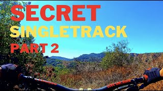
A steep and loose trail with a large rut at the bottom. Constantly evolving with maintenance. About the same skill as Hectic. This trail has less hikers than Cabarello, but the hikers are less likely to be expecting bike traffic. Please use a bell and remember the majority of users are hikers from the San Fernando Valley.

Local Trail Association
Traditionally Indigenous Territory

Recent Activity on Trail

Past Week
  • 0 rides
  •  
6 Months
  • 5 rides
  • 12 miles avg distance
All
  • 76 rides
  • Last: Jun 7, 2026
c1c2c3c4
January
February
March
April
May
June
July
August
September
October
November
December
update trails status or condition

Cookies Trail Reports

statusdatedescription
Jan 25, 2026 @ 6:27pm (America/Los_Angeles)
Jan 25, 2026
Ruts, 1 feet max depth, rideable
Jan 12, 2026 @ 12:08am (America/Los_Angeles)
Jan 12, 2026
Upper 3/4 is fine, could use some work but at the bottom there is major erosion and huge unridable ruts.
Aug 16, 2025 @ 3:17pm
Aug 16, 2025
The work on the Beginning is great, but it's kind of lost on where to go. The lower is so loose that I couldn't find a good line; I had to brake...
Jun 21, 2025 @ 12:44pm
Jun 21, 2025
I’ve been riding it every week and it’s good, thanks for the work that people are doing on it.
Mar 17, 2025 @ 9:02pm
Mar 17, 2025
Gone , fire crews destroyed this trail. Work incoming for cookies 2.0
more »
Status:
on Jan 25, 2026
Dry
Avg: 3.82 (6 votes)
Your vote: 0

view (0)
close
3D
Trail Conditions
  • Unknown
  • Snow Groomed
  • Snow Packed
  • Snow Covered
  • Snow Cover Partial
  • Freeze/thaw Cycle
  • Icy
  • Prevalent Mud
  • Wet
  • Variable
  • Ideal
  • Dry
  • Very Dry
Trail Flow (Ridden Direction)
Trailforks scans users ridelogs to determine the most popular direction each trail is ridden. A good flowing trail network will have most trails flowing in a single direction according to their intension.
The colour categories are based on what percentage of riders are riding a trail in its intended direction.
  • > 96%
  • > 90%
  • > 80%
  • > 70%
  • > 50%
  • < 50%
  • bi-directional trail
  • no data
Trail Last Ridden
Trailforks scans ridelogs to determine the last time a trail was ridden.
  • < 2 days
  • < 1 week
  • < 2 weeks
  • < 1 month
  • < 6 months
  • > 6 months
Trail Ridden Direction
The intended direction a trail should be ridden.
  • Downhill Only
  • Downhill Primary
  • Both Directions
  • Uphill Primary
  • Uphill Only
  • One Direction
Contribute Details
Colors indicate trail is missing specified detail.
  • Description
  • Photos
  • Description & Photos
  • Videos
Trail Popularity ?
Trailforks scans ridelogs to determine which trails are ridden the most in the last 9 months. Trails are compared with nearby trails in the same city region with a possible 25 colour shades. Think of this as a heatmap, more rides = more kinetic energy = warmer colors.
  • most popular
  • popular
  • less popular
  • not popular
ATV/ORV/OHV Filter
Max Vehicle Width
inches
US Cell Coverage
Legend
cell carrier legend

Radar Time
Activity Recordings
Trailforks uses anonymized public activity data. ?
Activity Recordings
Trailforks uses anonymized public activity data. ?
Personal Heatmap
Activity Types
all / none
Options
2
Date range month
Winter Trails
Warning A routing network for winter maps does not exist. Selecting trails using the winter trails layer has been disabled.
Missing Trails
Most Popular
Least Popular
Trails are colored based on popularity. The more popular a trail is, the more red. Less popular trails trend towards green.
Jump Magnitude Heatmap
Heatmap of where riders jump on trails. Zoom in to see individual jumps, click circles to view jump details.
BC Backroad Status

Service Road Atlas is a free to use, community-driven service for viewing and creating reports on the numerous back-country service roads around B.C. and Alberta.

map legend
Slope Aspect
Direction the slope faces
Flat N NE E SE S SW W NW
Trails Deemphasized
Trails are shown in grey.
disable
Only show trails with no bike usage.
Enable
Suggested Layers
Based on selected activity type

    Save the current map location and zoom level as your default home location whenever this page is loaded.

    Save
        Directions to cookies trailhead (34.131200, -118.538130)

        Photos

        32 more »
        130 |
        Jan 11, 2022 @ 7:49pm
        Jan 11, 2022
        127 |
        Jan 11, 2022 @ 7:49pm
        Jan 11, 2022
        141 |
        Jan 11, 2022 @ 7:49pm
        Jan 11, 2022
        117 |
        Jan 11, 2022 @ 7:49pm
        Jan 11, 2022

        Videos

        7 more »
        youtuber Secret Bike Trails Part 2 #bike #bicicleta #pedal
        14:14 | 463 | Apr 4, 2023 , Calabasas
        Cookies - Santa Monica Mountains
        4:28 | 721 | Feb 22, 2022 , Calabasas
        'Cookies Trail' A Beginners Perspective
        7:47 | 407 | Aug 16, 2020 , Calabasas
        COOKIES : MTB 5/20
        5:17 | 704 | Jun 15, 2020 , Calabasas

        Routes with this trail

        1.5 12 miles 2,219 ft 20
        Tarzana start and end loop

        20 Reviews & Comments


        We hope you've been enjoying Trailforks!

        Create a FREE account to view trail comments and much more.

        Nearby Trails

        • By r-jesseTF Pro & contributors
        • #83880 - 4,946 views

        Frequently Asked Questions About Cookies

        Where is Cookies located?
        Cookies is located in Topanga Creek, Calabasas, California, United States. It is part of the Topanga Creek trail network. The trailhead is located at coordinates 34.1312, -118.53813.
        How hard is Cookies?
        Cookies is rated as Black Diamond difficulty. The average grade is 17.5%.
        What is the elevation gain for Cookies?
        The trail has 674 ft of elevation descent. The elevation ranges from 1,004 ft to 1,679 ft.
        Is Cookies a point to point trail?
        Yes, Cookies is a point to point trail. The direction is Downhill Only. The trail type is singletrack.

        Hit the Trail

        Open in App

        Get this trail on your phone instantly.
        open trail in app

        Download Trail

        Save to wishlist, Garmin & download.
        save the trail

        Find Related Routes

        Find routes and users activities that include this trail.
        find routes for this trail

        You must enter a description before submitting.