more stats
1.6 miles
Distance
-1,082 ft
Descent
00:19:01
Avg time
-1,082 ft
Altitude change
2,757 ft
Altitude min
3,839 ft
Altitude max
3,839 ft
Altitude start
2,756 ft
Altitude end
-12.5%
Grade
-42%
Grade max
-2.3%
Grade min
2 miles
Distance down
00:19:01
Avg time

Crown Point (lower) Details

  • Activities
    • Mountain Bike
    • E-Bike
    • Hike
    • Trail Running
  • Riding Area
    Malde Creek
    Rossland, British Columbia
  • Difficulty Rating
  • Local Popularity
    70 in Mountain Biking [+]
    • 70 in E-Biking
    • 35 in Trail Running
    • 50 in Hiking
  • Global Ranking
    #55407 in Mountain Biking [+]
    • #65379 in E-Biking
    • #124807 in Trail Running
    • #110165 in Hiking
  • Trail Type
    Singletrack
  • Bike Type
    DH, AM
  • Direction
    Downhill Only
    Popular Direction Shown
  • Physical Rating
    Moderate
  • Dogs Allowed
    Yes
  • eBike Allowed
  • TTFs on Trail
    Bridge, Drop, Jump, Rock Face, Skinny
  • OSM Way

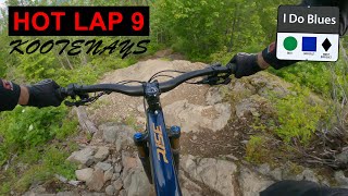
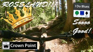
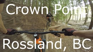
Crown Point is favorite amongst Rossland riders, providing an advanced, freeriding trail with a hints of 'North Shore' style, amidst a lush, mountain forest. The ride entertains from start to finish with sections of fast, flowy singletrack, mixed with tight, techy sections, and many log rides, booters, bridges and the occasional rock garden. Originally built by local riders in the early 90's, Crown Point has withstood the persistent pressures of logging to retain its stunning, natural setting above the fast flowing, Tiger Creek. The ride itself is greatly diversified and caters to wide range of abilities, from advanced x-country riders to the downhill, shuttle crowd, who typically park a vehicle in Warfield. For others, the long pedal to and from town is easily justified, especially during the height of a dry, hot summer, when Crown Point will remain cool and tacky.

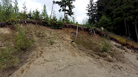
To reach the upper trailhead, proceed approx. 2 km up Malde Creek FSR to Birch Main FSR. Ride (gradual climb) almost 3 km to the end of Birch Main FSR where the singletrack commences. Crown Point begins with undulating traverse through open cut blocks, before a short descent to meet Branch 3000 (or 007) FSR. Turn right onto the road and pedal 400 m to where the main descent of Crown Point begins. Drop the seat and bomb down towards the tall, dark forest ahead. The trail stays close to a featured ridgeline at first and then falls imperceptibly towards the valley bottom, where it stays for the remainder of the ride. The trail is intersected half way with the crossing of Tiger Main FSR which is often a good place to regroup, before dropping across the high banks and featured benches above Tiger Creek, and finally ending in an open cut block above the Gas Line Rd.

Hints: For shuttle riders with a parked vehicle in Warfield, proceed across the Gas Line Rd, follow the dirt road on the west (left) side of Tiger Creek for 500m to Switchback trailheads. Turn right onto Lower Switchback trail which flows in fast, wide arcs down to the Railgrade trail. Turn right (straight) and descend towards to Warfield.

Riders returning to Rossland have several options. The quickest route, but least aesthetic, is to pedal back along the Gas Line Rd to where it joins the Railgrade trail and continues into Lower Rossland. Its a 5 km, hilly return on logging roads back to Rossland. Another option is to cross the Gas Line Rd at the end of Crown Point, follow the dirt road on the west side of Tiger Creek for 500m to Switchback trailheads. Take the Upper Switchback trail which joins Railgrade further down the valley. Climb the Railgrade back (turn left) towards town which will curves slowly into Lower Rossland. On the Railgrade you will encounter the Rubberhead trailhead which provides further options into Lower Rossland.

Local Trail Association

Recent Activity on Trail

Past Week
  • 2 rides
  • 13 miles average
6 Months
  • 12 rides
  • 14 miles avg distance
All
  • 182 rides
  • Last: Jun 19, 2026
c1c2c3c4
January
February
March
April
May
June
July
August
September
October
November
December
update trails status or condition

Crown Point (lower) Trail Reports

statusdatedescription
May 29, 2026 @ 5:21pm (America/Vancouver)
May 29, 2026
4 trees down. 2 on the upper crown point. 1 in the middle section. 1 lower
May 5, 2026 @ 11:44am (America/Vancouver)
May 5, 2026
reporter The KCTS trail crew completed seasonal inspection and maintenance.
Apr 25, 2026 @ 7:23pm (America/Vancouver)
Apr 25, 2026
Cleared about 8 trees including one on upper. One large tree after the jumps at the bottom that needs a bigger saw. Could use a good rake...
Apr 21, 2026 @ 7:43pm (America/Vancouver)
Apr 21, 2026
6 trees down at various locations
Aug 31, 2025 @ 2:32pm
Aug 31, 2025
more »
Status:
on May 29, 2026
Ideal
Avg: 4.37 (18 votes)
Your vote: 0

view (1,396)
close
3D
Trail Conditions
  • Unknown
  • Snow Groomed
  • Snow Packed
  • Snow Covered
  • Snow Cover Partial
  • Freeze/thaw Cycle
  • Icy
  • Prevalent Mud
  • Wet
  • Variable
  • Ideal
  • Dry
  • Very Dry
Trail Flow (Ridden Direction)
Trailforks scans users ridelogs to determine the most popular direction each trail is ridden. A good flowing trail network will have most trails flowing in a single direction according to their intension.
The colour categories are based on what percentage of riders are riding a trail in its intended direction.
  • > 96%
  • > 90%
  • > 80%
  • > 70%
  • > 50%
  • < 50%
  • bi-directional trail
  • no data
Trail Last Ridden
Trailforks scans ridelogs to determine the last time a trail was ridden.
  • < 2 days
  • < 1 week
  • < 2 weeks
  • < 1 month
  • < 6 months
  • > 6 months
Trail Ridden Direction
The intended direction a trail should be ridden.
  • Downhill Only
  • Downhill Primary
  • Both Directions
  • Uphill Primary
  • Uphill Only
  • One Direction
Contribute Details
Colors indicate trail is missing specified detail.
  • Description
  • Photos
  • Description & Photos
  • Videos
Trail Popularity ?
Trailforks scans ridelogs to determine which trails are ridden the most in the last 9 months. Trails are compared with nearby trails in the same city region with a possible 25 colour shades. Think of this as a heatmap, more rides = more kinetic energy = warmer colors.
  • most popular
  • popular
  • less popular
  • not popular
ATV/ORV/OHV Filter
Max Vehicle Width
inches
US Cell Coverage
Legend
cell carrier legend

Radar Time
Activity Recordings
Trailforks uses anonymized public activity data. ?
Activity Recordings
Trailforks uses anonymized public activity data. ?
Personal Heatmap
Activity Types
all / none
Options
2
Date range month
Winter Trails
Warning A routing network for winter maps does not exist. Selecting trails using the winter trails layer has been disabled.
Missing Trails
Most Popular
Least Popular
Trails are colored based on popularity. The more popular a trail is, the more red. Less popular trails trend towards green.
Jump Magnitude Heatmap
Heatmap of where riders jump on trails. Zoom in to see individual jumps, click circles to view jump details.
BC Backroad Status

Service Road Atlas is a free to use, community-driven service for viewing and creating reports on the numerous back-country service roads around B.C. and Alberta.

map legend
Slope Aspect
Direction the slope faces
Flat N NE E SE S SW W NW
Trails Deemphasized
Trails are shown in grey.
disable
Only show trails with no bike usage.
Enable
Suggested Layers
Based on selected activity type

    Save the current map location and zoom level as your default home location whenever this page is loaded.

    Save
        Directions to crown-point-lower trailhead (49.042440, -117.763900)

        Photos

        27 more »
        476 |
        Jun 28, 2022 @ 8:33pm
        Jun 28, 2022
        156 |
        Jun 28, 2022 @ 8:33pm
        Jun 28, 2022
        150 |
        Jun 28, 2022 @ 8:33pm
        Jun 28, 2022
        244 |
        Jun 28, 2022 @ 8:33pm
        Jun 28, 2022

        Videos

        4 more »
        youtuber HOT LAP 9: Orbea Rise: ROSSLAND/CASTLEGAR:...
        5:43 | 458 | Jul 5, 2022 , Rossland
        youtuber CROWN POINT: Rossland: Trail Review
        19:20 | 475 | Jul 2, 2022 , Rossland
        youtuber Lower Crown Point - Rossland, BC
        8:59 | 913 | Jul 10, 2019 , Rossland
        Insane Vertical
        0:13 | 560 | Jun 5, 2016 , Rossland

        Routes with this trail

        5.0 25 miles 4,668 ft 20 Loop
        The best route if you want to pedal SMDA and Crown Point in one long ride. Whiskey on the Rocks optional,...
        3.0 12 miles 1,932 ft 16 Loop
        Start downtown, and head to Upper Drake's via the Trail (accessed from Dunn Cres.) Ride the constantly...
        7 miles 833 ft 8 Shuttled
        The route if you're shuttling and want to return to the bottom of . Alternatively continue down the...

        3 Reviews & Comments


        We hope you've been enjoying Trailforks!

        Create a FREE account to view trail comments and much more.

        • By canadakaTF Pro Trailforks & contributors
        • #2148 - 6,219 views

        Frequently Asked Questions About Crown Point (lower)

        Where is Crown Point (lower) located?
        Crown Point (lower) is located in Malde Creek, Rossland, British Columbia, Canada. It is part of the Malde Creek trail network. The trailhead is located at coordinates 49.04244, -117.7639.
        How hard is Crown Point (lower)?
        Crown Point (lower) is rated as Black Diamond difficulty. The physical rating is Moderate. The average grade is 12.5%.
        What is the elevation gain for Crown Point (lower)?
        The trail has 330 m of elevation descent. The elevation ranges from 840 m to 1,170 m.
        Is Crown Point (lower) a point to point trail?
        Yes, Crown Point (lower) is a point to point trail. The direction is Downhill Only. The trail type is singletrack.

        Hit the Trail

        Open in App

        Get this trail on your phone instantly.
        open trail in app

        Download Trail

        Save to wishlist, Garmin & download.
        save the trail

        Find Related Routes

        Find routes and users activities that include this trail.
        find routes for this trail

        You must enter a description before submitting.