more stats
2,707 ft
Distance
-409 ft
Descent
00:05:15
Avg time
-409 ft
Altitude change
1,214 ft
Altitude min
1,623 ft
Altitude max
1,623 ft
Altitude start
1,214 ft
Altitude end
-15.1%
Grade
-46.8%
Grade max
-1.6%
Grade min
2,707 ft
Distance down
00:05:15
Avg time

Děd Details

  • Activities
    • Mountain Bike
    • E-Bike
  • Riding Area
    Děd
    Beroun
  • AKA
    DH Děd
  • Difficulty Rating
  • Voted Difficulty
    Black (1 vote)
  • Local Popularity
    95 in Mountain Biking [+]
    • 100 in E-Biking
  • Global Ranking
    #46470 in Mountain Biking [+]
    • #28485 in E-Biking
  • Trail Type
    Singletrack
  • Bike Type
    DH, AM
  • Direction
    Downhill Only
  • Dogs Allowed
    Yes
  • TTFs on Trail
    Berm, Jump, Gap Jump

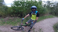
Stará sjezdová trať od rozhledny na vrcholu Dědu. Sporadicky udržována místními, občasné známky diverzní činnosti: klacky v zatáčkách, hřebíky v kořenech. Doporučeno před jízdou projít a zkontrolovat Všechny skoky lze objet. Berounská destinace pro procházky, pozor na pěší! / Old DH track starting at the top of the Děd hill. Track walk reccomended before ride! Watch for pedestrians!

This trail is unsanctioned.

Recent Activity on Trail

Past Week
  • 0 rides
  •  
6 Months
  • 6 rides
  • 11 miles avg distance
All
  • 38 rides
  • Last: Jun 1, 2026
c1c2c3c4
January
February
March
April
May
June
July
August
September
October
November
December
update trails status or condition

Děd Trail Reports

statusdatedescription
Oct 17, 2024 @ 12:58pm
Oct 17, 2024
No trees, clear all the way down. A bit narrow due to the fallen or cut trees along the trail but overall ok.
Jan 19, 2024 @ 3:00pm
Jan 19, 2024
Large tree down across trail, blocking trail
Dec 26, 2023 @ 6:27pm
Dec 26, 2023
Spadlé stromy na trailu, některé jsme odklidili, ale velké bez pily nešly....
Apr 9, 2023 @ 8:36am
Apr 9, 2023
Sep 28, 2021 @ 5:01am
Sep 28, 2021
reporter Pár menších padlých stromů, skoky a klopenky čisté.
more »
Status:
on Oct 17, 2024
Variable
Avg: 3.99 (6 votes)
Your vote: 0

view (268)
close
3D
Trail Conditions
  • Unknown
  • Snow Groomed
  • Snow Packed
  • Snow Covered
  • Snow Cover Partial
  • Freeze/thaw Cycle
  • Icy
  • Prevalent Mud
  • Wet
  • Variable
  • Ideal
  • Dry
  • Very Dry
Trail Flow (Ridden Direction)
Trailforks scans users ridelogs to determine the most popular direction each trail is ridden. A good flowing trail network will have most trails flowing in a single direction according to their intension.
The colour categories are based on what percentage of riders are riding a trail in its intended direction.
  • > 96%
  • > 90%
  • > 80%
  • > 70%
  • > 50%
  • < 50%
  • bi-directional trail
  • no data
Trail Last Ridden
Trailforks scans ridelogs to determine the last time a trail was ridden.
  • < 2 days
  • < 1 week
  • < 2 weeks
  • < 1 month
  • < 6 months
  • > 6 months
Trail Ridden Direction
The intended direction a trail should be ridden.
  • Downhill Only
  • Downhill Primary
  • Both Directions
  • Uphill Primary
  • Uphill Only
  • One Direction
Contribute Details
Colors indicate trail is missing specified detail.
  • Description
  • Photos
  • Description & Photos
  • Videos
Trail Popularity ?
Trailforks scans ridelogs to determine which trails are ridden the most in the last 9 months. Trails are compared with nearby trails in the same city region with a possible 25 colour shades. Think of this as a heatmap, more rides = more kinetic energy = warmer colors.
  • most popular
  • popular
  • less popular
  • not popular
ATV/ORV/OHV Filter
Max Vehicle Width
inches
US Cell Coverage
Legend
cell carrier legend

Radar Time
Activity Recordings
Trailforks uses anonymized public activity data. ?
Activity Recordings
Trailforks uses anonymized public activity data. ?
Personal Heatmap
Activity Types
all / none
Options
2
Date range month
Winter Trails
Warning A routing network for winter maps does not exist. Selecting trails using the winter trails layer has been disabled.
Missing Trails
Most Popular
Least Popular
Trails are colored based on popularity. The more popular a trail is, the more red. Less popular trails trend towards green.
Jump Magnitude Heatmap
Heatmap of where riders jump on trails. Zoom in to see individual jumps, click circles to view jump details.
BC Backroad Status

Service Road Atlas is a free to use, community-driven service for viewing and creating reports on the numerous back-country service roads around B.C. and Alberta.

map legend
Slope Aspect
Direction the slope faces
Flat N NE E SE S SW W NW
Trails Deemphasized
Trails are shown in grey.
disable
Only show trails with no bike usage.
Enable
Suggested Layers
Based on selected activity type

    Save the current map location and zoom level as your default home location whenever this page is loaded.

    Save
        Directions to d-d trailhead (49.967590, 14.034310)

        Photos

        10 more »
        206 |
        Apr 11, 2021 @ 5:40am
        Apr 11, 2021
        210 |
        Apr 11, 2021 @ 5:40am
        Apr 11, 2021
        188 |
        Apr 5, 2021 @ 6:32am
        Apr 5, 2021
        182 |
        Apr 5, 2021 @ 6:32am
        Apr 5, 2021

        Videos

        1 more »
        Enduro Děd
        3:13 | 1136 | Sep 29, 2018 , Beroun

        2 Reviews & Comments


        We hope you've been enjoying Trailforks!

        Create a FREE account to view trail comments and much more.

        • #148999 - 6,579 views

        Frequently Asked Questions About Děd

        Where is Děd located?
        Děd is located in Děd, Beroun, Czech Republic. It is part of the Děd trail network. The trailhead is located at coordinates 49.96759, 14.03431.
        How hard is Děd?
        Děd is rated as Black difficulty. The average grade is 15.1%.
        What is the elevation gain for Děd?
        The trail has 409 ft of elevation descent. The elevation ranges from 1,214 ft to 1,623 ft.
        Is Děd a point to point trail?
        Yes, Děd is a point to point trail. The direction is Downhill Only. The trail type is singletrack.

        Hit the Trail

        Open in App

        Get this trail on your phone instantly.
        open trail in app

        Download Trail

        Save to wishlist, Garmin & download.
        save the trail

        Find Related Routes

        Find routes and users activities that include this trail.
        find routes for this trail

        You must enter a description before submitting.