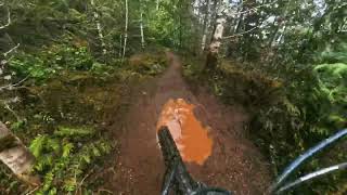
more stats
2,959 ft
Distance
13 ft
Climb
-195 ft
Descent
00:06:08
Avg time
-180 ft
Altitude change
758 ft
Altitude min
945 ft
Altitude max
939 ft
Altitude start
758 ft
Altitude end
-6.1%
Grade
-31.5%
Grade max
13.3%
Grade min
305 ft
Distance climb
2,060 ft
Distance down
548 ft
Distance flat
00:06:08
Avg time

That Dam Trail Details

  • Activities
    • Mountain Bike
    • E-Bike
    • Hike
    • Trail Running
  • Riding Area
    Cumberland trail network
    Cumberland, British Columbia
  • Difficulty Rating
  • Voted Difficulty
    Blue (5 votes)
  • Local Popularity
    85 in Mountain Biking [+]
    • 85 in E-Biking
    • 65 in Trail Running
    • 75 in Hiking
  • Global Ranking
    #22624 in Mountain Biking [+]
    • #25213 in E-Biking
    • #85305 in Trail Running
    • #81316 in Hiking
  • Trail Type
    Singletrack
  • Bike Type
    DH, AM, XC
  • Physical Rating
    Moderate
  • Dogs Allowed
    Yes
  • eBike Allowed
  • TTFs on Trail
    Bridge, Jump, Skinny, Wallride

Short climb up from Tea Pot brings you to a super fast, fun decent to the lake.

Access Info

Left from Lower Teapot

Local Trail Association
Traditionally Indigenous Territory

Recent Activity on Trail

Past Week
  • 25 rides
  • 11 miles average
6 Months
  • 373 rides
  • 11 miles avg distance
All
  • 2,593 rides
  • Last: Jun 20, 2026
c1c2c3c4
January
February
March
April
May
June
July
August
September
October
November
December
Status:
on Jun 18, 2026
Dry
Avg: 4.02 (49 votes)
Your vote: 0

view (11,902)
close
3D
Trail Conditions
  • Unknown
  • Snow Groomed
  • Snow Packed
  • Snow Covered
  • Snow Cover Partial
  • Freeze/thaw Cycle
  • Icy
  • Prevalent Mud
  • Wet
  • Variable
  • Ideal
  • Dry
  • Very Dry
Trail Flow (Ridden Direction)
Trailforks scans users ridelogs to determine the most popular direction each trail is ridden. A good flowing trail network will have most trails flowing in a single direction according to their intension.
The colour categories are based on what percentage of riders are riding a trail in its intended direction.
  • > 96%
  • > 90%
  • > 80%
  • > 70%
  • > 50%
  • < 50%
  • bi-directional trail
  • no data
Trail Last Ridden
Trailforks scans ridelogs to determine the last time a trail was ridden.
  • < 2 days
  • < 1 week
  • < 2 weeks
  • < 1 month
  • < 6 months
  • > 6 months
Trail Ridden Direction
The intended direction a trail should be ridden.
  • Downhill Only
  • Downhill Primary
  • Both Directions
  • Uphill Primary
  • Uphill Only
  • One Direction
Contribute Details
Colors indicate trail is missing specified detail.
  • Description
  • Photos
  • Description & Photos
  • Videos
Trail Popularity ?
Trailforks scans ridelogs to determine which trails are ridden the most in the last 9 months. Trails are compared with nearby trails in the same city region with a possible 25 colour shades. Think of this as a heatmap, more rides = more kinetic energy = warmer colors.
  • most popular
  • popular
  • less popular
  • not popular
ATV/ORV/OHV Filter
Max Vehicle Width
inches
US Cell Coverage
Legend
cell carrier legend

Radar Time
Activity Recordings
Trailforks uses anonymized public activity data. ?
Activity Recordings
Trailforks uses anonymized public activity data. ?
Personal Heatmap
Activity Types
all / none
Options
2
Date range month
Winter Trails
Warning A routing network for winter maps does not exist. Selecting trails using the winter trails layer has been disabled.
Missing Trails
Most Popular
Least Popular
Trails are colored based on popularity. The more popular a trail is, the more red. Less popular trails trend towards green.
Jump Magnitude Heatmap
Heatmap of where riders jump on trails. Zoom in to see individual jumps, click circles to view jump details.
BC Backroad Status

Service Road Atlas is a free to use, community-driven service for viewing and creating reports on the numerous back-country service roads around B.C. and Alberta.

map legend
Slope Aspect
Direction the slope faces
Flat N NE E SE S SW W NW
Trails Deemphasized
Trails are shown in grey.
disable
Only show trails with no bike usage.
Enable
Suggested Layers
Based on selected activity type

    Save the current map location and zoom level as your default home location whenever this page is loaded.

    Save
        Directions to dam-trail trailhead (49.596180, -125.036910)

        Photos

        25 more »
        63 |
        Feb 1, 2024 @ 12:38pm
        Feb 1, 2024
        89 |
        Oct 9, 2022 @ 7:20pm
        Oct 9, 2022
        218 |
        Dec 29, 2020 @ 11:29am
        Dec 29, 2020
        164 |
        Dec 1, 2020 @ 9:19pm
        Dec 1, 2020

        Videos

        11 more »
        youtuber Cumberland Green Room - Vancouver Island...
        7:39 | 62 | Apr 24, 2026 , Cumberland
        That Dam Trail in Cumberland, BC
        4:11 | 88 | Jul 12, 2025 , Cumberland
        That Damm trail
        2:14 | 57 | Apr 12, 2025 , Cumberland
        teapot/Damm trail
        0:16 | 51 | Feb 5, 2025 , Cumberland

        Trail Lists

        Routes with this trail

        6 miles 1,125 ft 7
        UROC Fiver series presented by Fox and supported by our Comox Valley bike stores. All riders who complete...
        2.5 19 miles 2,925 ft 23
        BCBR Stage 7 Cumberland. A faster take on the trail networks. All the flow. Great climbing.
        22 miles 3,784 ft 22
        The famous DODGEZILLA is back for 2025, enjoy! Stage 1: Scat → Brat Stage 2: Teapot (Starting at Slick...

        6 Reviews & Comments


        We hope you've been enjoying Trailforks!

        Create a FREE account to view trail comments and much more.

        • By skifreakTF Pro & contributors
        • #1421 - 6,319 views

        Frequently Asked Questions About That Dam Trail

        Where is That Dam Trail located?
        That Dam Trail is located in Cumberland trail network, Cumberland, British Columbia, Canada. It is part of the Cumberland trail network trail network. The trailhead is located at coordinates 49.59618, -125.03691.
        How hard is That Dam Trail?
        That Dam Trail is rated as Black Diamond difficulty. The physical rating is Moderate. The average grade is 6.1%.
        What is the elevation gain for That Dam Trail?
        That Dam Trail has 13 ft of elevation gain. The trail has 195 ft of elevation descent. The elevation ranges from 758 ft to 945 ft.
        How long is That Dam Trail?
        That Dam Trail is 2,959 ft long. The trail type is singletrack.

        Hit the Trail

        Open in App

        Get this trail on your phone instantly.
        open trail in app

        Download Trail

        Save to wishlist, Garmin & download.
        save the trail

        Find Related Routes

        Find routes and users activities that include this trail.
        find routes for this trail

        You must enter a description before submitting.