more stats
1.7 miles
Distance
-1,742 ft
Descent
00:33:31
Avg time
-1,742 ft
Altitude change
2,452 ft
Altitude min
4,194 ft
Altitude max
4,194 ft
Altitude start
2,451 ft
Altitude end
-19%
Grade
-57.8%
Grade max
1.7%
Grade min
59 ft
Distance climb
2 miles
Distance down
00:33:31
Avg time

Dark Crystal Details

  • Activities
    • Mountain Bike
    • E-Bike
  • Riding Area
    Blackcomb CRA
    Whistler, British Columbia
  • Difficulty Rating
  • Voted Difficulty
    Black Diamond (12 votes)
  • Local Popularity
    90 in Mountain Biking [+]
    • 100 in E-Biking
  • Global Ranking
    #139 in Mountain Biking [+]
    • #1136 in E-Biking
  • Trail Type
    Singletrack
  • Bike Type
    DH, AM
  • Direction
    Downhill Only
    Popular Direction Shown
  • Climb Difficulty
    Black Diamond
  • Physical Rating
    Hard
  • Season
    July - November
  • eBike Allowed
    Yes up to Class 1
  • TTFs on Trail
    Rock Face
  • Year Opened
    2015
  • Land Owner
    Whistler Blackcomb

This trail is NOT SUITABLE for wet weather riding. Please choose other trails during periods of rain or extended wet weather.

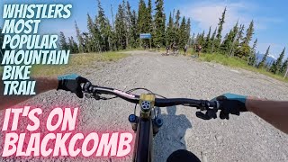
Now officially a part of the Blackcomb trail network, Dark Crystal descends from the bottom of the Crystal Ridge Express chairlift to the Blackcomb Access Road next to Micro Climate. Built by Scott Veach and Ben Haggar, Dark Crystal was designed to use as much natural terrain as possible with low angles to keep riders from having to use their brakes, and as a result, ensure the trail has longevity. It integrates as many rock slabs and faces as possible throughout and overall the descend is a lot of bang for your buck.

Disclaimer

Please follow these trail guidelines: - Respect spring and fall seasonal closures, due to trail conditions and black bear hibernation. - No Dogs. - No access above Microclimate before 9:30am daily.

Trail Supporters
Local Trail Association

Recent Activity on Trail

Past Week
  • 1 rides
  • 7 miles average
6 Months
  • 5 rides
  • 8 miles avg distance
All
  • 1,525 rides
  • Last: Jun 23, 2026
c1c2c3c4
January
February
March
April
May
June
July
August
September
October
November
December
update trails status or condition

Dark Crystal Trail Reports

statusdatedescription
Jun 7, 2026 @ 8:23pm (America/Vancouver)
Jun 7, 2026
reporter Please respect the seasonal spring bear closure. Access to Dark Crystal and Micro Climate opens July 1.
Jun 7, 2026 @ 2:04pm (America/Vancouver)
Jun 7, 2026
Small tree down across trail, can navigate over or aroundoor o
May 22, 2026 @ 6:59am (America/Vancouver)
May 22, 2026
reporter Please respect the seasonal spring bear closure. Access to Dark Crystal and Microclimate opens July 1.
May 2, 2026 @ 8:30am (America/Vancouver)
May 2, 2026
reporter
Trail does not open till July 1. currently snow covered and under construction with major dead fall clearing and repairs.
Dec 28, 2025 @ 5:41pm (America/Vancouver)
Dec 28, 2025
more »
Status:
on Jun 7, 2026
Avg: 4.78 (95 votes)
Your vote: 0

view (9,033)
close
3D
Trail Conditions
  • Unknown
  • Snow Groomed
  • Snow Packed
  • Snow Covered
  • Snow Cover Partial
  • Freeze/thaw Cycle
  • Icy
  • Prevalent Mud
  • Wet
  • Variable
  • Ideal
  • Dry
  • Very Dry
Trail Flow (Ridden Direction)
Trailforks scans users ridelogs to determine the most popular direction each trail is ridden. A good flowing trail network will have most trails flowing in a single direction according to their intension.
The colour categories are based on what percentage of riders are riding a trail in its intended direction.
  • > 96%
  • > 90%
  • > 80%
  • > 70%
  • > 50%
  • < 50%
  • bi-directional trail
  • no data
Trail Last Ridden
Trailforks scans ridelogs to determine the last time a trail was ridden.
  • < 2 days
  • < 1 week
  • < 2 weeks
  • < 1 month
  • < 6 months
  • > 6 months
Trail Ridden Direction
The intended direction a trail should be ridden.
  • Downhill Only
  • Downhill Primary
  • Both Directions
  • Uphill Primary
  • Uphill Only
  • One Direction
Contribute Details
Colors indicate trail is missing specified detail.
  • Description
  • Photos
  • Description & Photos
  • Videos
Trail Popularity ?
Trailforks scans ridelogs to determine which trails are ridden the most in the last 9 months. Trails are compared with nearby trails in the same city region with a possible 25 colour shades. Think of this as a heatmap, more rides = more kinetic energy = warmer colors.
  • most popular
  • popular
  • less popular
  • not popular
ATV/ORV/OHV Filter
Max Vehicle Width
inches
US Cell Coverage
Legend
cell carrier legend

Radar Time
Activity Recordings
Trailforks uses anonymized public activity data. ?
Activity Recordings
Trailforks uses anonymized public activity data. ?
Personal Heatmap
Activity Types
all / none
Options
2
Date range month
Winter Trails
Warning A routing network for winter maps does not exist. Selecting trails using the winter trails layer has been disabled.
Missing Trails
Most Popular
Least Popular
Trails are colored based on popularity. The more popular a trail is, the more red. Less popular trails trend towards green.
Jump Magnitude Heatmap
Heatmap of where riders jump on trails. Zoom in to see individual jumps, click circles to view jump details.
BC Backroad Status

Service Road Atlas is a free to use, community-driven service for viewing and creating reports on the numerous back-country service roads around B.C. and Alberta.

map legend
Slope Aspect
Direction the slope faces
Flat N NE E SE S SW W NW
Trails Deemphasized
Trails are shown in grey.
disable
Only show trails with no bike usage.
Enable
Suggested Layers
Based on selected activity type

    Save the current map location and zoom level as your default home location whenever this page is loaded.

    Save
        Directions to dark-crystal-49978 trailhead (50.119120, -122.906950)

        Photos

        176 more »
        1,671 |
        Oct 7, 2017 @ 4:30pm
        Oct 7, 2017
        1,356 |
        Aug 21, 2016 @ 10:55pm
        Aug 21, 2016
        111 |
        Jul 14, 2025 @ 9:05pm
        Jul 14, 2025
        184 |
        Aug 12, 2024 @ 1:09pm
        Aug 12, 2024

        Videos

        33 more »
        youtuber The Most Popular Mountain bike trail in...
        19:27 | 725 | Jul 28, 2024 , Whistler
        youtuber E-Bikes are... well... Something! - With...
        17:55 | 1082 | Oct 17, 2019 , Whistler
        youtuber The Loam is Real With This One! - The Iconic...
        13:32 | 2616 | Sep 25, 2019 , Whistler
        youtuber Fat Biking on Dark Crystal  Part 1 ...
        7:36 | 678 | Sep 20, 2019 , Whistler

        Articles

        Video: A Rip Down Blackcomb's Dark Crystal in 'Crystallize'
        Jan 1, 2020 from pinkbike.com
        Lucy Mackie takes a ride down Dark Crystal.

        Trail Lists

        Routes with this trail

        5.0 37 miles 8,991 ft 24
        Whistler's three classic runs in one ride. If you complete this you are a beast.
        10 miles 3,164 ft 10
        Whistler Relive Your Rides Blackcomb Classic Dark Crystal and Hey Bud For other ride suggestions for this...
        2.8 10 miles 2,717 ft 22 Loop
        Up to with a couple of little detours, down, climb up to Comfortably Numb and descend the Foreplay Descent...

        38 Reviews & Comments


        We hope you've been enjoying Trailforks!

        Create a FREE account to view trail comments and much more.

        • By robfxpTF Pro & contributors
        • #49978 - 56,969 views

        Frequently Asked Questions About Dark Crystal

        Where is Dark Crystal located?
        Dark Crystal is located in Blackcomb CRA, Whistler, British Columbia, Canada. It is part of the Blackcomb CRA trail network. The trailhead is located at coordinates 50.11912, -122.90695.
        How hard is Dark Crystal?
        Dark Crystal is rated as Black Diamond difficulty. The physical rating is Hard. The average grade is 19%. The climb difficulty is rated Black Diamond.
        What is the elevation gain for Dark Crystal?
        The trail has 1,742 ft of elevation descent. The elevation ranges from 2,452 ft to 4,194 ft.
        Is Dark Crystal a point to point trail?
        Yes, Dark Crystal is a point to point trail. The direction is Downhill Only. The trail type is singletrack.

        Hit the Trail

        Open in App

        Get this trail on your phone instantly.
        open trail in app

        Download Trail

        Save to wishlist, Garmin & download.
        save the trail

        Find Related Routes

        Find routes and users activities that include this trail.
        find routes for this trail

        You must enter a description before submitting.