more stats
2,526 ft
Distance
3 ft
Climb
-848 ft
Descent
00:21:03
Avg time
-845 ft
Altitude change
4,073 ft
Altitude min
4,921 ft
Altitude max
4,918 ft
Altitude start
4,072 ft
Altitude end
-33.5%
Grade
-90.8%
Grade max
4%
Grade min
82 ft
Distance climb
2,444 ft
Distance down
00:21:03
Avg time

Déchaînement Details

  • Activities
    • Mountain Bike
    • E-Bike
  • Riding Area
  • Difficulty Rating
  • Local Popularity
    90 in Mountain Biking
  • Global Ranking
    #52495 in Mountain Biking
  • Trail Type
    Singletrack
  • Bike Type
    DH
  • Dogs Allowed
    Yes
  • eBike Allowed
    Yes up to Class 1
  • TTFs on Trail
    Berm

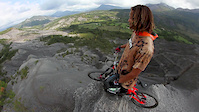
Trail technique et bien costaud, avec de grosses pentes bien raides en fin de parcours. Beaucoup de flow, ponctué de passages en goulet façon toboggan. Clairement pas pour les débutants du coin. Conseil : prévoyez des plaquettes de frein neuves

Disclaimer

Piste à pratiquer sous votre propre responsabilité.

Local Trail Association

Recent Activity on Trail

Past Week
  • 0 rides
  •  
6 Months
  • 0 rides
  •  
All
  • 16 rides
  • Last: Jun 7, 2026
c1c2c3c4
January
February
March
April
May
June
July
August
September
October
November
December
update trails status or condition

Déchaînement Trail Reports

statusdatedescription
Oct 17, 2025 @ 4:20pm (Europe/Paris)
Oct 17, 2025
Tramos bastante rotos.
Aug 30, 2025 @ 10:59am
Aug 30, 2025
Aug 7, 2025 @ 9:13am
Aug 7, 2025
Espectacular
Aug 2, 2025 @ 9:49am
Aug 2, 2025
Aug 10, 2024 @ 6:59am
Aug 10, 2024
sick trail, very steep and loamy. Took my Trailbike and wished for my Freerider. Still a lot of fun, but prepared for things to get steep, loose...
more »
Status:
on Oct 17, 2025
Variable
Avg: 4.21 (8 votes)
Your vote: 0

view (94)
close
3D
Trail Conditions
  • Unknown
  • Snow Groomed
  • Snow Packed
  • Snow Covered
  • Snow Cover Partial
  • Freeze/thaw Cycle
  • Icy
  • Prevalent Mud
  • Wet
  • Variable
  • Ideal
  • Dry
  • Very Dry
Trail Flow (Ridden Direction)
Trailforks scans users ridelogs to determine the most popular direction each trail is ridden. A good flowing trail network will have most trails flowing in a single direction according to their intension.
The colour categories are based on what percentage of riders are riding a trail in its intended direction.
  • > 96%
  • > 90%
  • > 80%
  • > 70%
  • > 50%
  • < 50%
  • bi-directional trail
  • no data
Trail Last Ridden
Trailforks scans ridelogs to determine the last time a trail was ridden.
  • < 2 days
  • < 1 week
  • < 2 weeks
  • < 1 month
  • < 6 months
  • > 6 months
Trail Ridden Direction
The intended direction a trail should be ridden.
  • Downhill Only
  • Downhill Primary
  • Both Directions
  • Uphill Primary
  • Uphill Only
  • One Direction
Contribute Details
Colors indicate trail is missing specified detail.
  • Description
  • Photos
  • Description & Photos
  • Videos
Trail Popularity ?
Trailforks scans ridelogs to determine which trails are ridden the most in the last 9 months. Trails are compared with nearby trails in the same city region with a possible 25 colour shades. Think of this as a heatmap, more rides = more kinetic energy = warmer colors.
  • most popular
  • popular
  • less popular
  • not popular
ATV/ORV/OHV Filter
Max Vehicle Width
inches
US Cell Coverage
Legend
cell carrier legend

Radar Time
Activity Recordings
Trailforks uses anonymized public activity data. ?
Activity Recordings
Trailforks uses anonymized public activity data. ?
Personal Heatmap
Activity Types
all / none
Options
2
Date range month
Winter Trails
Warning A routing network for winter maps does not exist. Selecting trails using the winter trails layer has been disabled.
Missing Trails
Most Popular
Least Popular
Trails are colored based on popularity. The more popular a trail is, the more red. Less popular trails trend towards green.
Jump Magnitude Heatmap
Heatmap of where riders jump on trails. Zoom in to see individual jumps, click circles to view jump details.
BC Backroad Status

Service Road Atlas is a free to use, community-driven service for viewing and creating reports on the numerous back-country service roads around B.C. and Alberta.

map legend
Slope Aspect
Direction the slope faces
Flat N NE E SE S SW W NW
Trails Deemphasized
Trails are shown in grey.
disable
Only show trails with no bike usage.
Enable
Suggested Layers
Based on selected activity type

    Save the current map location and zoom level as your default home location whenever this page is loaded.

    Save
        Directions to dechainement trailhead (42.775530, 0.580740)

        Photos

        No photos have been added for Déchaînement yet, add a photo.

        Videos

        6 more »
        COMMENCAL RAMONES 12 2016
        3:04 | 10510 | Nov 19, 2015 , Bagneres De Luchon
        - TchoukTV // Antoine Dubourgnon: Natural Born...
        3:01 | 4138 | Jun 15, 2014 , Bagneres De Luchon
        Beyond Rampage with Nick Pescetto - Training
        5:03 | 49141 | Oct 4, 2015 , Bagneres De Luchon
        Nico Vink is back
        0:29 | 2101 | Mar 3, 2016 , Bagneres De Luchon

        Reviews / Comments

        No reviews yet, be the first to write a review or ask a question.
        Use trail reports to comment on trail conditions.


        We hope you've been enjoying Trailforks!

        Create a FREE account to view trail comments and much more.

        • By max31 & contributors
        • #100490 - 1,154 views

        Frequently Asked Questions About Déchaînement

        Where is Déchaînement located?
        Déchaînement is located in Bagneres De Luchon, France. It is part of the Bagneres De Luchon trail network. The trailhead is located at coordinates 42.77553, 0.58074.
        How hard is Déchaînement?
        Déchaînement is rated as Black difficulty. The average grade is 31.6%.
        What is the elevation gain for Déchaînement?
        Déchaînement has 2 m of elevation gain. The trail has 846 m of elevation descent. The elevation ranges from 655 m to 1,500 m.
        Is Déchaînement a point to point trail?
        Déchaînement is not a point to point trail. The direction is Downhill Primary. The trail type is singletrack.

        Hit the Trail

        Open in App

        Get this trail on your phone instantly.
        open trail in app

        Download Trail

        Save to wishlist, Garmin & download.
        save the trail

        Find Related Routes

        Find routes and users activities that include this trail.
        find routes for this trail

        You must enter a description before submitting.