more stats
1,362 ft
Distance
-113 ft
Descent
00:02:51
Avg time
-113 ft
Altitude change
865 ft
Altitude min
978 ft
Altitude max
978 ft
Altitude start
866 ft
Altitude end
-8.3%
Grade
-29.6%
Grade max
1.4%
Grade min
1,122 ft
Distance down
240 ft
Distance flat
00:02:51
Avg time

Devil's Kitchen Details

  • Activities
    • Mountain Bike
  • Riding Area
    Hornby Island
    , British Columbia
  • Difficulty Rating
  • Voted Difficulty
    Black Diamond (3 votes)
  • Local Popularity
    95 in Mountain Biking
  • Global Ranking
    #34823 in Mountain Biking
  • Trail Type
    Singletrack
  • Bike Type
    AM, XC
  • Direction
    Downhill Only
    Popular Direction Shown
  • Climb Difficulty
    Black Diamond
  • Physical Rating
    Moderate
  • Trail Visibility
    Always easy to follow
  • Dogs Allowed
    Yes
  • TTFs on Trail
    Berm, Bridge, Drop, Jump, Gap Jump, Ladder Bridge

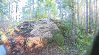
This trail is a key part of "The Way" from the top of Mount Geoffrey down to the bottom. In 2019 it was re-lined from a fall-line skid fest to a snaky, fast, flowy trail bringing it back into favour as a prime piece of the Hornby Island trail system. Mostly blue with a few optional black hits. There is a significant gap-to-drop that comes off of a wooden ramp on the right hand side about 2/3rds of the way down.

Local Trail Association

Recent Activity on Trail

Past Week
  • 24 rides
  • 30.8 km average
6 Months
  • 97 rides
  • 23.3 km avg distance
All
  • 817 rides
  • Last: Jun 15, 2024
c1c2c3c4
January
February
March
April
May
June
July
August
September
October
November
December
update trails status or condition

Devil's Kitchen Trail Reports

Status:
on Apr 25, 2026
Dry
Avg: 4.37 (18 votes)
Your vote: 0

view (4,042)
close
3D
Trail Conditions
  • Unknown
  • Snow Groomed
  • Snow Packed
  • Snow Covered
  • Snow Cover Partial
  • Freeze/thaw Cycle
  • Icy
  • Prevalent Mud
  • Wet
  • Variable
  • Ideal
  • Dry
  • Very Dry
Trail Flow (Ridden Direction)
Trailforks scans users ridelogs to determine the most popular direction each trail is ridden. A good flowing trail network will have most trails flowing in a single direction according to their intension.
The colour categories are based on what percentage of riders are riding a trail in its intended direction.
  • > 96%
  • > 90%
  • > 80%
  • > 70%
  • > 50%
  • < 50%
  • bi-directional trail
  • no data
Trail Last Ridden
Trailforks scans ridelogs to determine the last time a trail was ridden.
  • < 2 days
  • < 1 week
  • < 2 weeks
  • < 1 month
  • < 6 months
  • > 6 months
Trail Ridden Direction
The intended direction a trail should be ridden.
  • Downhill Only
  • Downhill Primary
  • Both Directions
  • Uphill Primary
  • Uphill Only
  • One Direction
Contribute Details
Colors indicate trail is missing specified detail.
  • Description
  • Photos
  • Description & Photos
  • Videos
Trail Popularity ?
Trailforks scans ridelogs to determine which trails are ridden the most in the last 9 months. Trails are compared with nearby trails in the same city region with a possible 25 colour shades. Think of this as a heatmap, more rides = more kinetic energy = warmer colors.
  • most popular
  • popular
  • less popular
  • not popular
ATV/ORV/OHV Filter
Max Vehicle Width
inches
US Cell Coverage
Legend
cell carrier legend

Radar Time
Activity Recordings
Trailforks uses anonymized public activity data. ?
Activity Recordings
Trailforks uses anonymized public activity data. ?
Personal Heatmap
Activity Types
all / none
Options
2
Date range month
Winter Trails
Warning A routing network for winter maps does not exist. Selecting trails using the winter trails layer has been disabled.
Missing Trails
Most Popular
Least Popular
Trails are colored based on popularity. The more popular a trail is, the more red. Less popular trails trend towards green.
Jump Magnitude Heatmap
Heatmap of where riders jump on trails. Zoom in to see individual jumps, click circles to view jump details.
BC Backroad Status

Service Road Atlas is a free to use, community-driven service for viewing and creating reports on the numerous back-country service roads around B.C. and Alberta.

map legend
Slope Aspect
Direction the slope faces
Flat N NE E SE S SW W NW
Trails Deemphasized
Trails are shown in grey.
disable
Only show trails with no bike usage.
Enable
Suggested Layers
Based on selected activity type

    Save the current map location and zoom level as your default home location whenever this page is loaded.

    Save
        Directions to devil-s-kitchen-7167 trailhead (49.515050, -124.693170)

        Photos

        8 more »
        192 |
        Jul 30, 2021 @ 7:27am
        Jul 30, 2021
        194 |
        Jul 30, 2021 @ 7:27am
        Jul 30, 2021
        332 |
        Sep 2, 2019 @ 10:49pm
        Sep 2, 2019
        491 |
        Sep 2, 2019 @ 10:49pm
        Sep 2, 2019

        Videos

        4 more »
        Devil's kitchen
        0:16 | 132 | Aug 7, 2025 , Hornby Island
        Hornby Enduro 2024
        18:00 | 204 | Jun 19, 2024 , Hornby Island
        Hornby 1
        2:15 | 639 | Jul 20, 2017 , Hornby Island
        Early Ride - Hornby Island
        0:46 | 1209 | Feb 24, 2015 , Hornby Island

        Routes with this trail

        5.0 2 miles 54 ft 8 Point to Point
        The Way - Top-to-bottom mix of black and blues that constitute "The Way" from years back. Starts off with...
        5.0 15 miles 2,721 ft 23
        Hornby Island Cup 2024 enduro
        1.0 22 miles 3,491 ft 20 Loop
        My favorite trails of Hornby Island! Video to come soon. 2 Black diamonds that are totally manageable +...

        1 Review & Comments


        We hope you've been enjoying Trailforks!

        Create a FREE account to view trail comments and much more.

        Frequently Asked Questions About Devil's Kitchen

        Where is Devil's Kitchen located?
        Devil's Kitchen is located in Hornby Island, British Columbia, Canada. It is part of the Hornby Island trail network. The trailhead is located at coordinates 49.51505, -124.69317.
        How hard is Devil's Kitchen?
        Devil's Kitchen is rated as Double Black Diamond difficulty. The physical rating is Moderate. The average grade is 8.3%. The climb difficulty is rated Black Diamond.
        What is the elevation gain for Devil's Kitchen?
        The trail has 113 ft of elevation descent. The elevation ranges from 865 ft to 978 ft.
        Is Devil's Kitchen a point to point trail?
        Yes, Devil's Kitchen is a point to point trail. The direction is Downhill Only. The trail type is singletrack.

        Hit the Trail

        Open in App

        Get this trail on your phone instantly.
        open trail in app

        Download Trail

        Save to wishlist, Garmin & download.
        save the trail

        Find Related Routes

        Find routes and users activities that include this trail.
        find routes for this trail

        You must enter a description before submitting.