more stats
902 ft
Distance
-173 ft
Descent
00:05:44
Avg time
-173 ft
Altitude change
1,178 ft
Altitude min
1,351 ft
Altitude max
1,351 ft
Altitude start
1,178 ft
Altitude end
-19.2%
Grade
-45.5%
Grade max
-3.1%
Grade min
902 ft
Distance down
00:05:44
Avg time

DH0 Details

  • Activities
    • Mountain Bike
    • E-Bike
  • Riding Area
  • Difficulty Rating
  • Voted Difficulty
    Double Black Diamond (1 vote)
  • Local Popularity
    15 in Mountain Biking [+]
    • 30 in E-Biking
  • Global Ranking
    #114911 in Mountain Biking [+]
    • #93947 in E-Biking
  • Trail Type
    Singletrack
  • Bike Type
    DH, AM
  • Direction
    Downhill Only
    Popular Direction Shown
  • Physical Rating
    Hard
  • eBike Allowed
    Yes up to Class 1
  • TTFs on Trail
    Berm, Drop, Jump, Rock Face, Rock Garden
  • Land Owner
    South African National Parks

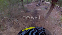
This is the high point of the DH trails at Tokai in altitude and difficulty. In other words its a long ride or push depending on the bike you bring. From the Level 5 jeep track that also takes you to "Cobra" the line drops away down a very steep rockery (read: nothing but rocks) . Although not long, this uber technical and very steep section has two tricky, rocky corners and an exit ramp that can either be rolled or gapped into the more serene territory below. This section earns its Double Black rating solely for the upper 50m. The lower two thirds is far gentler and you can relax a bit into some pleasant drops offs, fast berms and minor corners and rock gardens. A couple of small gap jumps shouldn't present too much of a challenge to properly equipped riders. Bring your DH bike or modern enduro/trail bike. Full face helmets are advisable.

Access Info

Take the jeep track to level 5 as if heading for "Cobra". The trail head for DH0 will appear on your right long before Cobra.

Trail Supporters
Local Trail Association

Recent Activity on Trail

Past Week
  • 0 rides
  •  
6 Months
  • 4 rides
  • 14 miles avg distance
All
  • 53 rides
  • Last: May 21, 2026
c1c2c3c4
January
February
March
April
May
June
July
August
September
October
November
December
update trails status or condition

DH0 Trail Reports

statusdatedescription
Nov 30, 2025 @ 1:04pm (Africa/Johannesburg)
Nov 30, 2025
Major erosion (major ruts or slumping, large boulders and roots exposed due to erosion)
Apr 29, 2025 @ 3:20am
Apr 29, 2025
reporter
Jan 12, 2024 @ 12:01am
Jan 12, 2024
Easier than double black
Jan 18, 2022 @ 4:31am
Jan 18, 2022
reporter
Aug 5, 2021 @ 2:11am
Aug 5, 2021
reporter The heavy rains have resulted in erosion on jeep track and some single track trails. Exercise caution.
more »
Status:
on Nov 30, 2025
Very Dry
Avg: 4.09 (5 votes)
Your vote: 0

view (2,028)
close
3D
Trail Conditions
  • Unknown
  • Snow Groomed
  • Snow Packed
  • Snow Covered
  • Snow Cover Partial
  • Freeze/thaw Cycle
  • Icy
  • Prevalent Mud
  • Wet
  • Variable
  • Ideal
  • Dry
  • Very Dry
Trail Flow (Ridden Direction)
Trailforks scans users ridelogs to determine the most popular direction each trail is ridden. A good flowing trail network will have most trails flowing in a single direction according to their intension.
The colour categories are based on what percentage of riders are riding a trail in its intended direction.
  • > 96%
  • > 90%
  • > 80%
  • > 70%
  • > 50%
  • < 50%
  • bi-directional trail
  • no data
Trail Last Ridden
Trailforks scans ridelogs to determine the last time a trail was ridden.
  • < 2 days
  • < 1 week
  • < 2 weeks
  • < 1 month
  • < 6 months
  • > 6 months
Trail Ridden Direction
The intended direction a trail should be ridden.
  • Downhill Only
  • Downhill Primary
  • Both Directions
  • Uphill Primary
  • Uphill Only
  • One Direction
Contribute Details
Colors indicate trail is missing specified detail.
  • Description
  • Photos
  • Description & Photos
  • Videos
Trail Popularity ?
Trailforks scans ridelogs to determine which trails are ridden the most in the last 9 months. Trails are compared with nearby trails in the same city region with a possible 25 colour shades. Think of this as a heatmap, more rides = more kinetic energy = warmer colors.
  • most popular
  • popular
  • less popular
  • not popular
ATV/ORV/OHV Filter
Max Vehicle Width
inches
US Cell Coverage
Legend
cell carrier legend

Radar Time
Activity Recordings
Trailforks uses anonymized public activity data. ?
Activity Recordings
Trailforks uses anonymized public activity data. ?
Personal Heatmap
Activity Types
all / none
Options
2
Date range month
Winter Trails
Warning A routing network for winter maps does not exist. Selecting trails using the winter trails layer has been disabled.
Missing Trails
Most Popular
Least Popular
Trails are colored based on popularity. The more popular a trail is, the more red. Less popular trails trend towards green.
Jump Magnitude Heatmap
Heatmap of where riders jump on trails. Zoom in to see individual jumps, click circles to view jump details.
BC Backroad Status

Service Road Atlas is a free to use, community-driven service for viewing and creating reports on the numerous back-country service roads around B.C. and Alberta.

map legend
Slope Aspect
Direction the slope faces
Flat N NE E SE S SW W NW
Trails Deemphasized
Trails are shown in grey.
disable
Only show trails with no bike usage.
Enable
Suggested Layers
Based on selected activity type

    Save the current map location and zoom level as your default home location whenever this page is loaded.

    Save
        Directions to dh0 trailhead (-34.049120, 18.396960)

        Photos

        0 more »
        40 |
        Nov 30, 2025 @ 3:04am
        Nov 30, 2025

        Videos

        3 more »
        youtuber 3 MOST Exhilarating Cape Town MTB Trails You...
        15:21 | 833 | Sep 14, 2020 , Tokai
        TOKAI MTB // DOWNHILL LINE // POV
        4:44 | 406 | Dec 26, 2019 , Tokai
        Tokai Raw Run
        4:07 | 753 | Sep 12, 2013 , Tokai

        Routes with this trail

        1.0 11 miles 2,807 ft 25 Out & Back
        1st Loop - Cobra, Mamba, Boomslang, Snake Eyes and Rinkhals 2nd Loop - DU0 to DH4 then finish off with 'My...

        Reviews / Comments

        No reviews yet, be the first to write a review or ask a question.
        Use trail reports to comment on trail conditions.


        We hope you've been enjoying Trailforks!

        Create a FREE account to view trail comments and much more.

        • By craig1451 & contributors
        • #107319 - 2,415 views

        Frequently Asked Questions About DH0

        Where is DH0 located?
        DH0 is located in Tokai Forest MTB Trails, Tokai, South Africa. It is part of the Tokai Forest MTB Trails trail network. The trailhead is located at coordinates -34.04912, 18.39696.
        How hard is DH0?
        DH0 is rated as Double Black Diamond difficulty. The physical rating is Hard. The average grade is 19.2%.
        What is the elevation gain for DH0?
        The trail has 173 ft of elevation descent. The elevation ranges from 1,178 ft to 1,351 ft.
        Is DH0 a point to point trail?
        Yes, DH0 is a point to point trail. The direction is Downhill Only. The trail type is singletrack.

        Hit the Trail

        Open in App

        Get this trail on your phone instantly.
        open trail in app

        Download Trail

        Save to wishlist, Garmin & download.
        save the trail

        Find Related Routes

        Find routes and users activities that include this trail.
        find routes for this trail

        You must enter a description before submitting.