


Open in App
Get this trail on your phone instantly.

A classic San Bernardino trail.
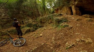
Used three times as a stage for the EWS, is one of the most technical trails we have.
The red soil at the beginning, soon gives way to waterfalls of rocks and steep tight sections. It is a short trail but not for everybody. The punchy techiness of it all is an icon in the area and often used to train for races.
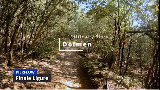
Takes his name from the actual Dolmen you can see on the side after a few minutes of riding.
San Bernardino Area is reachable from the E80 highway accessing Finale Ligure, drive towards the sea cross the bridge on Via XXV Aprile.
Given its nature, the trail can change after weather happenings and season changes. Always pay attention. Some technical features can be unexpected
| c1 | c2 | c3 | c4 |
|---|---|---|---|
January | February | March | April |
May | June | July | August |
September | October | November | December |

Service Road Atlas is a free to use, community-driven service for viewing and creating reports on the numerous back-country service roads around B.C. and Alberta.
Save the current map location and zoom level as your default home location whenever this page is loaded.
SaveWe hope you've been enjoying Trailforks!
Create a FREE account to view trail comments and much more.
You must enter a description before submitting.

