more stats
1.7 miles
Distance
-2,292 ft
Descent
00:23:47
Avg time
-2,292 ft
Altitude change
3,330 ft
Altitude min
5,623 ft
Altitude max
5,622 ft
Altitude start
3,330 ft
Altitude end
-25.6%
Grade
-107.1%
Grade max
2.7%
Grade min
98 ft
Distance climb
2 miles
Distance down
00:23:47
Avg time

Dolmens Details

  • Activities
    • Mountain Bike
    • E-Bike
  • Riding Area
  • Difficulty Rating
  • Voted Difficulty
    Black (2 votes)
  • Local Popularity
    65 in Mountain Biking [+]
    • 55 in E-Biking
  • Global Ranking
    #73464 in Mountain Biking [+]
    • #56141 in E-Biking
  • Trail Type
    Singletrack
  • Bike Type
    DH, AM
  • Direction
    Downhill Only
    Popular Direction Shown
  • Physical Rating
    Moderate
  • Dogs Allowed
    Yes
  • eBike Allowed
    Yes up to Class 1
  • Land Owner
    SIVAL

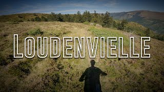
Voici une piste qui vous demandera un beau niveau tant technique que physique. Une ligne très variée qui démarre sur une zone d’estive sur les crêtes de Val Louron avant de plonger sur la magnifique forêt d’Adervielle au milieu de grands résineux.

Access Info

Accès par le col d'Azet

Local Trail Association

Recent Activity on Trail

Past Week
  • 0 rides
  •  
6 Months
  • 6 rides
  • 15.7 km avg distance
All
  • 28 rides
  • Last: May 30, 2026
c1c2c3c4
January
February
March
April
May
June
July
August
September
October
November
December
update trails status or condition

Dolmens Trail Reports

statusdatedescription
May 7, 2026 @ 2:04pm (Europe/Paris)
May 7, 2026
Fermé! La 2ème partie est bloquée par des travaux forestiers. La 1ere partie est roulable mais n’est plus entretenue (arbres tombés)..
Jul 10, 2025 @ 12:08pm
Jul 10, 2025
dusty steep loose dry and super fun
May 28, 2025 @ 12:15pm
May 28, 2025
3 trees down over trail All are passable
Aug 24, 2024 @ 2:17am
Aug 24, 2024
Árbol Caído. Tree Down
Jun 7, 2024 @ 7:11am
Jun 7, 2024
Arbol caído. Tree down
more »
Status:
on May 7, 2026
Avg: 4.43 (13 votes)
Your vote: 0

view (216)
close
3D
Trail Conditions
  • Unknown
  • Snow Groomed
  • Snow Packed
  • Snow Covered
  • Snow Cover Partial
  • Freeze/thaw Cycle
  • Icy
  • Prevalent Mud
  • Wet
  • Variable
  • Ideal
  • Dry
  • Very Dry
Trail Flow (Ridden Direction)
Trailforks scans users ridelogs to determine the most popular direction each trail is ridden. A good flowing trail network will have most trails flowing in a single direction according to their intension.
The colour categories are based on what percentage of riders are riding a trail in its intended direction.
  • > 96%
  • > 90%
  • > 80%
  • > 70%
  • > 50%
  • < 50%
  • bi-directional trail
  • no data
Trail Last Ridden
Trailforks scans ridelogs to determine the last time a trail was ridden.
  • < 2 days
  • < 1 week
  • < 2 weeks
  • < 1 month
  • < 6 months
  • > 6 months
Trail Ridden Direction
The intended direction a trail should be ridden.
  • Downhill Only
  • Downhill Primary
  • Both Directions
  • Uphill Primary
  • Uphill Only
  • One Direction
Contribute Details
Colors indicate trail is missing specified detail.
  • Description
  • Photos
  • Description & Photos
  • Videos
Trail Popularity ?
Trailforks scans ridelogs to determine which trails are ridden the most in the last 9 months. Trails are compared with nearby trails in the same city region with a possible 25 colour shades. Think of this as a heatmap, more rides = more kinetic energy = warmer colors.
  • most popular
  • popular
  • less popular
  • not popular
ATV/ORV/OHV Filter
Max Vehicle Width
inches
US Cell Coverage
Legend
cell carrier legend

Radar Time
Activity Recordings
Trailforks uses anonymized public activity data. ?
Activity Recordings
Trailforks uses anonymized public activity data. ?
Personal Heatmap
Activity Types
all / none
Options
2
Date range month
Winter Trails
Warning A routing network for winter maps does not exist. Selecting trails using the winter trails layer has been disabled.
Missing Trails
Most Popular
Least Popular
Trails are colored based on popularity. The more popular a trail is, the more red. Less popular trails trend towards green.
Jump Magnitude Heatmap
Heatmap of where riders jump on trails. Zoom in to see individual jumps, click circles to view jump details.
BC Backroad Status

Service Road Atlas is a free to use, community-driven service for viewing and creating reports on the numerous back-country service roads around B.C. and Alberta.

map legend
Slope Aspect
Direction the slope faces
Flat N NE E SE S SW W NW
Trails Deemphasized
Trails are shown in grey.
disable
Only show trails with no bike usage.
Enable
Suggested Layers
Based on selected activity type

    Save the current map location and zoom level as your default home location whenever this page is loaded.

    Save
        Directions to dolmens trailhead (42.811740, 0.380300)

        Photos

        1 more »
        86 |
        Jul 10, 2022 @ 5:26am
        Jul 10, 2022

        Videos

        2 more »
        youtuber Loudenvielle - Dolmens | Pyrenees 2023
        7:32 | 448 | Oct 28, 2023 , Loudenvielle
        Ruta Dolmens, Vallée du Louron
        9:17 | 729 | Feb 18, 2021 , Loudenvielle

        7 Reviews & Comments


        We hope you've been enjoying Trailforks!

        Create a FREE account to view trail comments and much more.

        • By JackyStyleTomTF Pro & contributors
        • #316693 - 1,659 views

        Frequently Asked Questions About Dolmens

        Where is Dolmens located?
        Dolmens is located in Louron Bike & Trail / Loudenvielle, Loudenvielle, France. It is part of the Louron Bike & Trail / Loudenvielle trail network. The trailhead is located at coordinates 42.81174, 0.3803.
        How hard is Dolmens?
        Dolmens is rated as Black difficulty. The physical rating is Moderate. The average grade is 25.6%.
        What is the elevation gain for Dolmens?
        The trail has 2,292 ft of elevation descent. The elevation ranges from 3,330 ft to 5,623 ft.
        Is Dolmens a point to point trail?
        Yes, Dolmens is a point to point trail. The direction is Downhill Only. The trail type is singletrack.

        Hit the Trail

        Open in App

        Get this trail on your phone instantly.
        open trail in app

        Download Trail

        Save to wishlist, Garmin & download.
        save the trail

        Find Related Routes

        Find routes and users activities that include this trail.
        find routes for this trail

        You must enter a description before submitting.