more stats
2.4 miles
Distance
36 ft
Climb
-1,587 ft
Descent
00:26:56
Avg time
-1,552 ft
Altitude change
3,270 ft
Altitude min
4,823 ft
Altitude max
4,822 ft
Altitude start
3,271 ft
Altitude end
-12.5%
Grade
-129.3%
Grade max
32.7%
Grade min
712 ft
Distance climb
2 miles
Distance down
538 ft
Distance flat
00:26:56
Avg time

Dopamine Details

  • Activities
    • Mountain Bike
    • E-Bike
    • Hike
    • Trail Running
  • Riding Area
    Morrissey Ridge
    Fernie, British Columbia
  • Difficulty Rating
  • Local Popularity
    25 in Mountain Biking [+]
    • 30 in E-Biking
    • 5 in Trail Running
    • 5 in Hiking
  • Global Ranking
    #118978 in Mountain Biking [+]
    • #93932 in E-Biking
    • #131817 in Trail Running
    • #124999 in Hiking
  • Trail Type
    Singletrack
  • Bike Type
    DH
  • Direction
    Downhill Primary
    Popular Direction Shown
  • Dogs Allowed
    Yes
  • eBike Allowed
    Yes up to Class 1
  • TTFs on Trail
    Drop, Gap Jump, Rock Face

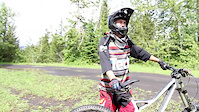
Very serious stunts on this trail: rock drops, cliff drops, monster gap jumps and more. You need to be on your game on this trail. If this is not your thing; you're not armoured up, or you don't have a DH bike; you'll likely be coming out on a spineboard.

Access Info

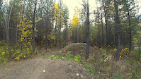
Either hit it from coming down Al Matador, or ride (or drive) up the Shuttle Road until you get to the gravel pit. Dopamine entrance is on the right of the pit, as you face the mountain above you.

Local Trail Association
Traditionally Indigenous Territory

Recent Activity on Trail

Past Week
  • 0 rides
  •  
6 Months
  • 0 rides
  •  
All
  • 5 rides
  • Last: Jun 22, 2026
c1c2c3c4
January
February
March
April
May
June
July
August
September
October
November
December
update trails status or condition

Dopamine Trail Reports

statusdatedescription
Oct 25, 2025 @ 9:30am (America/Edmonton)
Oct 25, 2025
Morrissey shuttle trails and roads are open again
Sep 4, 2025 @ 10:19am
Sep 4, 2025
Morrissey Shuttle trails and roads are closed until further notice due to logging operations. This includes all trails accessed via Matheson...
Jun 28, 2025 @ 10:11am
Jun 28, 2025
Most big Features unridable, i would rate it as a black Trail now, Not frequentes used and Kind of Remote feeling
Jun 10, 2024 @ 10:33am
Jun 10, 2024
Trail closed for forestry work
Oct 11, 2023 @ 10:58am
Oct 11, 2023
more »
Status:
on Oct 25, 2025
Avg: 4.19 (4 votes)
Your vote: 0

view (112)
close
3D
Trail Conditions
  • Unknown
  • Snow Groomed
  • Snow Packed
  • Snow Covered
  • Snow Cover Partial
  • Freeze/thaw Cycle
  • Icy
  • Prevalent Mud
  • Wet
  • Variable
  • Ideal
  • Dry
  • Very Dry
Trail Flow (Ridden Direction)
Trailforks scans users ridelogs to determine the most popular direction each trail is ridden. A good flowing trail network will have most trails flowing in a single direction according to their intension.
The colour categories are based on what percentage of riders are riding a trail in its intended direction.
  • > 96%
  • > 90%
  • > 80%
  • > 70%
  • > 50%
  • < 50%
  • bi-directional trail
  • no data
Trail Last Ridden
Trailforks scans ridelogs to determine the last time a trail was ridden.
  • < 2 days
  • < 1 week
  • < 2 weeks
  • < 1 month
  • < 6 months
  • > 6 months
Trail Ridden Direction
The intended direction a trail should be ridden.
  • Downhill Only
  • Downhill Primary
  • Both Directions
  • Uphill Primary
  • Uphill Only
  • One Direction
Contribute Details
Colors indicate trail is missing specified detail.
  • Description
  • Photos
  • Description & Photos
  • Videos
Trail Popularity ?
Trailforks scans ridelogs to determine which trails are ridden the most in the last 9 months. Trails are compared with nearby trails in the same city region with a possible 25 colour shades. Think of this as a heatmap, more rides = more kinetic energy = warmer colors.
  • most popular
  • popular
  • less popular
  • not popular
ATV/ORV/OHV Filter
Max Vehicle Width
inches
US Cell Coverage
Legend
cell carrier legend

Radar Time
Activity Recordings
Trailforks uses anonymized public activity data. ?
Activity Recordings
Trailforks uses anonymized public activity data. ?
Personal Heatmap
Activity Types
all / none
Options
2
Date range month
Winter Trails
Warning A routing network for winter maps does not exist. Selecting trails using the winter trails layer has been disabled.
Missing Trails
Most Popular
Least Popular
Trails are colored based on popularity. The more popular a trail is, the more red. Less popular trails trend towards green.
Jump Magnitude Heatmap
Heatmap of where riders jump on trails. Zoom in to see individual jumps, click circles to view jump details.
BC Backroad Status

Service Road Atlas is a free to use, community-driven service for viewing and creating reports on the numerous back-country service roads around B.C. and Alberta.

map legend
Slope Aspect
Direction the slope faces
Flat N NE E SE S SW W NW
Trails Deemphasized
Trails are shown in grey.
disable
Only show trails with no bike usage.
Enable
Suggested Layers
Based on selected activity type

    Save the current map location and zoom level as your default home location whenever this page is loaded.

    Save
        Directions to dopamine trailhead (49.454880, -115.018380)

        Photos

        250 more »
        770 |
        Jul 10, 2012 @ 12:17am
        Jul 10, 2012
        1,284 |
        Oct 25, 2015 @ 7:40pm
        Oct 25, 2015
        294 |
        Jul 11, 2021 @ 9:01pm
        Jul 11, 2021
        268 |
        Jun 10, 2020 @ 3:54pm
        Jun 10, 2020

        Videos

        6 more »
        Dopamine Fix
        2:02 | 965 | Jul 27, 2015 , Fernie
        Tanner rides Dopamine
        2:14 | 602 | Jul 17, 2013 , Fernie
        Jump, jump...jump
        0:50 | 920 | Oct 23, 2014 , Fernie
        Dopamine 2012 - Al Leger
        2:39 | 12844 | Sep 15, 2012 , Fernie

        1 Review & Comments


        We hope you've been enjoying Trailforks!

        Create a FREE account to view trail comments and much more.

        • By skibum6969TF Pro FTA VR SAR & contributors
        • #55865 - 5,353 views

        Frequently Asked Questions About Dopamine

        Where is Dopamine located?
        Dopamine is located in Morrissey Ridge, Fernie, British Columbia, Canada. It is part of the Morrissey Ridge trail network. The trailhead is located at coordinates 49.45488, -115.01838.
        How hard is Dopamine?
        Dopamine is rated as Double Black Diamond difficulty. The average grade is 12.5%.
        What is the elevation gain for Dopamine?
        Dopamine has 36 ft of elevation gain. The trail has 1,587 ft of elevation descent. The elevation ranges from 3,270 ft to 4,823 ft.
        Is Dopamine a point to point trail?
        Dopamine is not a point to point trail. The direction is Downhill Primary. The trail type is singletrack.

        Hit the Trail

        Open in App

        Get this trail on your phone instantly.
        open trail in app

        Download Trail

        Save to wishlist, Garmin & download.
        save the trail

        Find Related Routes

        Find routes and users activities that include this trail.
        find routes for this trail

        You must enter a description before submitting.