more stats
2.7 miles
Distance
398 ft
Climb
-378 ft
Descent
00:33:24
Avg time
17 ft
Altitude change
830 ft
Altitude min
895 ft
Altitude max
874 ft
Altitude start
892 ft
Altitude end
0.1%
Grade
-27%
Grade max
32.4%
Grade min
5,197 ft
Distance climb
4,580 ft
Distance down
4,331 ft
Distance flat
00:33:24
Avg time

Double Down Details

  • Activities
    • Mountain Bike
    • E-Bike
    • Hike
    • Trail Running
  • Riding Area
    Brushy Creek Regional Park
    Cedar Park, Texas
  • Difficulty Rating
  • Voted Difficulty
    Black Diamond (5 votes)
  • Local Popularity
    85 in Mountain Biking [+]
    • 85 in E-Biking
    • 90 in Trail Running
    • 70 in Hiking
  • Global Ranking
    #40729 in Mountain Biking [+]
    • #21156 in Trail Running
    • #35407 in Hiking
  • Hiking SAC Scale
    T2 Mountain Hiking
  • Trail Type
    Singletrack
  • Bike Type
    DH, AM, XC
  • Direction
    Both Directions
  • Climb Difficulty
    Black Diamond
  • Physical Rating
    Hard
  • Trail Visibility
    Always easy to follow
  • Dogs Allowed
    Yes
  • eBike Allowed
  • TTFs on Trail
    Drop, Rock Garden

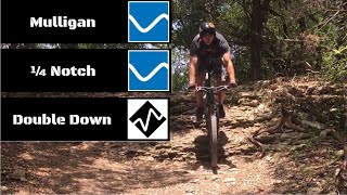
Double Down is an demanding technical mountain bike trail featuring steep descents, punchy climbs, and numerous rock ledges up to 2 feet high that riders must navigate by dropping or hopping up them. This physically grueling trail tests even advanced riders and can be ridden in both directions.

Originally part of the longer "Deception" route that included the 1/4 Notch segment, Double Down was later split into its own separate trail to isolate the highest difficulty portions. While 1/4 Notch offers a more moderate ride, Double Down caters strictly to advanced mountain bikers seeking an challenge on the trails.

Local Trail Association

Recent Activity on Trail

Past Week
  • 2 rides
  • 9 miles average
6 Months
  • 78 rides
  • 10 miles avg distance
All
  • 543 rides
  • Last: Jun 14, 2026
c1c2c3c4
January
February
March
April
May
June
July
August
September
October
November
December
Status:
on Jun 10, 2025
Ideal
Avg: 4.42 (8 votes)
Your vote: 0

view (4,445)
close
3D
Trail Conditions
  • Unknown
  • Snow Groomed
  • Snow Packed
  • Snow Covered
  • Snow Cover Partial
  • Freeze/thaw Cycle
  • Icy
  • Prevalent Mud
  • Wet
  • Variable
  • Ideal
  • Dry
  • Very Dry
Trail Flow (Ridden Direction)
Trailforks scans users ridelogs to determine the most popular direction each trail is ridden. A good flowing trail network will have most trails flowing in a single direction according to their intension.
The colour categories are based on what percentage of riders are riding a trail in its intended direction.
  • > 96%
  • > 90%
  • > 80%
  • > 70%
  • > 50%
  • < 50%
  • bi-directional trail
  • no data
Trail Last Ridden
Trailforks scans ridelogs to determine the last time a trail was ridden.
  • < 2 days
  • < 1 week
  • < 2 weeks
  • < 1 month
  • < 6 months
  • > 6 months
Trail Ridden Direction
The intended direction a trail should be ridden.
  • Downhill Only
  • Downhill Primary
  • Both Directions
  • Uphill Primary
  • Uphill Only
  • One Direction
Contribute Details
Colors indicate trail is missing specified detail.
  • Description
  • Photos
  • Description & Photos
  • Videos
Trail Popularity ?
Trailforks scans ridelogs to determine which trails are ridden the most in the last 9 months. Trails are compared with nearby trails in the same city region with a possible 25 colour shades. Think of this as a heatmap, more rides = more kinetic energy = warmer colors.
  • most popular
  • popular
  • less popular
  • not popular
ATV/ORV/OHV Filter
Max Vehicle Width
inches
US Cell Coverage
Legend
cell carrier legend

Radar Time
Activity Recordings
Trailforks uses anonymized public activity data. ?
Activity Recordings
Trailforks uses anonymized public activity data. ?
Personal Heatmap
Activity Types
all / none
Options
2
Date range month
Winter Trails
Warning A routing network for winter maps does not exist. Selecting trails using the winter trails layer has been disabled.
Missing Trails
Most Popular
Least Popular
Trails are colored based on popularity. The more popular a trail is, the more red. Less popular trails trend towards green.
Jump Magnitude Heatmap
Heatmap of where riders jump on trails. Zoom in to see individual jumps, click circles to view jump details.
BC Backroad Status

Service Road Atlas is a free to use, community-driven service for viewing and creating reports on the numerous back-country service roads around B.C. and Alberta.

map legend
Slope Aspect
Direction the slope faces
Flat N NE E SE S SW W NW
Trails Deemphasized
Trails are shown in grey.
disable
Only show trails with no bike usage.
Enable
Suggested Layers
Based on selected activity type

    Save the current map location and zoom level as your default home location whenever this page is loaded.

    Save
        Directions to double-down-119350 trailhead (30.501930, -97.794380)

        Photos

        12 more »
        175 |
        Aug 10, 2023 @ 3:44pm
        Aug 10, 2023
        240 |
        Aug 10, 2023 @ 3:43pm
        Aug 10, 2023
        231 |
        Aug 10, 2023 @ 3:43pm
        Aug 10, 2023
        257 |
        Feb 17, 2023 @ 4:10pm
        Feb 17, 2023

        Videos

        2 more »
        Challenging Trails at Brushy Creek PART 2...
        12:12 | 1553 | Jun 5, 2020 , Cedar Park
        youtuber OTB'D THE RIDE OUT - Deception Redemption Part...
        11:33 | 1580 | May 25, 2018 , Cedar Park

        Routes with this trail

        16 miles 869 ft 20 Loop
        A little bit of everything - almost all of the trails at Brushy Creek.
        27 miles 1,324 ft 34
        Big day on the bike if you're up for it

        2 Reviews & Comments


        We hope you've been enjoying Trailforks!

        Create a FREE account to view trail comments and much more.

        • By toddTF Pro Trailforks & contributors
        • #119350 - 6,385 views

        Frequently Asked Questions About Double Down

        Where is Double Down located?
        Double Down is located in Brushy Creek Regional Park, Cedar Park, Texas, United States. It is part of the Brushy Creek Regional Park trail network. The trailhead is located at coordinates 30.50193, -97.79438.
        How hard is Double Down?
        Double Down is rated as Black Diamond difficulty. The physical rating is Hard. The average grade is 0.1%. The climb difficulty is rated Black Diamond.
        What is the elevation gain for Double Down?
        Double Down has 398 ft of elevation gain. The trail has 378 ft of elevation descent. The elevation ranges from 830 ft to 895 ft.
        Is Double Down a point to point trail?
        Double Down is not a point to point trail. The direction is Both Directions. The trail type is singletrack.

        Hit the Trail

        Open in App

        Get this trail on your phone instantly.
        open trail in app

        Download Trail

        Save to wishlist, Garmin & download.
        save the trail

        Find Related Routes

        Find routes and users activities that include this trail.
        find routes for this trail

        You must enter a description before submitting.