more stats
4,232 ft
Distance
-779 ft
Descent
00:07:14
Avg time
-779 ft
Altitude change
2,821 ft
Altitude min
3,600 ft
Altitude max
3,600 ft
Altitude start
2,822 ft
Altitude end
-18.4%
Grade
-47%
Grade max
4,170 ft
Distance down
62 ft
Distance flat
00:07:14
Avg time

Downhill Details

  • Activities
    • Mountain Bike
    • E-Bike
  • Riding Area
  • Difficulty Rating
  • Local Popularity
    30 in Mountain Biking [+]
    • 10 in E-Biking
  • Global Ranking
    #96895 in Mountain Biking [+]
    • #103261 in E-Biking
  • Trail Type
    Singletrack
  • Bike Type
    DH
  • Direction
    Downhill Only
    Popular Direction Shown
  • Season
    April - November
  • eBike Allowed
  • TTFs on Trail
    Drop, Jump, Rock Face
  • Ride in Rain
    Yes

English below

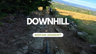
Geich hinter der Bergstation beginnt die Downhill. Die Streckenlänge beträgt 1,9 km, der Höhenunterschied 260 m. Im ersten Streckenabschnitt hat Diddie Schneider seinen New School Stil von Willingen in verkleinerter Form weitergeführt. Dieser zeichnet vor allem durch seine vielen verschiedenen Sprung- und Linienkombinationen aus.

Im 2. Abschnitt befinden sich vor allem einige schnelle Wiesenkurven, von wo aus die Strecke dann in einen verblockten steilen Teil auf Höhe Mittelstation mündet. Der untere Teil wurde zum Saisonstart überarbeitet und ausgebessert. Die Streckenführung ist gleich geblieben, es wurden u.a. ein Roadgap und ein Steinfeld eingebaut (siehe Bilder). Die Downhill Strecke ist wegen ihrer verschiedenen Linien und Umfahrungen auch für weniger geübte Fahrer geeignet. Völlige Anfänger sollten die Befahrung unterlassen.


Right behind the end of the chairlift, the downhill track beginns. It has a length of 1,9 km and a difference in altitude of 260 m. The first part of the trail features many different jump and line choice options. Part two has some fast meadow corners, with a blocked, technical part around the mid station. The lower part was improved at the beginning of the season, a Roadgap and a rockfield were added. Because of the many line options, the track is also suitable for less experienced riders, but total beginners shouldn't ride this trail.

Access Info

Chairlift: Turn right at the end of the chairlift, access beside the lift house.
T-Bar: Follow the gravelroad uphill and turn right at the top. Access beside lift house of the chairlift.

Bike Park

Recent Activity on Trail

Past Week
  • 3 rides
  • 27 miles average
6 Months
  • 28 rides
  • 23 miles avg distance
All
  • 151 rides
  • Last: Jul 2, 2026
c1c2c3c4
January
February
March
April
May
June
July
August
September
October
November
December
Status:
on Jun 13, 2026
Ideal
Avg: 4.33 (21 votes)
Your vote: 0

view (1,683)
close
3D
Trail Conditions
  • Unknown
  • Snow Groomed
  • Snow Packed
  • Snow Covered
  • Snow Cover Partial
  • Freeze/thaw Cycle
  • Icy
  • Prevalent Mud
  • Wet
  • Variable
  • Ideal
  • Dry
  • Very Dry
Trail Flow (Ridden Direction)
Trailforks scans users ridelogs to determine the most popular direction each trail is ridden. A good flowing trail network will have most trails flowing in a single direction according to their intension.
The colour categories are based on what percentage of riders are riding a trail in its intended direction.
  • > 96%
  • > 90%
  • > 80%
  • > 70%
  • > 50%
  • < 50%
  • bi-directional trail
  • no data
Trail Last Ridden
Trailforks scans ridelogs to determine the last time a trail was ridden.
  • < 2 days
  • < 1 week
  • < 2 weeks
  • < 1 month
  • < 6 months
  • > 6 months
Trail Ridden Direction
The intended direction a trail should be ridden.
  • Downhill Only
  • Downhill Primary
  • Both Directions
  • Uphill Primary
  • Uphill Only
  • One Direction
Contribute Details
Colors indicate trail is missing specified detail.
  • Description
  • Photos
  • Description & Photos
  • Videos
Trail Popularity ?
Trailforks scans ridelogs to determine which trails are ridden the most in the last 9 months. Trails are compared with nearby trails in the same city region with a possible 25 colour shades. Think of this as a heatmap, more rides = more kinetic energy = warmer colors.
  • most popular
  • popular
  • less popular
  • not popular
ATV/ORV/OHV Filter
Max Vehicle Width
inches
US Cell Coverage
Legend
cell carrier legend

Radar Time
Activity Recordings
Trailforks uses anonymized public activity data. ?
Activity Recordings
Trailforks uses anonymized public activity data. ?
Personal Heatmap
Activity Types
all / none
Options
2
Date range month
Winter Trails
Warning A routing network for winter maps does not exist. Selecting trails using the winter trails layer has been disabled.
Missing Trails
Most Popular
Least Popular
Trails are colored based on popularity. The more popular a trail is, the more red. Less popular trails trend towards green.
Jump Magnitude Heatmap
Heatmap of where riders jump on trails. Zoom in to see individual jumps, click circles to view jump details.
BC Backroad Status

Service Road Atlas is a free to use, community-driven service for viewing and creating reports on the numerous back-country service roads around B.C. and Alberta.

map legend
Slope Aspect
Direction the slope faces
Flat N NE E SE S SW W NW
Trails Deemphasized
Trails are shown in grey.
disable
Only show trails with no bike usage.
Enable
Suggested Layers
Based on selected activity type

    Save the current map location and zoom level as your default home location whenever this page is loaded.

    Save
        Directions to downhill-25897 trailhead (48.924140, 13.037420)

        Photos

        1 more »
        870 |
        Aug 20, 2014 @ 9:04am
        Aug 20, 2014

        Videos

        8 more »
        youtuber Downhill Strecke freundlich bedankt Bikepark...
        3:05 | 15 | Jun 12, 2026 , Bischofsmais
        Bikepark Geisskopf – Downhill – Nomad CC
        5:26 | 658 | Sep 7, 2018 , Bischofsmais
        DOWNHILL Top to bottom - Bikepark Geisskopf
        2:48 | 467 | Jun 12, 2018 , Bischofsmais
        youtuber Bikepark Geisskopf Downhill Raw in 3 minutes
        509 | Nov 2, 2017 , Bischofsmais

        Reviews / Comments

        No reviews yet, be the first to write a review or ask a question.
        Use trail reports to comment on trail conditions.


        We hope you've been enjoying Trailforks!

        Create a FREE account to view trail comments and much more.

        • By UniqueTerrainProductions & contributors
        • #25897 - 2,721 views

        Frequently Asked Questions About Downhill

        Where is Downhill located?
        Downhill is located in MTB Zone Bikepark Geisskopf, Bischofsmais, Germany. It is part of the MTB Zone Bikepark Geisskopf trail network. The trailhead is located at coordinates 48.92414, 13.03742.
        How hard is Downhill?
        Downhill is rated as Black difficulty. The average grade is 18.4%.
        What is the elevation gain for Downhill?
        The trail has 238 m of elevation descent. The elevation ranges from 860 m to 1,097 m.
        Is Downhill a point to point trail?
        Yes, Downhill is a point to point trail. The direction is Downhill Only. The trail type is singletrack.

        Hit the Trail

        Open in App

        Get this trail on your phone instantly.
        open trail in app

        Download Trail

        Save to wishlist, Garmin & download.
        save the trail

        Find Related Routes

        Find routes and users activities that include this trail.
        find routes for this trail

        You must enter a description before submitting.