more stats
1,339 ft
Distance
-140 ft
Descent
00:04:37
Avg time
-141 ft
Altitude change
1,096 ft
Altitude min
1,237 ft
Altitude max
1,237 ft
Altitude start
1,096 ft
Altitude end
-10.5%
Grade
-26.2%
Grade max
-0.8%
Grade min
1,237 ft
Distance down
66 ft
Distance flat
00:04:37
Avg time

Dragon Scales Details

  • Activities
    • Mountain Bike
    • E-Bike
    • Hike
    • Trail Running
  • Riding Area
    Slaughter Pen Trails
    Bentonville, Arkansas
  • Difficulty Rating
  • Voted Difficulty
    Black Diamond (1 vote)
  • Local Popularity
    85 in Mountain Biking [+]
    • 90 in E-Biking
    • 45 in Trail Running
    • 80 in Hiking
  • Trail Type
    Singletrack
  • Bike Type
    AM, XC, Adaptive MTB
  • Direction
    Downhill Only[+]
    Popular Direction Shown
    • Downhill Only for E-Biking
    • Downhill Only for Trail Running
    • Downhill Only for Hiking
  • Trail Visibility
    Always easy to follow
  • eBike Allowed
    Yes up to Class 1
  • TTFs on Trail
    Berm, Jump, Rock Garden

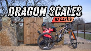
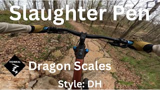
Not suggested for Hard Tails this is one Chunky Downhill but it's fast and requires fast reflexes this is one jump about two thirds of the way down that will land you right into a berm. It's fine but will make you go white knuckled if you don't expect it.

Adaptive Bike Info
aMTB Blue Rating: Intermediate features and steeper terrain.

Suspension and clearance recommended

Local Trail Association

Recent Activity on Trail

Past Week
  • 14 rides
  • 15 miles average
6 Months
  • 394 rides
  • 14 miles avg distance
All
  • 2,549 rides
  • Last: Jun 23, 2026
c1c2c3c4
January
February
March
April
May
June
July
August
September
October
November
December
Status:
on Apr 1, 2026
Dry
Avg: 4.48 (19 votes)
Your vote: 0

view (24,934)
close
3D
Trail Conditions
  • Unknown
  • Snow Groomed
  • Snow Packed
  • Snow Covered
  • Snow Cover Partial
  • Freeze/thaw Cycle
  • Icy
  • Prevalent Mud
  • Wet
  • Variable
  • Ideal
  • Dry
  • Very Dry
Trail Flow (Ridden Direction)
Trailforks scans users ridelogs to determine the most popular direction each trail is ridden. A good flowing trail network will have most trails flowing in a single direction according to their intension.
The colour categories are based on what percentage of riders are riding a trail in its intended direction.
  • > 96%
  • > 90%
  • > 80%
  • > 70%
  • > 50%
  • < 50%
  • bi-directional trail
  • no data
Trail Last Ridden
Trailforks scans ridelogs to determine the last time a trail was ridden.
  • < 2 days
  • < 1 week
  • < 2 weeks
  • < 1 month
  • < 6 months
  • > 6 months
Trail Ridden Direction
The intended direction a trail should be ridden.
  • Downhill Only
  • Downhill Primary
  • Both Directions
  • Uphill Primary
  • Uphill Only
  • One Direction
Contribute Details
Colors indicate trail is missing specified detail.
  • Description
  • Photos
  • Description & Photos
  • Videos
Trail Popularity ?
Trailforks scans ridelogs to determine which trails are ridden the most in the last 9 months. Trails are compared with nearby trails in the same city region with a possible 25 colour shades. Think of this as a heatmap, more rides = more kinetic energy = warmer colors.
  • most popular
  • popular
  • less popular
  • not popular
ATV/ORV/OHV Filter
Max Vehicle Width
inches
US Cell Coverage
Legend
cell carrier legend

Radar Time
Activity Recordings
Trailforks uses anonymized public activity data. ?
Activity Recordings
Trailforks uses anonymized public activity data. ?
Personal Heatmap
Activity Types
all / none
Options
2
Date range month
Winter Trails
Warning A routing network for winter maps does not exist. Selecting trails using the winter trails layer has been disabled.
Missing Trails
Most Popular
Least Popular
Trails are colored based on popularity. The more popular a trail is, the more red. Less popular trails trend towards green.
Jump Magnitude Heatmap
Heatmap of where riders jump on trails. Zoom in to see individual jumps, click circles to view jump details.
BC Backroad Status

Service Road Atlas is a free to use, community-driven service for viewing and creating reports on the numerous back-country service roads around B.C. and Alberta.

map legend
Slope Aspect
Direction the slope faces
Flat N NE E SE S SW W NW
Trails Deemphasized
Trails are shown in grey.
disable
Only show trails with no bike usage.
Enable
Suggested Layers
Based on selected activity type

    Save the current map location and zoom level as your default home location whenever this page is loaded.

    Save
        Directions to dragon-scales trailhead (36.404900, -94.200090)

        Photos

        8 more »
        99 |
        Oct 3, 2023 @ 1:53pm
        Oct 3, 2023
        218 |
        Nov 26, 2022 @ 6:12pm
        Nov 26, 2022
        213 |
        Oct 24, 2022 @ 1:03pm
        Oct 24, 2022
        161 |
        Oct 24, 2022 @ 1:02pm
        Oct 24, 2022

        Videos

        8 more »
        Dragon Scales Trail, Slaughter Pen,...
        134 | Jun 16, 2025 , Bentonville
        DRAGON SCALES, OZ Castle - Bentonville Arkansas.
        2:15 | 266 | May 4, 2024 , Bentonville
        Dragon Scales - Castle Hub - Slaughter Pen
        0:34 | 154 | Apr 10, 2024 , Bentonville
        Castle DH hub in Bentonville - Slaughter Pen
        4:22 | 285 | Dec 17, 2023 , Bentonville

        Routes with this trail

        5.0 16 miles 1,535 ft 54
        This route is a great place to start for first-time visitors to Slaughter Pen Trails. It hits all the...
        17 miles 1,643 ft 60 Loop
        While Expressway trail is closed, expert adaptive riders can leave from The Bend NWA to tackle the Whole...
        9 miles 1,139 ft 39
        A mix of Enduro lines just guessing

        3 Reviews & Comments


        We hope you've been enjoying Trailforks!

        Create a FREE account to view trail comments and much more.

        • By MaxLOLumeTF Pro & contributors
        • #478098 - 4,169 views

        Frequently Asked Questions About Dragon Scales

        Where is Dragon Scales located?
        Dragon Scales is located in Slaughter Pen Trails, Bentonville, Arkansas, United States. It is part of the Slaughter Pen Trails trail network. The trailhead is located at coordinates 36.4049, -94.20009.
        How hard is Dragon Scales?
        Dragon Scales is rated as Black Diamond difficulty. The average grade is 10.5%.
        What is the elevation gain for Dragon Scales?
        The trail has 140 ft of elevation descent. The elevation ranges from 1,096 ft to 1,237 ft.
        Is Dragon Scales a point to point trail?
        Yes, Dragon Scales is a point to point trail. The direction is Downhill Only. The trail type is singletrack.

        Hit the Trail

        Open in App

        Get this trail on your phone instantly.
        open trail in app

        Download Trail

        Save to wishlist, Garmin & download.
        save the trail

        Find Related Routes

        Find routes and users activities that include this trail.
        find routes for this trail

        You must enter a description before submitting.