more stats
4.0 miles
Distance
1,190 ft
Climb
-10 ft
Descent
00:27:10
Avg time
1,181 ft
Altitude change
7,379 ft
Altitude min
8,561 ft
Altitude max
7,380 ft
Altitude start
8,560 ft
Altitude end
5.6%
Grade
-6.8%
Grade max
27.9%
Grade min
4 miles
Distance climb
568 ft
Distance down
1,266 ft
Distance flat
00:27:10
Avg time

Dry Fork Details

  • Activities
    • Mountain Bike
    • Horse
    • Hike
    • Trail Running
  • Riding Area
    Log Chutes
    Durango, Colorado
  • Ref Number
    #616
  • Difficulty Rating
  • Local Popularity
    90 in Mountain Biking [+]
    • 65 in Trail Running
    • 60 in Hiking
    • 5 in Horseback
  • Global Ranking
    #37038 in Mountain Biking [+]
    • #83060 in Trail Running
    • #73213 in Hiking
    • #1177 in Horseback
  • Hiking SAC Scale
    T2 Mountain Hiking
  • Trail Type
    Singletrack
  • Bike Type
    AM, XC
  • Direction
    Both Directions
    Popular In Reverse
  • Climb Difficulty
    Blue
  • Physical Rating
    Moderate
  • Trail Visibility
    Always easy to follow
  • Dogs Allowed
    Yes
  • eBike Allowed
  • Land Owner

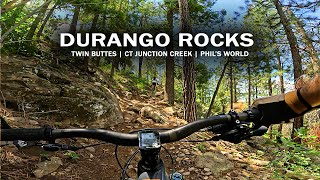
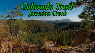
Multi direction trail that is often climbed more than descended, this trail weaves through ponderosa pines with a moderate grade. Often used to complete the Dry Fork > Colorado Trail > Hoffeins Connect loop.

The parking and road to access from the south (CR20Cool is closed from Dec 1 - April 15 annually for wildlife. You may not pass through the fence at this time.

Trail Supporters
Local Trail Association
Traditionally Indigenous Territory

Recent Activity on Trail

Past Week
  • 6 rides
  • 14.1 km average
6 Months
  • 60 rides
  • 20.1 km avg distance
All
  • 571 rides
  • Last: Jun 14, 2026
c1c2c3c4
January
February
March
April
May
June
July
August
September
October
November
December
update trails status or condition

Dry Fork Trail Reports

statusdatedescription
May 1, 2026 @ 10:43am (America/Denver)
May 1, 2026
reporter
May 1, 2026 @ 8:03am (America/Vancouver)
May 1, 2026
Apr 19, 2026 @ 7:32am (America/Denver)
Apr 19, 2026
reporter Trail clear and dry, but cannot access or exit to Lightner Creek until May 1.
Dec 1, 2025 @ 8:34am (America/Denver)
Dec 1, 2025
reporter Seasonal wildlife closures for all users from December 1 through April 30 in order to protect wintering wildlife, with the possibility of opening...
Nov 28, 2025 @ 7:45am (America/Denver)
Nov 28, 2025
Freeze Thaw making it a mudfest. There is no snow, but muddy after 8am.
more »
Status:
on May 1, 2026
Ideal
Avg: 4.26 (9 votes)
Your vote: 0

view (3,518)
close
3D
Trail Conditions
  • Unknown
  • Snow Groomed
  • Snow Packed
  • Snow Covered
  • Snow Cover Partial
  • Freeze/thaw Cycle
  • Icy
  • Prevalent Mud
  • Wet
  • Variable
  • Ideal
  • Dry
  • Very Dry
Trail Flow (Ridden Direction)
Trailforks scans users ridelogs to determine the most popular direction each trail is ridden. A good flowing trail network will have most trails flowing in a single direction according to their intension.
The colour categories are based on what percentage of riders are riding a trail in its intended direction.
  • > 96%
  • > 90%
  • > 80%
  • > 70%
  • > 50%
  • < 50%
  • bi-directional trail
  • no data
Trail Last Ridden
Trailforks scans ridelogs to determine the last time a trail was ridden.
  • < 2 days
  • < 1 week
  • < 2 weeks
  • < 1 month
  • < 6 months
  • > 6 months
Trail Ridden Direction
The intended direction a trail should be ridden.
  • Downhill Only
  • Downhill Primary
  • Both Directions
  • Uphill Primary
  • Uphill Only
  • One Direction
Contribute Details
Colors indicate trail is missing specified detail.
  • Description
  • Photos
  • Description & Photos
  • Videos
Trail Popularity ?
Trailforks scans ridelogs to determine which trails are ridden the most in the last 9 months. Trails are compared with nearby trails in the same city region with a possible 25 colour shades. Think of this as a heatmap, more rides = more kinetic energy = warmer colors.
  • most popular
  • popular
  • less popular
  • not popular
ATV/ORV/OHV Filter
Max Vehicle Width
inches
US Cell Coverage
Legend
cell carrier legend

Radar Time
Activity Recordings
Trailforks uses anonymized public activity data. ?
Activity Recordings
Trailforks uses anonymized public activity data. ?
Personal Heatmap
Activity Types
all / none
Options
2
Date range month
Winter Trails
Warning A routing network for winter maps does not exist. Selecting trails using the winter trails layer has been disabled.
Missing Trails
Most Popular
Least Popular
Trails are colored based on popularity. The more popular a trail is, the more red. Less popular trails trend towards green.
Jump Magnitude Heatmap
Heatmap of where riders jump on trails. Zoom in to see individual jumps, click circles to view jump details.
BC Backroad Status

Service Road Atlas is a free to use, community-driven service for viewing and creating reports on the numerous back-country service roads around B.C. and Alberta.

map legend
Slope Aspect
Direction the slope faces
Flat N NE E SE S SW W NW
Trails Deemphasized
Trails are shown in grey.
disable
Only show trails with no bike usage.
Enable
Suggested Layers
Based on selected activity type

    Save the current map location and zoom level as your default home location whenever this page is loaded.

    Save
        Directions to dry-fork trailhead (37.331170, -107.938770)

        Photos

        12 more »
        203 |
        Oct 3, 2020 @ 10:37am
        Oct 3, 2020
        226 |
        Sep 18, 2020 @ 4:56pm
        Sep 18, 2020
        87 |
        Jul 2, 2022 @ 1:46pm
        Jul 2, 2022
        172 |
        Oct 3, 2020 @ 7:28pm
        Oct 3, 2020

        Videos

        2 more »
        Colorado MTB Trip 2024 | Durango, Twin Buttes,...
        39:22 | 87 | Jan 6, 2025 , Durango
        youtuber Best Alpine MTB trail in Durango, CO - CT...
        10:07 | 250 | Apr 12, 2024 , Durango

        Routes with this trail

        3.5 15 miles 2,397 ft 4 Out & Back
        Classic Dry Fork route, best ridden clockwise.
        26 miles 2,400 ft 4 Loop
        A loop that starts in town and heads west on Hwy 160 to Lightner Creek Road. The route heads North to the...
        53 miles 7,930 ft 7
        For riding from Ski Resort to Durango on mostly singletrack and on the CT.

        3 Reviews & Comments


        We hope you've been enjoying Trailforks!

        Create a FREE account to view trail comments and much more.

        • By toddTF Pro Trailforks & contributors
        • #13822 - 4,929 views

        Frequently Asked Questions About Dry Fork

        Where is Dry Fork located?
        Dry Fork is located in Log Chutes, Durango, Colorado, United States. It is part of the Log Chutes trail network. The trailhead is located at coordinates 37.33117, -107.93877.
        How hard is Dry Fork?
        Dry Fork is rated as Blue difficulty. The physical rating is Moderate. The average grade is 5.6%. The climb difficulty is rated Blue.
        What is the elevation gain for Dry Fork?
        Dry Fork has 1,190 ft of elevation gain. The trail has 10 ft of elevation descent. The elevation ranges from 7,379 ft to 8,561 ft.
        Is Dry Fork a point to point trail?
        Dry Fork is not a point to point trail. The direction is Both Directions. The trail type is singletrack.

        Hit the Trail

        Open in App

        Get this trail on your phone instantly.
        open trail in app

        Download Trail

        Save to wishlist, Garmin & download.
        save the trail

        Find Related Routes

        Find routes and users activities that include this trail.
        find routes for this trail

        You must enter a description before submitting.