
Open in App
Get this trail on your phone instantly.

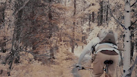
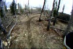
Elbow Valley [EV], along with Sulphur Springs, has been used by mountain bikers since the late 80s. It is an old hiking trail that also gets used by trail runners, horses and cows.
Most people start EV from Station Flats, and use it to connect with Sulphur Springs. East to west on EV past the SS turnoff puts you onto a looong climb followed by a loose descent, more climbing, crossing Moose Mountain Road and then a fairly long descent that will cross Sulphur Springs and continue down to meet Family Guy and then cross Ing's Mine Road. The trail climbs for 1km past Ing's, and then gradually descends the last 2km to Powderface.
The trail surface varies a lot over its length, but the east end has seen the most use and is seriously blown out in places. Overall it's a blue trail, but some parts may have you thinking it's much harder. Expect everything from narrow dirt singletrack to scree to what looks like a steep gravel road with big root steps across it. Like Sulphur Springs, EV has turned into a connector trail, allowing riders to construct loops with other trails.
Access is from Station Flats or Powderface trailheads off of Hwy 66. It can also be reached from Ing's Mine Road, Moose Mountain Road, and Sulphur Springs trail [in two places].
| c1 | c2 | c3 | c4 |
|---|---|---|---|
January | February | March | April |
May | June | July | August |
September | October | November | December |

Service Road Atlas is a free to use, community-driven service for viewing and creating reports on the numerous back-country service roads around B.C. and Alberta.
Save the current map location and zoom level as your default home location whenever this page is loaded.
SaveWe hope you've been enjoying Trailforks!
Create a FREE account to view trail comments and much more.
You must enter a description before submitting.

