more stats
696 ft
Distance
-58 ft
Descent
00:01:12
Avg time
-60 ft
Altitude change
125 ft
Altitude min
186 ft
Altitude max
186 ft
Altitude start
125 ft
Altitude end
-8.7%
Grade
-21.9%
Grade max
-1.7%
Grade min
663 ft
Distance down
33 ft
Distance flat
00:01:12
Avg time

Eldridge Falls Details

  • Activities
    • Mountain Bike
    • E-Bike
    • Winter Fat Bike
    • Hike
    • Trail Running
  • Riding Area
    Grey Mountain
    Falmouth, Nova Scotia
  • Difficulty Rating
  • Local Popularity
    80 in Mountain Biking [+]
    • 5 in E-Biking
    • 5 in Trail Running
    • 5 in Hiking
  • Global Ranking
    #87569 in Mountain Biking [+]
    • #263097 in Trail Running
    • #240872 in Hiking
  • Trail Type
    Singletrack
  • Bike Type
    DH, AM, XC, Fat
  • Direction
    Downhill Primary
  • Physical Rating
    Moderate
  • Family Friendly
    Yes
  • Dogs Allowed
    Yes
  • eBike Allowed
  • TTFs on Trail
    Drop, Jump, Gap Jump
  • Ride in Rain
    Yes

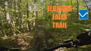
This is a no holds barred fast as you can go with rocks, jumps, trees a couple of descents. You have to pay attention as this trail grabs you. Proof of this as The KOM has dropped from mid 30 second to probably below 30 seconds soon Yes,the trail is slow but get the KOM and you get legit bragging rights... for the time being!

Local Trail Association
Traditionally Indigenous Territory

Recent Activity on Trail

Past Week
  • 1 rides
  • 14 miles average
6 Months
  • 23 rides
  • 11 miles avg distance
All
  • 89 rides
  • Last: Jun 20, 2026
c1c2c3c4
January
February
March
April
May
June
July
August
September
October
November
December
update trails status or condition

Eldridge Falls Trail Reports

statusdatedescription
Apr 8, 2026 @ 10:56pm (America/Halifax)
Apr 8, 2026
Trails are clear and good to ride, might be a few small wet spots
Nov 15, 2025 @ 4:46pm (America/Halifax)
Nov 15, 2025
Trail is clear and has been leaf blown, may have some wet spots
Jun 28, 2024 @ 2:07pm
Jun 28, 2024
May 31, 2024 @ 1:46pm
May 31, 2024
May 18, 2024 @ 8:32am
May 18, 2024
more »
Status:
on Apr 8, 2026
Variable
Avg: 3.99 (2 votes)
Your vote: 0

view (402)
close
3D
Trail Conditions
  • Unknown
  • Snow Groomed
  • Snow Packed
  • Snow Covered
  • Snow Cover Partial
  • Freeze/thaw Cycle
  • Icy
  • Prevalent Mud
  • Wet
  • Variable
  • Ideal
  • Dry
  • Very Dry
Trail Flow (Ridden Direction)
Trailforks scans users ridelogs to determine the most popular direction each trail is ridden. A good flowing trail network will have most trails flowing in a single direction according to their intension.
The colour categories are based on what percentage of riders are riding a trail in its intended direction.
  • > 96%
  • > 90%
  • > 80%
  • > 70%
  • > 50%
  • < 50%
  • bi-directional trail
  • no data
Trail Last Ridden
Trailforks scans ridelogs to determine the last time a trail was ridden.
  • < 2 days
  • < 1 week
  • < 2 weeks
  • < 1 month
  • < 6 months
  • > 6 months
Trail Ridden Direction
The intended direction a trail should be ridden.
  • Downhill Only
  • Downhill Primary
  • Both Directions
  • Uphill Primary
  • Uphill Only
  • One Direction
Contribute Details
Colors indicate trail is missing specified detail.
  • Description
  • Photos
  • Description & Photos
  • Videos
Trail Popularity ?
Trailforks scans ridelogs to determine which trails are ridden the most in the last 9 months. Trails are compared with nearby trails in the same city region with a possible 25 colour shades. Think of this as a heatmap, more rides = more kinetic energy = warmer colors.
  • most popular
  • popular
  • less popular
  • not popular
ATV/ORV/OHV Filter
Max Vehicle Width
inches
US Cell Coverage
Legend
cell carrier legend

Radar Time
Activity Recordings
Trailforks uses anonymized public activity data. ?
Activity Recordings
Trailforks uses anonymized public activity data. ?
Personal Heatmap
Activity Types
all / none
Options
2
Date range month
Winter Trails
Warning A routing network for winter maps does not exist. Selecting trails using the winter trails layer has been disabled.
Missing Trails
Most Popular
Least Popular
Trails are colored based on popularity. The more popular a trail is, the more red. Less popular trails trend towards green.
Jump Magnitude Heatmap
Heatmap of where riders jump on trails. Zoom in to see individual jumps, click circles to view jump details.
BC Backroad Status

Service Road Atlas is a free to use, community-driven service for viewing and creating reports on the numerous back-country service roads around B.C. and Alberta.

map legend
Slope Aspect
Direction the slope faces
Flat N NE E SE S SW W NW
Trails Deemphasized
Trails are shown in grey.
disable
Only show trails with no bike usage.
Enable
Suggested Layers
Based on selected activity type

    Save the current map location and zoom level as your default home location whenever this page is loaded.

    Save
        Directions to eldridge-falls trailhead (44.992370, -64.226800)

        Photos

        1 more »
        124 |
        Jan 2, 2021 @ 11:52am
        Jan 2, 2021

        Videos

        2 more »
        Grey Mountain - Eldridge falls
        0:58 | 407 | Oct 6, 2021 , Falmouth
        Eldridge Falls Sept. 2019
        0:00 | 130 | Oct 2, 2019 , Falmouth

        Routes with this trail

        2 + Hrs on Grey Archived
        13 miles 1,606 ft 55
        If you are not familiar how the trail system works, here is a route I use to hit all the Common Trails on...

        Reviews / Comments

        No reviews yet, be the first to write a review or ask a question.
        Use trail reports to comment on trail conditions.


        We hope you've been enjoying Trailforks!

        Create a FREE account to view trail comments and much more.

        • By bacurry AVMBA & contributors
        • #43079 - 5,629 views

        Frequently Asked Questions About Eldridge Falls

        Where is Eldridge Falls located?
        Eldridge Falls is located in Grey Mountain, Falmouth, Nova Scotia, Canada. It is part of the Grey Mountain trail network. The trailhead is located at coordinates 44.99237, -64.2268.
        How hard is Eldridge Falls?
        Eldridge Falls is rated as Blue difficulty. The physical rating is Moderate. The average grade is 8.7%.
        What is the elevation gain for Eldridge Falls?
        The trail has 58 ft of elevation descent. The elevation ranges from 125 ft to 186 ft.
        Is Eldridge Falls a point to point trail?
        Eldridge Falls is not a point to point trail. The direction is Downhill Primary. The trail type is singletrack.

        Hit the Trail

        Open in App

        Get this trail on your phone instantly.
        open trail in app

        Download Trail

        Save to wishlist, Garmin & download.
        save the trail

        Find Related Routes

        Find routes and users activities that include this trail.
        find routes for this trail

        You must enter a description before submitting.