more stats
1.2 miles
Distance
38 ft
Climb
-531 ft
Descent
00:12:19
Avg time
-494 ft
Altitude change
4,694 ft
Altitude min
5,202 ft
Altitude max
5,188 ft
Altitude start
4,695 ft
Altitude end
-7.6%
Grade
-32.6%
Grade max
11.2%
Grade min
948 ft
Distance climb
5,194 ft
Distance down
381 ft
Distance flat
00:12:19
Avg time

Electric Monkey Details

  • Activities
    • Mountain Bike
    • E-Bike
  • Riding Area
    Pass Powderkeg
    Blairmore, Alberta
  • Difficulty Rating
  • Local Popularity
    90 in Mountain Biking [+]
    • 95 in E-Biking
  • Global Ranking
    #875 in Mountain Biking
  • Trail Type
    Machine Groomed
  • Bike Type
    AM, XC
  • Trail Visibility
    Always easy to follow
  • Season
    May-October
  • eBike Allowed
    Yes up to Class 1
  • TTFs on Trail
    Berm, Jump, Rock Garden
  • Year Opened
    2022
  • Land Owner

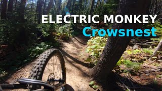
Electric Monkey is a downhill-only, machine-built bike trail. On this trail, you'll find lots of flowy singletrack, as well as a few short rocky sections that add some technical challenge. There are plenty of berms and optional jumps to make this trail fun for a variety of riding styles and abilities.

Access Info

Climb Chainsaw Massacre.

Disclaimer

Downhill biking only, no hiking

Trail Supporters
Local Trail Association

Recent Activity on Trail

Past Week
  • 17 rides
  • 16 miles average
6 Months
  • 68 rides
  • 12 miles avg distance
All
  • 742 rides
  • Last: Jun 23, 2026
c1c2c3c4
January
February
March
April
May
June
July
August
September
October
November
December
update trails status or condition

Electric Monkey Trail Reports

statusdatedescription
Jun 9, 2026 @ 5:37pm (America/Creston)
Jun 9, 2026
Some water and mud.
Jun 7, 2026 @ 10:01am (America/Creston)
Jun 7, 2026
Mint. Quite a few bearms have been reworked and are running very good.
May 1, 2026 @ 6:29pm (America/Edmonton)
May 1, 2026
Couple small snow patches, but worth riding. Trees are cleared. One uprooted tree just above the last ski run crossing that's pulled up part of...
Apr 30, 2026 @ 11:04am (America/Creston)
Apr 30, 2026
Snow on track at top section and downed trees. Need chainsaws to remove.
Sep 20, 2025 @ 12:18pm (America/Edmonton)
Sep 20, 2025
Tree down after narrow section
more »
Status:
on Jun 9, 2026
Variable
Avg: 4.2 (15 votes)
Your vote: 0

view (3,810)
close
3D
Trail Conditions
  • Unknown
  • Snow Groomed
  • Snow Packed
  • Snow Covered
  • Snow Cover Partial
  • Freeze/thaw Cycle
  • Icy
  • Prevalent Mud
  • Wet
  • Variable
  • Ideal
  • Dry
  • Very Dry
Trail Flow (Ridden Direction)
Trailforks scans users ridelogs to determine the most popular direction each trail is ridden. A good flowing trail network will have most trails flowing in a single direction according to their intension.
The colour categories are based on what percentage of riders are riding a trail in its intended direction.
  • > 96%
  • > 90%
  • > 80%
  • > 70%
  • > 50%
  • < 50%
  • bi-directional trail
  • no data
Trail Last Ridden
Trailforks scans ridelogs to determine the last time a trail was ridden.
  • < 2 days
  • < 1 week
  • < 2 weeks
  • < 1 month
  • < 6 months
  • > 6 months
Trail Ridden Direction
The intended direction a trail should be ridden.
  • Downhill Only
  • Downhill Primary
  • Both Directions
  • Uphill Primary
  • Uphill Only
  • One Direction
Contribute Details
Colors indicate trail is missing specified detail.
  • Description
  • Photos
  • Description & Photos
  • Videos
Trail Popularity ?
Trailforks scans ridelogs to determine which trails are ridden the most in the last 9 months. Trails are compared with nearby trails in the same city region with a possible 25 colour shades. Think of this as a heatmap, more rides = more kinetic energy = warmer colors.
  • most popular
  • popular
  • less popular
  • not popular
ATV/ORV/OHV Filter
Max Vehicle Width
inches
US Cell Coverage
Legend
cell carrier legend

Radar Time
Activity Recordings
Trailforks uses anonymized public activity data. ?
Activity Recordings
Trailforks uses anonymized public activity data. ?
Personal Heatmap
Activity Types
all / none
Options
2
Date range month
Winter Trails
Warning A routing network for winter maps does not exist. Selecting trails using the winter trails layer has been disabled.
Missing Trails
Most Popular
Least Popular
Trails are colored based on popularity. The more popular a trail is, the more red. Less popular trails trend towards green.
Jump Magnitude Heatmap
Heatmap of where riders jump on trails. Zoom in to see individual jumps, click circles to view jump details.
BC Backroad Status

Service Road Atlas is a free to use, community-driven service for viewing and creating reports on the numerous back-country service roads around B.C. and Alberta.

map legend
Slope Aspect
Direction the slope faces
Flat N NE E SE S SW W NW
Trails Deemphasized
Trails are shown in grey.
disable
Only show trails with no bike usage.
Enable
Suggested Layers
Based on selected activity type

    Save the current map location and zoom level as your default home location whenever this page is loaded.

    Save
        Directions to electric-monkey trailhead (49.599520, -114.457940)

        Photos

        7 more »
        127 |
        Sep 25, 2023 @ 9:07am
        Sep 25, 2023
        182 |
        Sep 25, 2023 @ 9:08am
        Sep 25, 2023
        163 |
        Sep 25, 2023 @ 8:55am
        Sep 25, 2023
        160 |
        Sep 25, 2023 @ 8:55am
        Sep 25, 2023

        Videos

        9 more »
        youtuber Bees Knees Enduro 2024 | Crowsnest Pass, AB
        25:49 | 163 | Apr 5, 2025 , Blairmore
        youtuber Crowsnest Pass: The Ultimate Blue Flow Adventure
        25:54 | 128 | Nov 8, 2024 , Blairmore
        youtuber Electric Monkey | Crowsnest Pass, AB
        5:47 | 426 | Sep 3, 2023 , Blairmore
        Bee's Knees Enduro 2025
        20:52 | 44 | Sep 9, 2025 , Blairmore

        Routes with this trail

        22 miles 4,122 ft 8
        This is an option for one of 2 days of single track 6
        22 miles 4,125 ft 8
        This is an option for Single Track 6 in Crowsnest
        21 miles 4,135 ft 8
        An option for a second day

        2 Reviews & Comments


        We hope you've been enjoying Trailforks!

        Create a FREE account to view trail comments and much more.

        • By DaveW2TF Pro UROC & contributors
        • #453359 - 2,793 views

        Frequently Asked Questions About Electric Monkey

        Where is Electric Monkey located?
        Electric Monkey is located in Pass Powderkeg, Blairmore, Alberta, Canada. It is part of the Pass Powderkeg trail network. The trailhead is located at coordinates 49.59952, -114.45794.
        How hard is Electric Monkey?
        Electric Monkey is rated as Blue difficulty. The average grade is 7.6%.
        What is the elevation gain for Electric Monkey?
        Electric Monkey has 38 ft of elevation gain. The trail has 531 ft of elevation descent. The elevation ranges from 4,694 ft to 5,202 ft.
        Is Electric Monkey a point to point trail?
        Yes, Electric Monkey is a point to point trail. The direction is Downhill Only. The trail type is machine groomed.

        Hit the Trail

        Open in App

        Get this trail on your phone instantly.
        open trail in app

        Download Trail

        Save to wishlist, Garmin & download.
        save the trail

        Find Related Routes

        Find routes and users activities that include this trail.
        find routes for this trail

        You must enter a description before submitting.