This trail is permanently closed/decommissioned
more stats
2.4 miles
Distance
714 ft
Climb
-1,089 ft
Descent
00:23:41
Avg time
-376 ft
Altitude change
1,611 ft
Altitude min
2,151 ft
Altitude max
2,151 ft
Altitude start
1,776 ft
Altitude end
-2.918%
Grade
-65.671%
Grade max
47.986%
Grade min
4,827 ft
Distance climb
1 mile
Distance down
1,273 ft
Distance flat
00:23:41
Avg time

Ellison DH Details

  • Activities
    • Mountain Bike
    • E-Bike
    • Hike
    • Trail Running
  • Riding Area
    Ellison Provincial Park
    Vernon, British Columbia
  • Difficulty Rating
  • Local Popularity
    70 in Mountain Biking [+]
    • 65 in E-Biking
    • 70 in Trail Running
    • 55 in Hiking
  • Trail Type
    Singletrack
  • Bike Type
    AM, XC
  • Dogs Allowed
    Yes
  • eBike Allowed

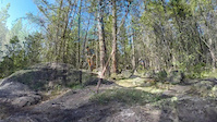
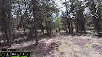
The Ellison DH is a fun descent with views of Okanagan Lake. It traverses some steep scree sections -- watch your line closely. There is some pedalling uphill into Ellison Park near the end. Trail is unsanctioned and not recommended due to land issues. NOCS is actively working with Trails BC on alternative routes.

This trail is unsanctioned.

Recent Activity on Trail

Past Week
  • 0 rides
  •  
6 Months
  • 9 rides
  • 10 miles avg distance
All
  • 100 rides
  • Last: May 26, 2026
c1c2c3c4
January
February
March
April
May
June
July
August
September
October
November
December
update trails status or condition

Ellison DH Trail Reports

statusdatedescription
Apr 25, 2026 @ 10:27am (America/Vancouver)
Apr 25, 2026
Jan 10, 2026 @ 1:53pm (America/Vancouver)
Jan 10, 2026
One large log across trail
Jun 1, 2025 @ 9:34pm
Jun 1, 2025
A couple of ladies reported to me that several trees were down, probably from yesterday's windstorm.
Mar 2, 2024 @ 4:06pm
Mar 2, 2024
Big pine is now a huck to flat or skinny. Don’t recommend skinny option unless it is dry, dry, dry. Log is not flattened!!!
Feb 26, 2024 @ 1:47pm
Feb 26, 2024
Very large pine across trail just after the little root drop… Start slowing down EARLY.
more »
Status:
on Apr 25, 2026
Avg: 3.27 (12 votes)
Your vote: 0

view (761)
close
3D
Trail Conditions
  • Unknown
  • Snow Groomed
  • Snow Packed
  • Snow Covered
  • Snow Cover Partial
  • Freeze/thaw Cycle
  • Icy
  • Prevalent Mud
  • Wet
  • Variable
  • Ideal
  • Dry
  • Very Dry
Trail Flow (Ridden Direction)
Trailforks scans users ridelogs to determine the most popular direction each trail is ridden. A good flowing trail network will have most trails flowing in a single direction according to their intension.
The colour categories are based on what percentage of riders are riding a trail in its intended direction.
  • > 96%
  • > 90%
  • > 80%
  • > 70%
  • > 50%
  • < 50%
  • bi-directional trail
  • no data
Trail Last Ridden
Trailforks scans ridelogs to determine the last time a trail was ridden.
  • < 2 days
  • < 1 week
  • < 2 weeks
  • < 1 month
  • < 6 months
  • > 6 months
Trail Ridden Direction
The intended direction a trail should be ridden.
  • Downhill Only
  • Downhill Primary
  • Both Directions
  • Uphill Primary
  • Uphill Only
  • One Direction
Contribute Details
Colors indicate trail is missing specified detail.
  • Description
  • Photos
  • Description & Photos
  • Videos
Trail Popularity ?
Trailforks scans ridelogs to determine which trails are ridden the most in the last 9 months. Trails are compared with nearby trails in the same city region with a possible 25 colour shades. Think of this as a heatmap, more rides = more kinetic energy = warmer colors.
  • most popular
  • popular
  • less popular
  • not popular
ATV/ORV/OHV Filter
Max Vehicle Width
inches
US Cell Coverage
Legend
cell carrier legend

Radar Time
Activity Recordings
Trailforks uses anonymized public activity data. ?
Activity Recordings
Trailforks uses anonymized public activity data. ?
Personal Heatmap
Activity Types
all / none
Options
2
Date range month
Winter Trails
Warning A routing network for winter maps does not exist. Selecting trails using the winter trails layer has been disabled.
Missing Trails
Most Popular
Least Popular
Trails are colored based on popularity. The more popular a trail is, the more red. Less popular trails trend towards green.
Jump Magnitude Heatmap
Heatmap of where riders jump on trails. Zoom in to see individual jumps, click circles to view jump details.
BC Backroad Status

Service Road Atlas is a free to use, community-driven service for viewing and creating reports on the numerous back-country service roads around B.C. and Alberta.

map legend
Slope Aspect
Direction the slope faces
Flat N NE E SE S SW W NW
Trails Deemphasized
Trails are shown in grey.
disable
Only show trails with no bike usage.
Enable
Suggested Layers
Based on selected activity type

    Save the current map location and zoom level as your default home location whenever this page is loaded.

    Save
        Directions to ellison-dh trailhead (50.153010, -119.441950)

        Photos

        24 more »
        205 |
        Oct 8, 2017 @ 11:29pm
        Oct 8, 2017
        191 |
        May 23, 2017 @ 11:43pm
        May 23, 2017
        198 |
        Oct 8, 2017 @ 11:29pm
        Oct 8, 2017
        161 |
        May 24, 2017 @ 12:06am
        May 24, 2017

        Videos

        2 more »
        Ellison Park GoPro & Drone
        0:05 | 860 | May 17, 2015 , Vernon
        Ellison DH Descent Portion
        4:13 | 877 | Jul 7, 2014 , Vernon

        5 Reviews & Comments


        We hope you've been enjoying Trailforks!

        Create a FREE account to view trail comments and much more.

        • #5728 - 5,594 views

        Frequently Asked Questions About Ellison DH

        Where is Ellison DH located?
        Ellison DH is located in Ellison Provincial Park, Vernon, British Columbia, Canada. It is part of the Ellison Provincial Park trail network. The trailhead is located at coordinates 50.15301, -119.44195.
        How hard is Ellison DH?
        Ellison DH is rated as Black Diamond difficulty. The average grade is 2.918%.
        What is the elevation gain for Ellison DH?
        Ellison DH has 714 ft of elevation gain. The trail has 1,089 ft of elevation descent. The elevation ranges from 1,611 ft to 2,151 ft.
        How long is Ellison DH?
        Ellison DH is 2.4 miles long. The trail type is singletrack.

        Hit the Trail

        Open in App

        Get this trail on your phone instantly.
        open trail in app

        Download Trail

        Save to wishlist, Garmin & download.
        save the trail

        Find Related Routes

        Find routes and users activities that include this trail.
        find routes for this trail

        You must enter a description before submitting.