more stats
3,169 ft
Distance
3 ft
Climb
-412 ft
Descent
00:04:37
Avg time
-409 ft
Altitude change
1,148 ft
Altitude min
1,557 ft
Altitude max
1,557 ft
Altitude start
1,148 ft
Altitude end
-12.9%
Grade
-58.6%
Grade max
2.3%
Grade min
154 ft
Distance climb
2,920 ft
Distance down
95 ft
Distance flat
00:04:37
Avg time

Elsbeere Singletrail Details

  • Activities
    • Mountain Bike
    • E-Bike
  • Riding Area
  • Ref Number
    #78
  • Difficulty Rating
  • Voted Difficulty
    Red (2 votes)
  • Local Popularity
    20 in Mountain Biking [+]
    • 5 in E-Biking
  • Global Ranking
    #32539 in Mountain Biking [+]
    • #104649 in E-Biking
  • Trail Type
    Singletrack
  • Bike Type
    AM, XC
  • Direction
    Downhill Only
    Popular Direction Shown
  • Physical Rating
    Easy
  • Trail Visibility
    Always easy to follow
  • Season
    March to October
  • eBike Allowed
    Yes up to Class 1
  • Year Opened
    2023

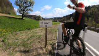
The single trail runs through a mixed forest and leads over forest floor with partly stony character and different gradients. In the lower part, the trail divides into 2 variants. Overall, the trail can be ridden smoothly by advanced bikers.

Disclaimer

Wearing a helmet is compulsory. Ride at your own risk.

Trail Supporters

  • Marco

    since 2022
    Maintainer
Local Trail Association

Recent Activity on Trail

Past Week
  • 0 rides
  •  
6 Months
  • 3 rides
  • 21 miles avg distance
All
  • 6 rides
  • Last: May 23, 2026
c1c2c3c4
January
February
March
April
May
June
July
August
September
October
November
December
update trails status or condition

Elsbeere Singletrail Trail Reports

statusdatedescription
Mar 1, 2026 @ 8:46am (Europe/Vienna)
Feb 28, 2026
Der Elsbeere Singletrail ist ab heute wieder für die Saison geöffnet! Aktuelle Infos zu Sperren findet ihr auf unserer Website...
Apr 3, 2025 @ 11:06am
Apr 3, 2025
Stellenweise noch nass!
Mar 1, 2025 @ 5:43am
Mar 1, 2025
Trail geöffnet! Vorrangig trocken. Viel Spaß!
Oct 31, 2024 @ 9:13am
Oct 31, 2024
Wintersperre! Der Trail ist bis voraussichtlich 01.03.2025 gesperrt!
Sep 22, 2024 @ 12:51am
Sep 22, 2024
Wieder geöffnet! Der Elsbeere Singletrail steht euch nach Inspektion und Reparaturen wieder zur Verfügung!
more »
Status:
on Mar 1, 2026
Avg: 4.32 (4 votes)
Your vote: 0

view (43)
close
3D
Trail Conditions
  • Unknown
  • Snow Groomed
  • Snow Packed
  • Snow Covered
  • Snow Cover Partial
  • Freeze/thaw Cycle
  • Icy
  • Prevalent Mud
  • Wet
  • Variable
  • Ideal
  • Dry
  • Very Dry
Trail Flow (Ridden Direction)
Trailforks scans users ridelogs to determine the most popular direction each trail is ridden. A good flowing trail network will have most trails flowing in a single direction according to their intension.
The colour categories are based on what percentage of riders are riding a trail in its intended direction.
  • > 96%
  • > 90%
  • > 80%
  • > 70%
  • > 50%
  • < 50%
  • bi-directional trail
  • no data
Trail Last Ridden
Trailforks scans ridelogs to determine the last time a trail was ridden.
  • < 2 days
  • < 1 week
  • < 2 weeks
  • < 1 month
  • < 6 months
  • > 6 months
Trail Ridden Direction
The intended direction a trail should be ridden.
  • Downhill Only
  • Downhill Primary
  • Both Directions
  • Uphill Primary
  • Uphill Only
  • One Direction
Contribute Details
Colors indicate trail is missing specified detail.
  • Description
  • Photos
  • Description & Photos
  • Videos
Trail Popularity ?
Trailforks scans ridelogs to determine which trails are ridden the most in the last 9 months. Trails are compared with nearby trails in the same city region with a possible 25 colour shades. Think of this as a heatmap, more rides = more kinetic energy = warmer colors.
  • most popular
  • popular
  • less popular
  • not popular
ATV/ORV/OHV Filter
Max Vehicle Width
inches
US Cell Coverage
Legend
cell carrier legend

Radar Time
Activity Recordings
Trailforks uses anonymized public activity data. ?
Activity Recordings
Trailforks uses anonymized public activity data. ?
Personal Heatmap
Activity Types
all / none
Options
2
Date range month
Winter Trails
Warning A routing network for winter maps does not exist. Selecting trails using the winter trails layer has been disabled.
Missing Trails
Most Popular
Least Popular
Trails are colored based on popularity. The more popular a trail is, the more red. Less popular trails trend towards green.
Jump Magnitude Heatmap
Heatmap of where riders jump on trails. Zoom in to see individual jumps, click circles to view jump details.
BC Backroad Status

Service Road Atlas is a free to use, community-driven service for viewing and creating reports on the numerous back-country service roads around B.C. and Alberta.

map legend
Slope Aspect
Direction the slope faces
Flat N NE E SE S SW W NW
Trails Deemphasized
Trails are shown in grey.
disable
Only show trails with no bike usage.
Enable
Suggested Layers
Based on selected activity type

    Save the current map location and zoom level as your default home location whenever this page is loaded.

    Save
        Directions to elsbeere-singletrail trailhead (48.115360, 15.766220)

        Photos

        27 more »
        83 |
        Aug 25, 2023 @ 3:58am
        Aug 25, 2023
        59 |
        Aug 18, 2023 @ 12:36pm
        Aug 18, 2023
        95 |
        Jul 23, 2023 @ 5:35am
        Jul 23, 2023
        50 |
        Jul 23, 2023 @ 5:35am
        Jul 23, 2023

        Videos

        2 more »
        youtuber Short but Fun - Elsbeere Singletrail (MTB St....
        5:31 | 101 | Mar 16, 2025 , Pyhra
        Elsbeere Singletrail Abfahrt 21.04.2023
        3:00 | 223 | Jun 24, 2023 , Pyhra

        5 Reviews & Comments


        We hope you've been enjoying Trailforks!

        Create a FREE account to view trail comments and much more.

        • By mfreynho & contributors
        • #599510 - 783 views

        Frequently Asked Questions About Elsbeere Singletrail

        Where is Elsbeere Singletrail located?
        Elsbeere Singletrail is located in Hometrails St. Pölten, Pyhra, Austria. It is part of the Hometrails St. Pölten trail network. The trailhead is located at coordinates 48.11536, 15.76622.
        How hard is Elsbeere Singletrail?
        Elsbeere Singletrail is rated as Red difficulty. The physical rating is Easy. The average grade is 12.9%.
        What is the elevation gain for Elsbeere Singletrail?
        Elsbeere Singletrail has 1 m of elevation gain. The trail has 126 m of elevation descent. The elevation ranges from 350 m to 475 m.
        Is Elsbeere Singletrail a point to point trail?
        Yes, Elsbeere Singletrail is a point to point trail. The direction is Downhill Only. The trail type is singletrack.

        Hit the Trail

        Open in App

        Get this trail on your phone instantly.
        open trail in app

        Download Trail

        Save to wishlist, Garmin & download.
        save the trail

        Find Related Routes

        Find routes and users activities that include this trail.
        find routes for this trail

        You must enter a description before submitting.