
Open in App
Get this trail on your phone instantly.

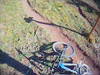
Great descent that can be done from Coal Bank or Molas Pass. Steep, rooty and technical in places with tight switchbacks and multiple water crossings and a few punchy climbs to keep you honest.
Usually cleared and ready by mid to late July.
When you exit the trail you can either take Cascade Creek (E) or cross the creek and do Cascade Creek (W), which lets you cross it again at the end.
| c1 | c2 | c3 | c4 |
|---|---|---|---|
January | February | March | April |
May | June | July | August |
September | October | November | December |

Service Road Atlas is a free to use, community-driven service for viewing and creating reports on the numerous back-country service roads around B.C. and Alberta.
Save the current map location and zoom level as your default home location whenever this page is loaded.
SaveWe hope you've been enjoying Trailforks!
Create a FREE account to view trail comments and much more.
You must enter a description before submitting.

