more stats
5.7 miles
Distance
1,545 ft
Climb
-1,541 ft
Descent
02:24:54
Avg time
2 ft
Altitude change
1,320 ft
Altitude min
2,027 ft
Altitude max
1,320 ft
Altitude start
1,322 ft
Altitude end
-54.2%
Grade max
50.8%
Grade min
3 miles
Distance climb
2 miles
Distance down
2,717 ft
Distance flat
02:24:54
Avg time

Falcon Trail Details

  • Activities
    • Mountain Bike
    • E-Bike
    • Horse
    • Hike
    • Trail Running
  • Riding Area
    Santa Margarita Lake
    Santa Margarita, California
  • Difficulty Rating
  • Local Popularity
    75 in Mountain Biking [+]
    • 100 in E-Biking
    • 100 in Trail Running
    • 90 in Hiking
    • 5 in Horseback
  • Global Ranking
    #53485 in Mountain Biking [+]
    • #14341 in E-Biking
    • #17075 in Trail Running
    • #47419 in Hiking
    • #2887 in Horseback
  • Trail Type
    Singletrack
  • Bike Type
    AM, XC
  • Direction
    Both Directions
  • Climb Difficulty
    Black Diamond
  • Physical Rating
    Hard
  • Trail Visibility
    Always easy to follow
  • Season
    Year Round
  • Dogs Allowed
    Yes
  • eBike Allowed
    Yes up to Class 1
  • Ride in Rain
    Yes
  • Land Owner
    San Luis Obispo County Parks

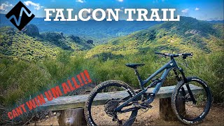
Stunning vistas of the lake. Beautiful area with rugged topography. Not recommended in summer due to extreme heat and exposure on trail with no available shade. Steep and loose. Frequented by equestrians. Late fall through spring is best time to access but expect water related obstructions and varied conditions dependent on recent weather conditions. Brush cleared and tread improved in early 2024.

Local Trail Association
Traditionally Indigenous Territory

Recent Activity on Trail

Past Week
  • 0 rides
  •  
6 Months
  • 3 rides
  • 14 miles avg distance
All
  • 8 rides
  • Last: Mar 15, 2026
c1c2c3c4
January
February
March
April
May
June
July
August
September
October
November
December
update trails status or condition

Falcon Trail Trail Reports

statusdatedescription
Aug 6, 2024 @ 3:25pm
Aug 6, 2024
its getting dusty out there.
Aug 6, 2024 @ 3:22pm
Aug 6, 2024
Aug 6, 2024 @ 2:05pm
Aug 6, 2024
Feb 15, 2024 @ 11:40am
Feb 15, 2024
reporter Closed by SLO County Parks due to weather conditions.
Feb 12, 2024 @ 12:29am
Feb 12, 2024
reporter Falcon Trail has had a lot of great maintenance work recently (and still ongoing). It is well brushed for MTB or horse. Tread work and drainage...
more »
Status:
on Aug 6, 2024
Very Dry
Avg: 4.19 (4 votes)
Your vote: 0

view (43)
close
3D
Trail Conditions
  • Unknown
  • Snow Groomed
  • Snow Packed
  • Snow Covered
  • Snow Cover Partial
  • Freeze/thaw Cycle
  • Icy
  • Prevalent Mud
  • Wet
  • Variable
  • Ideal
  • Dry
  • Very Dry
Trail Flow (Ridden Direction)
Trailforks scans users ridelogs to determine the most popular direction each trail is ridden. A good flowing trail network will have most trails flowing in a single direction according to their intension.
The colour categories are based on what percentage of riders are riding a trail in its intended direction.
  • > 96%
  • > 90%
  • > 80%
  • > 70%
  • > 50%
  • < 50%
  • bi-directional trail
  • no data
Trail Last Ridden
Trailforks scans ridelogs to determine the last time a trail was ridden.
  • < 2 days
  • < 1 week
  • < 2 weeks
  • < 1 month
  • < 6 months
  • > 6 months
Trail Ridden Direction
The intended direction a trail should be ridden.
  • Downhill Only
  • Downhill Primary
  • Both Directions
  • Uphill Primary
  • Uphill Only
  • One Direction
Contribute Details
Colors indicate trail is missing specified detail.
  • Description
  • Photos
  • Description & Photos
  • Videos
Trail Popularity ?
Trailforks scans ridelogs to determine which trails are ridden the most in the last 9 months. Trails are compared with nearby trails in the same city region with a possible 25 colour shades. Think of this as a heatmap, more rides = more kinetic energy = warmer colors.
  • most popular
  • popular
  • less popular
  • not popular
ATV/ORV/OHV Filter
Max Vehicle Width
inches
US Cell Coverage
Legend
cell carrier legend

Radar Time
Activity Recordings
Trailforks uses anonymized public activity data. ?
Activity Recordings
Trailforks uses anonymized public activity data. ?
Personal Heatmap
Activity Types
all / none
Options
2
Date range month
Winter Trails
Warning A routing network for winter maps does not exist. Selecting trails using the winter trails layer has been disabled.
Missing Trails
Most Popular
Least Popular
Trails are colored based on popularity. The more popular a trail is, the more red. Less popular trails trend towards green.
Jump Magnitude Heatmap
Heatmap of where riders jump on trails. Zoom in to see individual jumps, click circles to view jump details.
BC Backroad Status

Service Road Atlas is a free to use, community-driven service for viewing and creating reports on the numerous back-country service roads around B.C. and Alberta.

map legend
Slope Aspect
Direction the slope faces
Flat N NE E SE S SW W NW
Trails Deemphasized
Trails are shown in grey.
disable
Only show trails with no bike usage.
Enable
Suggested Layers
Based on selected activity type

    Save the current map location and zoom level as your default home location whenever this page is loaded.

    Save
        Directions to falcon-trail trailhead (35.329950, -120.451170)

        Photos

        No photos have been added for Falcon Trail yet, add a photo.

        Videos

        2 more »
        2020 Capra / Falcon Trail / CANT WIN UM ALL!!!...
        10:24 | 818 | Jan 17, 2022 , Santa Margarita
        Humble Pie Served on the Falcon Trail
        13:24 | 597 | Apr 16, 2020 , Santa Margarita

        4 Reviews & Comments


        We hope you've been enjoying Trailforks!

        Create a FREE account to view trail comments and much more.

        • By CraigCampbellTF Pro & contributors
        • #29340 - 3,717 views

        Frequently Asked Questions About Falcon Trail

        Where is Falcon Trail located?
        Falcon Trail is located in Santa Margarita Lake, Santa Margarita, California, United States. It is part of the Santa Margarita Lake trail network. The trailhead is located at coordinates 35.32995, -120.45117.
        How hard is Falcon Trail?
        Falcon Trail is rated as Black Diamond difficulty. The physical rating is Hard. The climb difficulty is rated Black Diamond.
        What is the elevation gain for Falcon Trail?
        Falcon Trail has 1,545 ft of elevation gain. The trail has 1,541 ft of elevation descent. The elevation ranges from 1,320 ft to 2,027 ft.
        Is Falcon Trail a point to point trail?
        Falcon Trail is not a point to point trail. The direction is Both Directions. The trail type is singletrack.

        Hit the Trail

        Open in App

        Get this trail on your phone instantly.
        open trail in app

        Download Trail

        Save to wishlist, Garmin & download.
        save the trail

        Find Related Routes

        Find routes and users activities that include this trail.
        find routes for this trail

        You must enter a description before submitting.