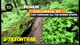
more stats
3,130 ft
Distance
-340 ft
Descent
00:05:11
Avg time
-338 ft
Altitude change
467 ft
Altitude min
807 ft
Altitude max
807 ft
Altitude start
469 ft
Altitude end
-10.8%
Grade
-37%
Grade max
5.6%
Grade min
66 ft
Distance climb
2,552 ft
Distance down
512 ft
Distance flat
00:05:11
Avg time

Femur Details

  • Activities
    • Mountain Bike
    • E-Bike
    • Hike
    • Trail Running
  • Riding Area
    Vedder Mountain
    Chilliwack, British Columbia
  • Difficulty Rating
  • Voted Difficulty
    Black Diamond (3 votes)
  • Local Popularity
    100 in Mountain Biking [+]
    • 100 in E-Biking
    • 90 in Trail Running
    • 75 in Hiking
  • Global Ranking
    #7601 in Mountain Biking [+]
    • #3107 in E-Biking
    • #20029 in Trail Running
    • #62703 in Hiking
  • Trail Type
    Singletrack
  • Bike Type
    DH, AM
  • Direction
    Downhill Primary
    Popular Direction Shown
  • Dogs Allowed
    Yes
  • eBike Allowed
    Yes up to Class 1
  • Land Owner
    RSTBC

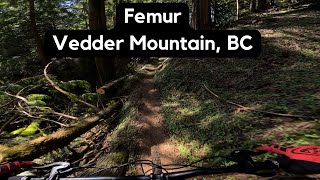
Super fun fast flowing trail. The first section features some loamy flats and dips in and around several ravines, downhill bikes will be a bit slower through the first section. The trail then gives way to a series of bermed corners and features sections with connecting berms to keep the flow going and is a great way to end off a lap on Vedder. There are two small steep shale chutes at the bottom, make sure you slow down. Exit carefully onto the road.

Access Info

This trail can be accessed by following Electric Lettuce into Mango Mango. Mango Mango exits onto an access road and the entrance to femur is directly across.

There is an alternate entrance that is more downhill friendly further down the trail after the first cross ditch, slow down or you might miss it. This entrance enter to your left.

A short lap of femur is also possible when travelling up Parmenter Rd. The road forks for a second time and a large rocked yellow gate blocks access to the right, while the left fork continues further up the mountain and forms the main access to the Vedder trail network. If you hike-a-bike over the yellow you can follow it up all the way to the femur entrance. This provides a great little loop in the winter when the higher trails are snowed in.

Trail Supporters
Local Trail Association
Traditionally Indigenous Territory

Recent Activity on Trail

Past Week
  • 7 rides
  • 9 miles average
6 Months
  • 93 rides
  • 8 miles avg distance
All
  • 1,617 rides
  • Last: Jun 17, 2026
c1c2c3c4
January
February
March
April
May
June
July
August
September
October
November
December
update trails status or condition

Femur Trail Reports

statusdatedescription
Jun 11, 2026 @ 10:20am (America/Vancouver)
Jun 11, 2026
Jun 8, 2026 @ 5:33pm (America/Vancouver)
Jun 8, 2026
Apr 6, 2026 @ 11:15am (America/Vancouver)
Apr 6, 2026
Mar 17, 2026 @ 8:23am (America/Vancouver)
Mar 17, 2026
Thanks so much for clearing the tree at the bottom of the trail!!
Mar 2, 2026 @ 4:22pm (America/Vancouver)
Mar 2, 2026
Tree still down near the end of the trail. Lots of time to see it and easy to step over
more » 20 social media mentions
Status:
on Jun 11, 2026
Ideal
Avg: 4.36 (53 votes)
Your vote: 0

view (12,956)
close
3D
Trail Conditions
  • Unknown
  • Snow Groomed
  • Snow Packed
  • Snow Covered
  • Snow Cover Partial
  • Freeze/thaw Cycle
  • Icy
  • Prevalent Mud
  • Wet
  • Variable
  • Ideal
  • Dry
  • Very Dry
Trail Flow (Ridden Direction)
Trailforks scans users ridelogs to determine the most popular direction each trail is ridden. A good flowing trail network will have most trails flowing in a single direction according to their intension.
The colour categories are based on what percentage of riders are riding a trail in its intended direction.
  • > 96%
  • > 90%
  • > 80%
  • > 70%
  • > 50%
  • < 50%
  • bi-directional trail
  • no data
Trail Last Ridden
Trailforks scans ridelogs to determine the last time a trail was ridden.
  • < 2 days
  • < 1 week
  • < 2 weeks
  • < 1 month
  • < 6 months
  • > 6 months
Trail Ridden Direction
The intended direction a trail should be ridden.
  • Downhill Only
  • Downhill Primary
  • Both Directions
  • Uphill Primary
  • Uphill Only
  • One Direction
Contribute Details
Colors indicate trail is missing specified detail.
  • Description
  • Photos
  • Description & Photos
  • Videos
Trail Popularity ?
Trailforks scans ridelogs to determine which trails are ridden the most in the last 9 months. Trails are compared with nearby trails in the same city region with a possible 25 colour shades. Think of this as a heatmap, more rides = more kinetic energy = warmer colors.
  • most popular
  • popular
  • less popular
  • not popular
ATV/ORV/OHV Filter
Max Vehicle Width
inches
US Cell Coverage
Legend
cell carrier legend

Radar Time
Activity Recordings
Trailforks uses anonymized public activity data. ?
Activity Recordings
Trailforks uses anonymized public activity data. ?
Personal Heatmap
Activity Types
all / none
Options
2
Date range month
Winter Trails
Warning A routing network for winter maps does not exist. Selecting trails using the winter trails layer has been disabled.
Missing Trails
Most Popular
Least Popular
Trails are colored based on popularity. The more popular a trail is, the more red. Less popular trails trend towards green.
Jump Magnitude Heatmap
Heatmap of where riders jump on trails. Zoom in to see individual jumps, click circles to view jump details.
BC Backroad Status

Service Road Atlas is a free to use, community-driven service for viewing and creating reports on the numerous back-country service roads around B.C. and Alberta.

map legend
Slope Aspect
Direction the slope faces
Flat N NE E SE S SW W NW
Trails Deemphasized
Trails are shown in grey.
disable
Only show trails with no bike usage.
Enable
Suggested Layers
Based on selected activity type

    Save the current map location and zoom level as your default home location whenever this page is loaded.

    Save
        Directions to femur trailhead (49.080620, -121.993070)

        Photos

        74 more »
        2,080 |
        Apr 27, 2016 @ 6:06pm
        Apr 27, 2016
        658 |
        Oct 29, 2012 @ 9:18pm
        Oct 29, 2012
        53 |
        Jan 26, 2024 @ 7:06pm
        Jan 26, 2024
        61 |
        Aug 20, 2023 @ 9:47pm
        Aug 20, 2023

        Videos

        13 more »
        Femur   - Chilliwack, BC - MTB Trail Preview -...
        0:22 | 177 | Jan 4, 2025 , Chilliwack
        Femur, Vedder Mountain BC
        3:25 | 183 | Apr 16, 2024 , Chilliwack
        Vedder Mtn
        11:45 | 1073 | Jul 14, 2018 , Chilliwack
        Femur with BCpov
        1278 | Apr 25, 2017 , Chilliwack

        Routes with this trail

        3.0 3 miles 831 ft 9 Loop
        Good climb on the awesome new , followed by flowy downhill fun. TTF's include bridges (can be bypassed)...
        3.0 6 miles 1,503 ft 14
        XC(ish) for BC loop. Long easy climb to warmup. mix of flow and tech trails that you around the top of ...
        3.5 6 miles 1,690 ft 37
        Inaugural Chilliwack Toonie Tuesday Ride. Pre-race competitive group riding, the goal is to push your own...

        Trail Events

        1 Review & Comments


        We hope you've been enjoying Trailforks!

        Create a FREE account to view trail comments and much more.

        • By BCpovTF Pro & contributors
        • #948 - 11,715 views

        Frequently Asked Questions About Femur

        Where is Femur located?
        Femur is located in Vedder Mountain, Chilliwack, British Columbia, Canada. It is part of the Vedder Mountain trail network. The trailhead is located at coordinates 49.08062, -121.99307.
        How hard is Femur?
        Femur is rated as Blue difficulty. The average grade is 10.8%.
        What is the elevation gain for Femur?
        The trail has 340 ft of elevation descent. The elevation ranges from 467 ft to 807 ft.
        Is Femur a point to point trail?
        Femur is not a point to point trail. The direction is Downhill Primary. The trail type is singletrack.

        Hit the Trail

        Open in App

        Get this trail on your phone instantly.
        open trail in app

        Download Trail

        Save to wishlist, Garmin & download.
        save the trail

        Find Related Routes

        Find routes and users activities that include this trail.
        find routes for this trail

        You must enter a description before submitting.