more stats
2,892 ft
Distance
-332 ft
Descent
00:05:00
Avg time
-332 ft
Altitude change
2,245 ft
Altitude min
2,576 ft
Altitude max
2,576 ft
Altitude start
2,245 ft
Altitude end
-11.465%
Grade
-23.164%
Grade max
0.603%
Grade min
2,781 ft
Distance down
111 ft
Distance flat
00:05:00
Avg time

Ferngully Details

  • Activities
    • Mountain Bike
    • E-Bike
    • Hike
    • Trail Running
  • Riding Area
    Three Blind Mice
    Penticton, British Columbia
  • Difficulty Rating
  • Local Popularity
    40 in Mountain Biking [+]
    • 50 in E-Biking
    • 5 in Trail Running
    • 5 in Hiking
  • Global Ranking
    #108988 in Mountain Biking [+]
    • #89358 in E-Biking
    • #306412 in Trail Running
    • #270799 in Hiking
  • Trail Type
    Singletrack
  • Bike Type
    AM, XC
  • Direction
    Downhill Primary
    Popular Direction Shown
  • Physical Rating
    Easy
  • Season
    May-November
  • Dogs Allowed
    Yes
  • eBike Allowed
    Yes up to Class 1

FERNS!! Who knew?
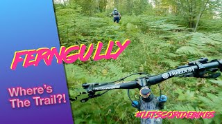
It is one of the older trails in the Mice, this little hidden trail is seldom ridden but is quite a flowy enjoyable cruise if you don't mind tall shrubs and ferns alongside the trail. It stays wet for a long time in the spring as it is very sheltered (hence the ferns).

The trail tread is narrow and the shrubs are tall so don't come in cookin hot and blow off into a deadfall or rock.

Access Info

If approaching from the original entrance on Drops ... Turn at the map.

Sometimes ridden in from Prime Rib at the hard right hander, just keep straight and use your Dog The Bounty Hunter senses. It drops down into the gully via a goat path slightly wider than your crankset.

Local Trail Association

Recent Activity on Trail

Past Week
  • 0 rides
  •  
6 Months
  • 3 rides
  • 10 miles avg distance
All
  • 27 rides
  • Last: May 14, 2026
c1c2c3c4
January
February
March
April
May
June
July
August
September
October
November
December
update trails status or condition

Ferngully Trail Reports

statusdatedescription
Aug 6, 2024 @ 2:38am
Aug 6, 2024
Overgrown and two trees down.
Apr 7, 2023 @ 7:23pm
Apr 7, 2023
reporter
Trees cut out. Dirt is prime. Shrubs are low so visibility good. Scratched the entrance a little more visible.
Oct 23, 2022 @ 1:29pm
Oct 23, 2022
reporter Tree down 9”
Apr 17, 2022 @ 11:07am
Apr 17, 2022
reporter Perfect. Low fern coverage so best visibility.
Jan 27, 2022 @ 9:09pm
Jan 27, 2022
reporter snow or ice covered
more »
Status:
on Aug 6, 2024
Very Dry
Avg: 4.21 (3 votes)
Your vote: 0

view (114)
close
3D
Trail Conditions
  • Unknown
  • Snow Groomed
  • Snow Packed
  • Snow Covered
  • Snow Cover Partial
  • Freeze/thaw Cycle
  • Icy
  • Prevalent Mud
  • Wet
  • Variable
  • Ideal
  • Dry
  • Very Dry
Trail Flow (Ridden Direction)
Trailforks scans users ridelogs to determine the most popular direction each trail is ridden. A good flowing trail network will have most trails flowing in a single direction according to their intension.
The colour categories are based on what percentage of riders are riding a trail in its intended direction.
  • > 96%
  • > 90%
  • > 80%
  • > 70%
  • > 50%
  • < 50%
  • bi-directional trail
  • no data
Trail Last Ridden
Trailforks scans ridelogs to determine the last time a trail was ridden.
  • < 2 days
  • < 1 week
  • < 2 weeks
  • < 1 month
  • < 6 months
  • > 6 months
Trail Ridden Direction
The intended direction a trail should be ridden.
  • Downhill Only
  • Downhill Primary
  • Both Directions
  • Uphill Primary
  • Uphill Only
  • One Direction
Contribute Details
Colors indicate trail is missing specified detail.
  • Description
  • Photos
  • Description & Photos
  • Videos
Trail Popularity ?
Trailforks scans ridelogs to determine which trails are ridden the most in the last 9 months. Trails are compared with nearby trails in the same city region with a possible 25 colour shades. Think of this as a heatmap, more rides = more kinetic energy = warmer colors.
  • most popular
  • popular
  • less popular
  • not popular
ATV/ORV/OHV Filter
Max Vehicle Width
inches
US Cell Coverage
Legend
cell carrier legend

Radar Time
Activity Recordings
Trailforks uses anonymized public activity data. ?
Activity Recordings
Trailforks uses anonymized public activity data. ?
Personal Heatmap
Activity Types
all / none
Options
2
Date range month
Winter Trails
Warning A routing network for winter maps does not exist. Selecting trails using the winter trails layer has been disabled.
Missing Trails
Most Popular
Least Popular
Trails are colored based on popularity. The more popular a trail is, the more red. Less popular trails trend towards green.
Jump Magnitude Heatmap
Heatmap of where riders jump on trails. Zoom in to see individual jumps, click circles to view jump details.
BC Backroad Status

Service Road Atlas is a free to use, community-driven service for viewing and creating reports on the numerous back-country service roads around B.C. and Alberta.

map legend
Slope Aspect
Direction the slope faces
Flat N NE E SE S SW W NW
Trails Deemphasized
Trails are shown in grey.
disable
Only show trails with no bike usage.
Enable
Suggested Layers
Based on selected activity type

    Save the current map location and zoom level as your default home location whenever this page is loaded.

    Save
        Directions to ferngully trailhead (49.569260, -119.553310)

        Photos

        6 more »
        64 |
        Oct 23, 2022 @ 6:53pm
        Oct 23, 2022
        93 |
        Jul 11, 2019 @ 9:41pm
        Jul 11, 2019
        83 |
        Jul 11, 2019 @ 9:40pm
        Jul 11, 2019
        77 |
        Aug 10, 2017 @ 8:36pm
        Aug 10, 2017

        Videos

        1 more »
        youtuber FernGully Trail Preview | #letsgoridebikes
        3:40 | 202 | Aug 19, 2022 , Penticton

        Routes with this trail

        87 miles 16,565 ft 66 Loop
        Almost everything in the mice
        1 mile 319 ft 1
        A short but vicious challenge. Judged by your peers...and your ego. Plan to be at the base of the Hill...

        Trail Products

        Reviews / Comments

        No reviews yet, be the first to write a review or ask a question.
        Use trail reports to comment on trail conditions.


        We hope you've been enjoying Trailforks!

        Create a FREE account to view trail comments and much more.

        • By 1partatatimeTF Pro PACA & contributors
        • #19106 - 1,699 views

        Frequently Asked Questions About Ferngully

        Where is Ferngully located?
        Ferngully is located in Three Blind Mice, Penticton, British Columbia, Canada. It is part of the Three Blind Mice trail network. The trailhead is located at coordinates 49.56926, -119.55331.
        How hard is Ferngully?
        Ferngully is rated as Blue difficulty. The physical rating is Easy. The average grade is 11.465%.
        What is the elevation gain for Ferngully?
        The trail has 332 ft of elevation descent. The elevation ranges from 2,245 ft to 2,576 ft.
        Is Ferngully a point to point trail?
        Ferngully is not a point to point trail. The direction is Downhill Primary. The trail type is singletrack.

        Hit the Trail

        Open in App

        Get this trail on your phone instantly.
        open trail in app

        Download Trail

        Save to wishlist, Garmin & download.
        save the trail

        Find Related Routes

        Find routes and users activities that include this trail.
        find routes for this trail

        You must enter a description before submitting.