more stats
3,520 ft
Distance
43 ft
Climb
-210 ft
Descent
00:03:13
Avg time
-168 ft
Altitude change
1,090 ft
Altitude min
1,259 ft
Altitude max
1,259 ft
Altitude start
1,089 ft
Altitude end
-4.8%
Grade
-34.3%
Grade max
18.4%
Grade min
630 ft
Distance climb
1,998 ft
Distance down
856 ft
Distance flat
00:03:13
Avg time

Fire Line Details

  • Activities
    • Mountain Bike
    • E-Bike
    • Hike
    • Trail Running
  • Riding Area
    Coler Mountain Bike Preserve
    Bentonville, Arkansas
  • Difficulty Rating
  • Voted Difficulty
    Black Diamond (5 votes)
  • Local Popularity
    90 in Mountain Biking [+]
    • 95 in E-Biking
  • Global Ranking
    #381 in Mountain Biking [+]
    • #880 in E-Biking
  • Trail Type
    Singletrack
  • Bike Type
  • Direction
    Downhill Only
    Popular Direction Shown
  • Climb Difficulty
    Green
  • Physical Rating
    Moderate
  • Trail Visibility
    Always easy to follow
  • Dogs Allowed
    Yes
  • eBike Allowed
    Yes up to Class 1
  • TTFs on Trail
    Berm, Drop, Jump, Roller Coaster
  • OSM Way

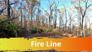
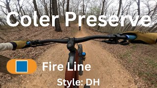
This directional intermediate downhill flow/jump trail starts at the Hub and ends at the northeast end of Coler. The trail includes many rollers, jumps and berms. It is great fun for all ages that are moderately skilled on a mountain bike.

Adaptive Bike Info
aMTB Green Rating: Beginner features and moderate terrain.

aMTB1x - wide open but advanced features exist

Local Trail Association

Recent Activity on Trail

Past Week
  • 19 rides
  • 12 miles average
6 Months
  • 539 rides
  • 14 miles avg distance
All
  • 4,049 rides
  • Last: Jun 21, 2026
c1c2c3c4
January
February
March
April
May
June
July
August
September
October
November
December
update trails status or condition

Fire Line Trail Reports

Status:
on Jun 13, 2026
Ideal
Avg: 4.68 (56 votes)
Your vote: 0

view (42,436)
close
3D
Trail Conditions
  • Unknown
  • Snow Groomed
  • Snow Packed
  • Snow Covered
  • Snow Cover Partial
  • Freeze/thaw Cycle
  • Icy
  • Prevalent Mud
  • Wet
  • Variable
  • Ideal
  • Dry
  • Very Dry
Trail Flow (Ridden Direction)
Trailforks scans users ridelogs to determine the most popular direction each trail is ridden. A good flowing trail network will have most trails flowing in a single direction according to their intension.
The colour categories are based on what percentage of riders are riding a trail in its intended direction.
  • > 96%
  • > 90%
  • > 80%
  • > 70%
  • > 50%
  • < 50%
  • bi-directional trail
  • no data
Trail Last Ridden
Trailforks scans ridelogs to determine the last time a trail was ridden.
  • < 2 days
  • < 1 week
  • < 2 weeks
  • < 1 month
  • < 6 months
  • > 6 months
Trail Ridden Direction
The intended direction a trail should be ridden.
  • Downhill Only
  • Downhill Primary
  • Both Directions
  • Uphill Primary
  • Uphill Only
  • One Direction
Contribute Details
Colors indicate trail is missing specified detail.
  • Description
  • Photos
  • Description & Photos
  • Videos
Trail Popularity ?
Trailforks scans ridelogs to determine which trails are ridden the most in the last 9 months. Trails are compared with nearby trails in the same city region with a possible 25 colour shades. Think of this as a heatmap, more rides = more kinetic energy = warmer colors.
  • most popular
  • popular
  • less popular
  • not popular
ATV/ORV/OHV Filter
Max Vehicle Width
inches
US Cell Coverage
Legend
cell carrier legend

Radar Time
Activity Recordings
Trailforks uses anonymized public activity data. ?
Activity Recordings
Trailforks uses anonymized public activity data. ?
Personal Heatmap
Activity Types
all / none
Options
2
Date range month
Winter Trails
Warning A routing network for winter maps does not exist. Selecting trails using the winter trails layer has been disabled.
Missing Trails
Most Popular
Least Popular
Trails are colored based on popularity. The more popular a trail is, the more red. Less popular trails trend towards green.
Jump Magnitude Heatmap
Heatmap of where riders jump on trails. Zoom in to see individual jumps, click circles to view jump details.
BC Backroad Status

Service Road Atlas is a free to use, community-driven service for viewing and creating reports on the numerous back-country service roads around B.C. and Alberta.

map legend
Slope Aspect
Direction the slope faces
Flat N NE E SE S SW W NW
Trails Deemphasized
Trails are shown in grey.
disable
Only show trails with no bike usage.
Enable
Suggested Layers
Based on selected activity type

    Save the current map location and zoom level as your default home location whenever this page is loaded.

    Save
        Directions to fire-line-85161 trailhead (36.391700, -94.236010)

        Photos

        16 more »
        38 |
        May 16, 2026 @ 6:19pm
        May 16, 2026
        111 |
        Sep 10, 2025 @ 9:56pm
        Sep 10, 2025
        204 |
        Oct 26, 2023 @ 8:13pm
        Oct 26, 2023
        245 |
        Oct 13, 2023 @ 1:09pm
        Oct 13, 2023

        Videos

        31 more »
        youtuber 'Drop the Hammer' Is the Drop Line of Our...
        13:59 | 1015 | Jan 1, 2022 , Bentonville
        youtuber Hardtails on Hard Trails- Hitting the Biggest...
        10:16 | 977 | Aug 12, 2019 , Bentonville
        Fire Line Trail, Coler MTB Preserve, Bentonville
        3:08 | 197 | Mar 21, 2025 , Bentonville
        Fire Line - The Hub - Coler Preserve
        2:32 | 279 | May 3, 2024 , Bentonville

        Routes with this trail

        5.0 138 miles 12,933 ft 95
        This is the route Payson McElveen posted on his strava for the Bentonville trail challenge 2021.
        5.0 154 miles 16,667 ft 120
        This is my plan for the 2021 Bentonville Trail Challenge.
        5.0 5 miles 569 ft 6
        This is just a portion of Coler that is designed to be good for new to intermediate riders.

        15 Reviews & Comments


        We hope you've been enjoying Trailforks!

        Create a FREE account to view trail comments and much more.

        • By WanderingManTF Pro BSMTB & contributors
        • #85161 - 10,906 views

        Frequently Asked Questions About Fire Line

        Where is Fire Line located?
        Fire Line is located in Coler Mountain Bike Preserve, Bentonville, Arkansas, United States. It is part of the Coler Mountain Bike Preserve trail network. The trailhead is located at coordinates 36.3917, -94.23601.
        How hard is Fire Line?
        Fire Line is rated as Blue difficulty. The physical rating is Moderate. The average grade is 4.8%. The climb difficulty is rated Green.
        What is the elevation gain for Fire Line?
        Fire Line has 43 ft of elevation gain. The trail has 210 ft of elevation descent. The elevation ranges from 1,090 ft to 1,259 ft.
        Is Fire Line a point to point trail?
        Yes, Fire Line is a point to point trail. The direction is Downhill Only. The trail type is singletrack.

        Hit the Trail

        Open in App

        Get this trail on your phone instantly.
        open trail in app

        Download Trail

        Save to wishlist, Garmin & download.
        save the trail

        Find Related Routes

        Find routes and users activities that include this trail.
        find routes for this trail

        You must enter a description before submitting.