more stats
2,277 ft
Distance
6 ft
Climb
-148 ft
Descent
1 mile
High Point
-142 ft
Altitude change
5,269 ft
Altitude min
5,411 ft
Altitude start
5,269 ft
Altitude end
-6.3%
Grade
-21.6%
Grade max
8.3%
Grade min
174 ft
Distance climb
1,778 ft
Distance down
279 ft
Distance flat

Fireball Details

  • Activities
    • Mountain Bike
    • E-Bike
  • Riding Area
    Firefly Mountain Bike Park
    White Hills, Utah
  • Difficulty Rating
  • Voted Difficulty
    Black Diamond (1 vote)
  • Local Popularity
    25 in Mountain Biking [+]
    • 50 in E-Biking
  • Global Ranking
    #40780 in Mountain Biking [+]
    • #80577 in E-Biking
  • Trail Type
    Singletrack
  • Bike Type
    DH, AM, XC, DJ
  • Direction
    Downhill Only
    Popular Direction Shown
  • Trail Visibility
    Always easy to follow
  • Season
    Year Round
  • eBike Allowed
  • TTFs on Trail
    Berm, Drop, Jump, Gap Jump, Other
  • Year Opened
    2024

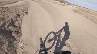
Fire Ball is the Black/Expert Downhill-only track for Firefly's new Downhill Mountain Bike Park. Multiple mandatory gap jumps and some other large jumps, bumps, and berms. The signature feature is the awesome, huge wooden plank jump towards the bottom as you head into the final two large jumps.

Access Info

Single route uphill leads to the starting line for all 3 tracks. Best park access being worked on right now, with a parking lot being added near the bottom soon as well.

Trail Supporters
Local Trail Association
Traditionally Indigenous Territory

Recent Activity on Trail

Past Week
  • 0 rides
  •  
6 Months
  • 6 rides
  • 5 miles avg distance
All
  • 38 rides
  • Last: Jun 1, 2026
c1c2c3c4
January
February
March
April
May
June
July
August
September
October
November
December
update trails status or condition

Fireball Trail Reports

statusdatedescription
Oct 18, 2025 @ 4:19pm (America/Boise)
Oct 18, 2025
Aug 23, 2025 @ 7:54am
Aug 23, 2025
Weeds are making this trail unrideable. They are large and all over the berms and lips. You are either being slowed down by riding over them or...
Apr 19, 2025 @ 12:37pm
Apr 19, 2025
Apr 10, 2025 @ 8:04pm
Apr 10, 2025
Running great!
Jan 31, 2025 @ 9:12am
Jan 31, 2025
more »
Status:
on Oct 18, 2025
Dry
Avg: 4.24 (3 votes)
Your vote: 0

view (586)
close
3D
Trail Conditions
  • Unknown
  • Snow Groomed
  • Snow Packed
  • Snow Covered
  • Snow Cover Partial
  • Freeze/thaw Cycle
  • Icy
  • Prevalent Mud
  • Wet
  • Variable
  • Ideal
  • Dry
  • Very Dry
Trail Flow (Ridden Direction)
Trailforks scans users ridelogs to determine the most popular direction each trail is ridden. A good flowing trail network will have most trails flowing in a single direction according to their intension.
The colour categories are based on what percentage of riders are riding a trail in its intended direction.
  • > 96%
  • > 90%
  • > 80%
  • > 70%
  • > 50%
  • < 50%
  • bi-directional trail
  • no data
Trail Last Ridden
Trailforks scans ridelogs to determine the last time a trail was ridden.
  • < 2 days
  • < 1 week
  • < 2 weeks
  • < 1 month
  • < 6 months
  • > 6 months
Trail Ridden Direction
The intended direction a trail should be ridden.
  • Downhill Only
  • Downhill Primary
  • Both Directions
  • Uphill Primary
  • Uphill Only
  • One Direction
Contribute Details
Colors indicate trail is missing specified detail.
  • Description
  • Photos
  • Description & Photos
  • Videos
Trail Popularity ?
Trailforks scans ridelogs to determine which trails are ridden the most in the last 9 months. Trails are compared with nearby trails in the same city region with a possible 25 colour shades. Think of this as a heatmap, more rides = more kinetic energy = warmer colors.
  • most popular
  • popular
  • less popular
  • not popular
ATV/ORV/OHV Filter
Max Vehicle Width
inches
US Cell Coverage
Legend
cell carrier legend

Radar Time
Activity Recordings
Trailforks uses anonymized public activity data. ?
Activity Recordings
Trailforks uses anonymized public activity data. ?
Personal Heatmap
Activity Types
all / none
Options
2
Date range month
Winter Trails
Warning A routing network for winter maps does not exist. Selecting trails using the winter trails layer has been disabled.
Missing Trails
Most Popular
Least Popular
Trails are colored based on popularity. The more popular a trail is, the more red. Less popular trails trend towards green.
Jump Magnitude Heatmap
Heatmap of where riders jump on trails. Zoom in to see individual jumps, click circles to view jump details.
BC Backroad Status

Service Road Atlas is a free to use, community-driven service for viewing and creating reports on the numerous back-country service roads around B.C. and Alberta.

map legend
Slope Aspect
Direction the slope faces
Flat N NE E SE S SW W NW
Trails Deemphasized
Trails are shown in grey.
disable
Only show trails with no bike usage.
Enable
Suggested Layers
Based on selected activity type

    Save the current map location and zoom level as your default home location whenever this page is loaded.

    Save
        Directions to fireball-806042 trailhead (40.298120, -112.127820)

        Photos

        13 more »
        78 |
        Jun 26, 2025 @ 1:22pm
        Jun 26, 2025
        154 |
        Nov 6, 2024 @ 8:13pm
        Nov 6, 2024
        133 |
        Nov 6, 2024 @ 8:13pm
        Nov 6, 2024
        161 |
        Nov 6, 2024 @ 8:12pm
        Nov 6, 2024

        Videos

        2 more »
        New Fireball trail at Firefly Bike Park is insane!
        7:19 | 363 | Nov 22, 2024 , White Hills
        Fireball - Cedar Fort
        0:27 | | Mar 2, 2025 , White Hills

        4 Reviews & Comments


        We hope you've been enjoying Trailforks!

        Create a FREE account to view trail comments and much more.

        • By kamsparianTF Pro & contributors
        • #806042 - 1,388 views

        Frequently Asked Questions About Fireball

        Where is Fireball located?
        Fireball is located in Firefly Mountain Bike Park, White Hills, Utah, United States. It is part of the Firefly Mountain Bike Park trail network. The trailhead is located at coordinates 40.29812, -112.12782.
        How hard is Fireball?
        Fireball is rated as Black Diamond difficulty. The average grade is 6.3%.
        What is the elevation gain for Fireball?
        Fireball has 6 ft of elevation gain. The trail has 148 ft of elevation descent. The elevation ranges from 5,269 ft to 5,411 ft.
        Is Fireball a point to point trail?
        Yes, Fireball is a point to point trail. The direction is Downhill Only. The trail type is singletrack.

        Hit the Trail

        Open in App

        Get this trail on your phone instantly.
        open trail in app

        Download Trail

        Save to wishlist, Garmin & download.
        save the trail

        Find Related Routes

        Find routes and users activities that include this trail.
        find routes for this trail

        You must enter a description before submitting.