more stats
4.1 miles
Distance
1,124 ft
Climb
-1,991 ft
Descent
01:19:30
Avg time
-866 ft
Altitude change
634 ft
Altitude min
1,837 ft
Altitude max
1,501 ft
Altitude start
634 ft
Altitude end
-3.969%
Grade
-33.403%
Grade max
28.695%
Grade min
2 miles
Distance climb
2 miles
Distance down
101 ft
Distance flat
01:19:30
Avg time

Five Peaks Details

  • Activities
    • Mountain Bike
    • Hike
    • Trail Running
  • Riding Area
    Pentland Hills
    Edinburgh
  • Difficulty Rating
  • Voted Difficulty
    Black (5 votes)
  • Local Popularity
    35 in Mountain Biking [+]
    • 55 in Trail Running
    • 85 in Hiking
  • Global Ranking
    #98660 in Mountain Biking [+]
    • #62076 in Trail Running
    • #1695 in Hiking
  • Trail Type
    Mixed
  • Bike Type
    AM, XC
  • Direction
    Downhill Primary
    Popular Direction Shown
  • Climb Difficulty
    Blue
  • Physical Rating
    Hard
  • Dogs Allowed
    Yes

Note: This can be *really* busy with walkers at peak times.

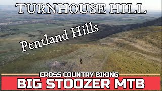
Long path taking in West Kip, East Kip, Scald Law (highest point in the Pentlands), Carnethy and Turnhouse.

Apart from the initial climb to West Kip, the climbs are all rideable. The descents off the peaks are steep in places with plenty of line choice. Part way down some of the descents there are sections of gravel paths with lots of switchbacks.

This trail is unsanctioned.

Recent Activity on Trail

Past Week
  • 0 rides
  •  
6 Months
  • 1 rides
  • 33.9 km avg distance
All
  • 27 rides
  • Last: Jun 15, 2026
c1c2c3c4
January
February
March
April
May
June
July
August
September
October
November
December
update trails status or condition

Five Peaks Trail Reports

statusdatedescription
May 3, 2025 @ 3:17pm
May 3, 2025
Some decent are definetly not red. bit loose but still worth it
Apr 6, 2023 @ 10:14pm
Apr 6, 2023
Sep 13, 2022 @ 4:50am
Sep 13, 2022
West kip push up not easy with an e bike . In places very lose and dry, with some steep sections . Would be easier to go on the grass, but...
Jun 16, 2021 @ 10:07am
Jun 16, 2021
Dry and loose
May 28, 2020 @ 1:07am
May 28, 2020
very dry and loose
more »
Status:
on May 3, 2025
Dry
Avg: 3.71 (8 votes)
Your vote: 0

view (547)
close
3D
Trail Conditions
  • Unknown
  • Snow Groomed
  • Snow Packed
  • Snow Covered
  • Snow Cover Partial
  • Freeze/thaw Cycle
  • Icy
  • Prevalent Mud
  • Wet
  • Variable
  • Ideal
  • Dry
  • Very Dry
Trail Flow (Ridden Direction)
Trailforks scans users ridelogs to determine the most popular direction each trail is ridden. A good flowing trail network will have most trails flowing in a single direction according to their intension.
The colour categories are based on what percentage of riders are riding a trail in its intended direction.
  • > 96%
  • > 90%
  • > 80%
  • > 70%
  • > 50%
  • < 50%
  • bi-directional trail
  • no data
Trail Last Ridden
Trailforks scans ridelogs to determine the last time a trail was ridden.
  • < 2 days
  • < 1 week
  • < 2 weeks
  • < 1 month
  • < 6 months
  • > 6 months
Trail Ridden Direction
The intended direction a trail should be ridden.
  • Downhill Only
  • Downhill Primary
  • Both Directions
  • Uphill Primary
  • Uphill Only
  • One Direction
Contribute Details
Colors indicate trail is missing specified detail.
  • Description
  • Photos
  • Description & Photos
  • Videos
Trail Popularity ?
Trailforks scans ridelogs to determine which trails are ridden the most in the last 9 months. Trails are compared with nearby trails in the same city region with a possible 25 colour shades. Think of this as a heatmap, more rides = more kinetic energy = warmer colors.
  • most popular
  • popular
  • less popular
  • not popular
ATV/ORV/OHV Filter
Max Vehicle Width
inches
US Cell Coverage
Legend
cell carrier legend

Radar Time
Activity Recordings
Trailforks uses anonymized public activity data. ?
Activity Recordings
Trailforks uses anonymized public activity data. ?
Personal Heatmap
Activity Types
all / none
Options
2
Date range month
Winter Trails
Warning A routing network for winter maps does not exist. Selecting trails using the winter trails layer has been disabled.
Missing Trails
Most Popular
Least Popular
Trails are colored based on popularity. The more popular a trail is, the more red. Less popular trails trend towards green.
Jump Magnitude Heatmap
Heatmap of where riders jump on trails. Zoom in to see individual jumps, click circles to view jump details.
BC Backroad Status

Service Road Atlas is a free to use, community-driven service for viewing and creating reports on the numerous back-country service roads around B.C. and Alberta.

map legend
Slope Aspect
Direction the slope faces
Flat N NE E SE S SW W NW
Trails Deemphasized
Trails are shown in grey.
disable
Only show trails with no bike usage.
Enable
Suggested Layers
Based on selected activity type

    Save the current map location and zoom level as your default home location whenever this page is loaded.

    Save
        Directions to five-peaks trailhead (55.829810, -3.318870)

        Photos

        63 more »
        127 |
        Jun 10, 2023 @ 11:41am
        Jun 10, 2023
        110 |
        Jun 10, 2023 @ 11:41am
        Jun 10, 2023
        112 |
        Jun 10, 2023 @ 11:41am
        Jun 10, 2023
        93 |
        Jun 10, 2023 @ 11:41am
        Jun 10, 2023

        Videos

        10 more »
        youtuber Pentland Hills mtb. 5 Peaks Loop. FULL ROUTE...
        4:24 | 349 | Jun 7, 2023 , Edinburgh
        youtuber Pentland Hills 5 Peaks. Stage 3. TRAVERSING...
        46:21 | 109 | Jun 7, 2023 , Edinburgh
        youtuber Pentland Hills mtb. 5 Peaks. THE SUMMITS AND...
        26:08 | 108 | Jun 7, 2023 , Edinburgh
        youtuber TURNHOUSE HILL. Pentland Hills MTB. Lothian....
        13:55 | 98 | Jun 7, 2023 , Edinburgh

        Routes with this trail

        3.3 15 miles 2,748 ft 7 Loop
        A loop from the Harlaw car park over the 5 peaks trail which gets you some stunning views and fun descents
        21 miles 4,157 ft 9 Loop
        This route takes in some of the best descents in the Pentlands. You've got to find the days with less wind...
        24 miles 4,317 ft 9
        Pentland Peaks Gold Route September 2022

        2 Reviews & Comments


        We hope you've been enjoying Trailforks!

        Create a FREE account to view trail comments and much more.

        • #36995 - 16,589 views

        Frequently Asked Questions About Five Peaks

        Where is Five Peaks located?
        Five Peaks is located in Pentland Hills, Edinburgh, United Kingdom. It is part of the Pentland Hills trail network. The trailhead is located at coordinates 55.82981, -3.31887.
        How hard is Five Peaks?
        Five Peaks is rated as Red difficulty. The physical rating is Hard. The average grade is 3.969%. The climb difficulty is rated Blue.
        What is the elevation gain for Five Peaks?
        Five Peaks has 1,124 ft of elevation gain. The trail has 1,991 ft of elevation descent. The elevation ranges from 634 ft to 1,837 ft.
        Is Five Peaks a point to point trail?
        Five Peaks is not a point to point trail. The direction is Downhill Primary. The trail type is mixed.

        Hit the Trail

        Open in App

        Get this trail on your phone instantly.
        open trail in app

        Download Trail

        Save to wishlist, Garmin & download.
        save the trail

        Find Related Routes

        Find routes and users activities that include this trail.
        find routes for this trail

        You must enter a description before submitting.