more stats
2,848 ft
Distance
-131 ft
Descent
00:03:15
Avg time
-133 ft
Altitude change
109 ft
Altitude min
242 ft
Altitude max
242 ft
Altitude start
108 ft
Altitude end
-4.7%
Grade
-13.5%
Grade max
2.3%
Grade min
30 ft
Distance climb
2,451 ft
Distance down
371 ft
Distance flat
00:03:15
Avg time

Flow Creek Details

  • Activities
    • Mountain Bike
    • Winter Fat Bike
  • Riding Area
    Blackstrap Hill Preserve
    Falmouth, Maine
  • AKA
    flow trail
  • Difficulty Rating
  • Voted Difficulty
    Blue (1 vote)
  • Local Popularity
    100 in Mountain Biking
  • Global Ranking
    #1960 in Mountain Biking
  • Trail Type
    Machine Groomed
  • Bike Type
    DH, AM, XC, DJ, Fat
  • Direction
    Downhill Only
  • Physical Rating
    Moderate
  • Trail Visibility
    Always easy to follow
  • TTFs on Trail
    Berm, Bridge, Drop, Jump, Gap Jump, Roller Coaster
  • Year Opened
    2019
  • Land Owner

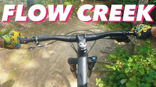
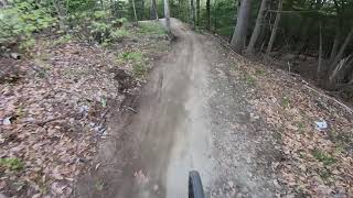
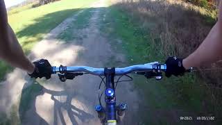
Machine built flow trail with several features including step-ups, rollers, tabletops and berms. Flows much better since a recent rebuild, and a classic way to end a ride at Blackstrap. Best if you start in the woods up by the sand pit and rally into the double track uphill of Flow Creek's start, where the sides of the jeep trail can be jibbed.

Local Trail Association
Traditionally Indigenous Territory

Recent Activity on Trail

Past Week
  • 14 rides
  • 9 miles average
6 Months
  • 149 rides
  • 7 miles avg distance
All
  • 2,961 rides
  • Last: Jun 17, 2026
c1c2c3c4
January
February
March
April
May
June
July
August
September
October
November
December
update trails status or condition

Flow Creek Trail Reports

Status:
on Aug 8, 2025
Dry
Avg: 4.49 (8 votes)
Your vote: 0

view (17,013)
close
3D
Trail Conditions
  • Unknown
  • Snow Groomed
  • Snow Packed
  • Snow Covered
  • Snow Cover Partial
  • Freeze/thaw Cycle
  • Icy
  • Prevalent Mud
  • Wet
  • Variable
  • Ideal
  • Dry
  • Very Dry
Trail Flow (Ridden Direction)
Trailforks scans users ridelogs to determine the most popular direction each trail is ridden. A good flowing trail network will have most trails flowing in a single direction according to their intension.
The colour categories are based on what percentage of riders are riding a trail in its intended direction.
  • > 96%
  • > 90%
  • > 80%
  • > 70%
  • > 50%
  • < 50%
  • bi-directional trail
  • no data
Trail Last Ridden
Trailforks scans ridelogs to determine the last time a trail was ridden.
  • < 2 days
  • < 1 week
  • < 2 weeks
  • < 1 month
  • < 6 months
  • > 6 months
Trail Ridden Direction
The intended direction a trail should be ridden.
  • Downhill Only
  • Downhill Primary
  • Both Directions
  • Uphill Primary
  • Uphill Only
  • One Direction
Contribute Details
Colors indicate trail is missing specified detail.
  • Description
  • Photos
  • Description & Photos
  • Videos
Trail Popularity ?
Trailforks scans ridelogs to determine which trails are ridden the most in the last 9 months. Trails are compared with nearby trails in the same city region with a possible 25 colour shades. Think of this as a heatmap, more rides = more kinetic energy = warmer colors.
  • most popular
  • popular
  • less popular
  • not popular
ATV/ORV/OHV Filter
Max Vehicle Width
inches
US Cell Coverage
Legend
cell carrier legend

Radar Time
Activity Recordings
Trailforks uses anonymized public activity data. ?
Activity Recordings
Trailforks uses anonymized public activity data. ?
Personal Heatmap
Activity Types
all / none
Options
2
Date range month
Winter Trails
Warning A routing network for winter maps does not exist. Selecting trails using the winter trails layer has been disabled.
Missing Trails
Most Popular
Least Popular
Trails are colored based on popularity. The more popular a trail is, the more red. Less popular trails trend towards green.
Jump Magnitude Heatmap
Heatmap of where riders jump on trails. Zoom in to see individual jumps, click circles to view jump details.
BC Backroad Status

Service Road Atlas is a free to use, community-driven service for viewing and creating reports on the numerous back-country service roads around B.C. and Alberta.

map legend
Slope Aspect
Direction the slope faces
Flat N NE E SE S SW W NW
Trails Deemphasized
Trails are shown in grey.
disable
Only show trails with no bike usage.
Enable
Suggested Layers
Based on selected activity type

    Save the current map location and zoom level as your default home location whenever this page is loaded.

    Save
        Directions to flow-creek trailhead (43.790570, -70.326690)

        Photos

        9 more »
        211 |
        Nov 19, 2023 @ 6:12pm
        Nov 19, 2023
        277 |
        Nov 11, 2020 @ 6:37am
        Nov 11, 2020
        289 |
        Nov 11, 2020 @ 6:37am
        Nov 11, 2020
        274 |
        Nov 11, 2020 @ 6:37am
        Nov 11, 2020

        Videos

        3 more »
        Flow Trails in Maine!? Riding Flow Creek at...
        9:16 | 835 | Aug 9, 2020 , Falmouth
        Flow Creek Trail 2020 @ Blackstrap
        2:22 | 808 | May 28, 2020 , Falmouth
        Flow Creek Trail-Black Strap Hill Falmouth
        4:42 | 1523 | Nov 3, 2019 , Falmouth

        Routes with this trail

        5.0 12 miles 1,856 ft 23 Loop
        This route puts you through the best descents in Blackstrap, including all the common descents off the...
        4.0 8 miles 833 ft 9 Loop
        Nice Blackstrap loop - gets you some nice singletrack then to the top of the flow trails.
        19 miles 2,173 ft 23 Loop
        A big-terrain perimeter loop linking three of Greater Portland’s most iconic riding zones—East Windham...

        3 Reviews & Comments


        We hope you've been enjoying Trailforks!

        Create a FREE account to view trail comments and much more.

        • By 207-5010 & contributors
        • #214273 - 7,834 views

        Frequently Asked Questions About Flow Creek

        Where is Flow Creek located?
        Flow Creek is located in Blackstrap Hill Preserve, Falmouth, Maine, United States. It is part of the Blackstrap Hill Preserve trail network. The trailhead is located at coordinates 43.79057, -70.32669.
        How hard is Flow Creek?
        Flow Creek is rated as Blue difficulty. The physical rating is Moderate. The average grade is 4.7%.
        What is the elevation gain for Flow Creek?
        The trail has 131 ft of elevation descent. The elevation ranges from 109 ft to 242 ft.
        Is Flow Creek a point to point trail?
        Yes, Flow Creek is a point to point trail. The direction is Downhill Only. The trail type is machine groomed.

        Hit the Trail

        Open in App

        Get this trail on your phone instantly.
        open trail in app

        Download Trail

        Save to wishlist, Garmin & download.
        save the trail

        Find Related Routes

        Find routes and users activities that include this trail.
        find routes for this trail

        You must enter a description before submitting.