more stats
4.7 miles
Distance
115 ft
Climb
-1,123 ft
Descent
00:41:13
Avg time
-1,008 ft
Altitude change
3,442 ft
Altitude min
4,451 ft
Altitude max
4,451 ft
Altitude start
3,445 ft
Altitude end
-4.1%
Grade
-37.5%
Grade max
15.5%
Grade min
3,438 ft
Distance climb
3 miles
Distance down
3,625 ft
Distance flat
00:41:13
Avg time

Flow Job Details

  • Activities
    • Mountain Bike
    • Hike
    • Trail Running
  • Riding Area
    Red Rock - Cowboy Trails
    Las Vegas, Nevada
  • Difficulty Rating
  • Voted Difficulty
    Blue (5 votes)
  • Local Popularity
    80 in Mountain Biking [+]
    • 80 in Trail Running
    • 75 in Hiking
  • Global Ranking
    #14563 in Mountain Biking [+]
    • #257 in Trail Running
    • #407 in Hiking
  • Trail Type
    Singletrack
  • Bike Type
    XC
  • Direction
    Downhill Primary
  • Climb Difficulty
    Blue
  • Physical Rating
    Moderate
  • Dogs Allowed
    Yes
  • Year Opened
    2018

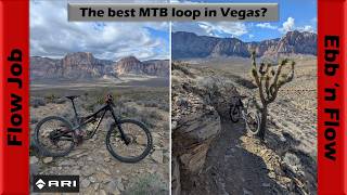
This trail was built with a purpose, to be ridden in both directions. Therefore, please ride the downhill with caution and keep your eyes on the trail ahead of you. There are some hidden corners that could be disastrous should you be riding too fast and out of control.

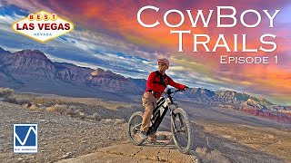
The builder(s) must have spend hundreds if not thousands of hours building this amazing single track trail that naturally connects the two riding areas of Cowboy Trails and Blue Diamond Trails together with the extension of Goat Roper. Nice work

As the entrance signs at the summit shows: Ride it...Don't slide it...

Trail Supporters
  • BLM
    BLM
    Land Manager
Local Trail Association

Recent Activity on Trail

Past Week
  • 0 rides
  •  
6 Months
  • 35 rides
  • 15 miles avg distance
All
  • 382 rides
  • Last: Jun 15, 2026
c1c2c3c4
January
February
March
April
May
June
July
August
September
October
November
December
update trails status or condition

Flow Job Trail Reports

statusdatedescription
Feb 19, 2026 @ 5:10pm (America/Los_Angeles)
Feb 19, 2026
Jan 4, 2026 @ 7:32am (America/Los_Angeles)
Jan 4, 2026
Dirt is compact, really great climbing trail given the terrain.
Dec 28, 2025 @ 8:25am (America/Los_Angeles)
Dec 28, 2025
Entrance off the 159 has been blocked by a giant dirt barrier. Still accessible by going around and over the fence.
Dec 17, 2025 @ 3:38pm (America/Los_Angeles)
Dec 17, 2025
Rode up it, but trail is running as fast as I've ever seen it. Dirt is super compacted with almost no loose stuff. If you're a kom chaser, now's a...
Nov 18, 2025 @ 12:09pm (America/Los_Angeles)
Nov 18, 2025
Trail was in great condition climbing up from Blue Diamond / Parking area west of Blue Diamond... Good to see the trail in such good condition...
more »
Status:
on Feb 19, 2026
Ideal
Avg: 4.22 (40 votes)
Your vote: 0

view (1,894)
close
3D
Trail Conditions
  • Unknown
  • Snow Groomed
  • Snow Packed
  • Snow Covered
  • Snow Cover Partial
  • Freeze/thaw Cycle
  • Icy
  • Prevalent Mud
  • Wet
  • Variable
  • Ideal
  • Dry
  • Very Dry
Trail Flow (Ridden Direction)
Trailforks scans users ridelogs to determine the most popular direction each trail is ridden. A good flowing trail network will have most trails flowing in a single direction according to their intension.
The colour categories are based on what percentage of riders are riding a trail in its intended direction.
  • > 96%
  • > 90%
  • > 80%
  • > 70%
  • > 50%
  • < 50%
  • bi-directional trail
  • no data
Trail Last Ridden
Trailforks scans ridelogs to determine the last time a trail was ridden.
  • < 2 days
  • < 1 week
  • < 2 weeks
  • < 1 month
  • < 6 months
  • > 6 months
Trail Ridden Direction
The intended direction a trail should be ridden.
  • Downhill Only
  • Downhill Primary
  • Both Directions
  • Uphill Primary
  • Uphill Only
  • One Direction
Contribute Details
Colors indicate trail is missing specified detail.
  • Description
  • Photos
  • Description & Photos
  • Videos
Trail Popularity ?
Trailforks scans ridelogs to determine which trails are ridden the most in the last 9 months. Trails are compared with nearby trails in the same city region with a possible 25 colour shades. Think of this as a heatmap, more rides = more kinetic energy = warmer colors.
  • most popular
  • popular
  • less popular
  • not popular
ATV/ORV/OHV Filter
Max Vehicle Width
inches
US Cell Coverage
Legend
cell carrier legend

Radar Time
Activity Recordings
Trailforks uses anonymized public activity data. ?
Activity Recordings
Trailforks uses anonymized public activity data. ?
Personal Heatmap
Activity Types
all / none
Options
2
Date range month
Winter Trails
Warning A routing network for winter maps does not exist. Selecting trails using the winter trails layer has been disabled.
Missing Trails
Most Popular
Least Popular
Trails are colored based on popularity. The more popular a trail is, the more red. Less popular trails trend towards green.
Jump Magnitude Heatmap
Heatmap of where riders jump on trails. Zoom in to see individual jumps, click circles to view jump details.
BC Backroad Status

Service Road Atlas is a free to use, community-driven service for viewing and creating reports on the numerous back-country service roads around B.C. and Alberta.

map legend
Slope Aspect
Direction the slope faces
Flat N NE E SE S SW W NW
Trails Deemphasized
Trails are shown in grey.
disable
Only show trails with no bike usage.
Enable
Suggested Layers
Based on selected activity type

    Save the current map location and zoom level as your default home location whenever this page is loaded.

    Save
        Directions to flow-job trailhead (36.095520, -115.426690)

        Photos

        76 more »
        805 |
        May 14, 2018 @ 8:53pm
        May 14, 2018
        711 |
        Apr 20, 2018 @ 7:22pm
        Apr 20, 2018
        22 |
        Mar 21, 2026 @ 3:47pm
        Mar 21, 2026
        28 |
        Mar 21, 2026 @ 3:47pm
        Mar 21, 2026

        Videos

        16 more »
        youtuber Epic EMTB Ride @ Cowboy Trails  E1 - Las Vegas...
        9:22 | 613 | Jan 14, 2022 , Las Vegas
        youtuber FLOW JOB  //  VEGAS MOUNTAIN BIKE TRAILS
        12:57 | 1975 | Apr 17, 2019 , Las Vegas
        youtuber Is Flow Job to Ebb 'n Flow the best loop in...
        34:13 | 84 | Feb 20, 2026 , Las Vegas
        Flow Job - Fun Sections
        19:20 | 97 | Mar 29, 2025 , Las Vegas

        Routes with this trail

        4.0 13 miles 1,688 ft 2
        Ebb n' Flow is one of Vegas's newest trails and it should not be missed by experienced riders! The climb...
        4.3 32 miles 3,201 ft 21
        blue diamond to blue diamond around the cowboy
        5.0 8 miles 935 ft 4 Point to Point
        A technical climb up rolling bumps sets you up for the downhill down a flowy trail to the bottom.

        24 Reviews & Comments


        We hope you've been enjoying Trailforks!

        Create a FREE account to view trail comments and much more.

        • By k2kTF Pro & contributors
        • #125330 - 18,298 views

        Frequently Asked Questions About Flow Job

        Where is Flow Job located?
        Flow Job is located in Red Rock - Cowboy Trails, Las Vegas, Nevada, United States. It is part of the Red Rock - Cowboy Trails trail network. The trailhead is located at coordinates 36.09552, -115.42669.
        How hard is Flow Job?
        Flow Job is rated as Blue difficulty. The physical rating is Moderate. The average grade is 4.1%. The climb difficulty is rated Blue.
        What is the elevation gain for Flow Job?
        Flow Job has 115 ft of elevation gain. The trail has 1,123 ft of elevation descent. The elevation ranges from 3,442 ft to 4,451 ft.
        Is Flow Job a point to point trail?
        Flow Job is not a point to point trail. The direction is Downhill Primary. The trail type is singletrack.

        Hit the Trail

        Open in App

        Get this trail on your phone instantly.
        open trail in app

        Download Trail

        Save to wishlist, Garmin & download.
        save the trail

        Find Related Routes

        Find routes and users activities that include this trail.
        find routes for this trail

        You must enter a description before submitting.