



Open in App
Get this trail on your phone instantly.

WARNING BIKERS:
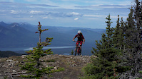
This is not a bike trail. Careful research, preparation and navigation are needed. This uses the folding mountain hiking trail accessed by a steep hike-a-bike climb from highway 16 and the Folding Mountain Brewery. Watch for hikers!!
Many trail types encountered including single-track, tight willow sections, steep rocky sections, steep rooty sections, drop away ridge lines. Scope out any ridge lines, scree rides and technical sections first before trying to ride. There are always fallen trees and other hazards
This unsanctioned trail is not supported by any local trail associations. Planning, navigation, bear spray, survival pack, cellphone/tracking, expert level riding skills and fitness required. If this is you, expect a rewarding but surprisingly quick ride with amazing views, wildlife, challenging technical riding and one of the few rides of it's kind in Alberta.
HIKING:
Just to the east of Jasper National Park and south of Hwy 16 is an unassuming mountain that often gets overlooked, dwarfed as it is by Roche a Perdrix and the Fiddle Range. But tucked in behind the summit of Folding Mountain is a heavenly pocket of Rocky Mountain wilderness that many environmentalists wish to see blessed with provincial or national park status.
Difficult, steep and heavily treed first section up to the ridge/shoulder. Then a long middle section while mostly horizontal has some meandering up/down sections. Long slow approach to the final pitch / scree scrabble to the "peak" of folding mountain. Once on the plateau it is wide open to explore. Some trail runners connect over to the Fiddle Range somehow..
Take Highway 16 west of Hinton and travel 25 kilometres until you come to Folding Mountain Resort. Park and walk back to the turn-off. Follow the left ditch toward Jasper for 5 minutes until you pass a telephone pole, where you will see a cutting through the trees marking the trail.
| c1 | c2 | c3 | c4 |
|---|---|---|---|
January | February | March | April |
May | June | July | August |
September | October | November | December |


Service Road Atlas is a free to use, community-driven service for viewing and creating reports on the numerous back-country service roads around B.C. and Alberta.
Save the current map location and zoom level as your default home location whenever this page is loaded.
SaveWe hope you've been enjoying Trailforks!
Create a FREE account to view trail comments and much more.
You must enter a description before submitting.

