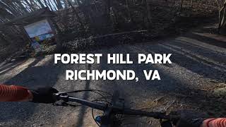
more stats
2.8 miles
Distance
290 ft
Climb
-280 ft
Descent
00:25:54
Avg time
9 ft
Altitude change
73 ft
Altitude min
167 ft
Altitude max
88 ft
Altitude start
95 ft
Altitude end
0.1%
Grade
-21.4%
Grade max
28.9%
Grade min
1 mile
Distance climb
1 mile
Distance down
2,073 ft
Distance flat
00:25:54
Avg time

Forest Hill Park Details

  • Activities
    • Mountain Bike
    • Hike
    • Trail Running
  • Riding Area
    James River Park System
    Richmond, Virginia
  • Difficulty Rating
  • Voted Difficulty
    Blue (2 votes)
  • Local Popularity
    100 in Mountain Biking [+]
    • 85 in Trail Running
    • 50 in Hiking
  • Global Ranking
    #8122 in Mountain Biking [+]
    • #6818 in Trail Running
    • #97715 in Hiking
  • Trail Type
    Singletrack
  • Bike Type
    AM
  • Direction
    Both Directions
  • Climb Difficulty
    Blue
  • Physical Rating
    Moderate
  • Season
    Year Round
  • Dogs Allowed
    Yes
  • TTFs on Trail
    Bridge, Jump, Rock Face
  • Land Owner

Forest Hill Park has been around for awhile. It celebrated it’s 160th anniversary in 2002 and was also named a historic landmark by both the National Register of Historic Places and the Virginia Landmarks Register. Once a large country estate, the park became a terminus for a trolley line that was brought from downtown Richmond, which drew new residents to South Side Richmond. In the early 1900’s, an amusement park was established in the park. Waning popularity caused the amusement park to close in 1932, partially due to the Great Depression. The park was acquired by the City of Richmond in 1933.

The park is about 100 acres and has 3.2 miles of trails. The trails have been used as part of the Xterra Off-Road triathlon race numerous times since 2000 and were completely over-hauled in 2009. The trails are accessible from the James River Park System at Reedy Creek and Riverside Drive. Since the trail system is so small, most people combine them with Buttermilk, North Bank, and Belle Isle to create a longer route. The trail system would be considered flowing singletrack with several long climbs.

Access Info

From the Reedy Creek parking area take a left on Riverside drive and look for a dirt-ish road immediately after the road crosses over the creek. This is both the entrance and exit point to the loop. I will describe the loop in the counterclockwise direction below.

Stay on the dirt road sized walking path that drops down along the creek until you see a large cement block with a manhole in the top of it (approximately 3' tall). A square pipe crosses the creek here and you ride across it (it's about 3' wide....and be careful, walk if necessary). The easiest access to ride onto the "bridge" is riding around the upstream side of the cement block and then riding across.

From here the trail is fairly straightforward. Continue up a climb, ride the trail skirting the parking lot, down a fun decent with some interesting whoop-dee's, continue up another climb until you reach a single lane paved walk way. Ride across this, down the stairs on the other side and up the brief climb. At the top of this climb you end up at the top of some stone stairs. From here ride the pathway that continues adjacent a chain link fence that encloses the James River Park System "physical plant" (where they keep all of their stuff for maintaining the park). This will lead you to some more trail that continues up to a road with another paved walking trail crossing.

Cross the paved path and continue on the singletrack down to a bridge over Reedy creek (wooden 3' wide with hand railings). Cross this, the trail continues right from here. From here the trail is easier to follow for about a half mile with some side hill meanderings. Eventually you get a descent with a hairpin right turn. After this continue down across the creek and start the climb up right. The top of this climb appears to go straight, but take the left turn up hill here and continue through switchbacks and turns the remaining half mile to where we began.

Note, counter-clockwise is just the direction I prefer. In the last several years (2009 - present 8/10/13) the races in the area have used this section the other direction.

Trail Supporters
  • past supporters

Local Trail Association
Traditionally Indigenous Territory

Recent Activity on Trail

Past Week
  • 3 rides
  • 18 miles average
6 Months
  • 57 rides
  • 13 miles avg distance
All
  • 512 rides
  • Last: Jun 21, 2026
c1c2c3c4
January
February
March
April
May
June
July
August
September
October
November
December
update trails status or condition

Forest Hill Park Trail Reports

statusdatedescription
Oct 7, 2025 @ 4:38pm (America/New_York)
Oct 7, 2025
Great city loop. some sections blown out from ridings and dry conditions but still loads of fun. just need to be more careful in the turns.
May 2, 2025 @ 2:32pm
May 2, 2025
Dec 24, 2024 @ 7:15am
Dec 24, 2024
Jun 10, 2024 @ 9:49am
Jun 10, 2024
Dec 26, 2023 @ 12:00pm
Dec 26, 2023
more »
Status:
on Oct 7, 2025
Dry
Avg: 4.43 (10 votes)
Your vote: 0

view (7,925)
close
3D
Trail Conditions
  • Unknown
  • Snow Groomed
  • Snow Packed
  • Snow Covered
  • Snow Cover Partial
  • Freeze/thaw Cycle
  • Icy
  • Prevalent Mud
  • Wet
  • Variable
  • Ideal
  • Dry
  • Very Dry
Trail Flow (Ridden Direction)
Trailforks scans users ridelogs to determine the most popular direction each trail is ridden. A good flowing trail network will have most trails flowing in a single direction according to their intension.
The colour categories are based on what percentage of riders are riding a trail in its intended direction.
  • > 96%
  • > 90%
  • > 80%
  • > 70%
  • > 50%
  • < 50%
  • bi-directional trail
  • no data
Trail Last Ridden
Trailforks scans ridelogs to determine the last time a trail was ridden.
  • < 2 days
  • < 1 week
  • < 2 weeks
  • < 1 month
  • < 6 months
  • > 6 months
Trail Ridden Direction
The intended direction a trail should be ridden.
  • Downhill Only
  • Downhill Primary
  • Both Directions
  • Uphill Primary
  • Uphill Only
  • One Direction
Contribute Details
Colors indicate trail is missing specified detail.
  • Description
  • Photos
  • Description & Photos
  • Videos
Trail Popularity ?
Trailforks scans ridelogs to determine which trails are ridden the most in the last 9 months. Trails are compared with nearby trails in the same city region with a possible 25 colour shades. Think of this as a heatmap, more rides = more kinetic energy = warmer colors.
  • most popular
  • popular
  • less popular
  • not popular
ATV/ORV/OHV Filter
Max Vehicle Width
inches
US Cell Coverage
Legend
cell carrier legend

Radar Time
Activity Recordings
Trailforks uses anonymized public activity data. ?
Activity Recordings
Trailforks uses anonymized public activity data. ?
Personal Heatmap
Activity Types
all / none
Options
2
Date range month
Winter Trails
Warning A routing network for winter maps does not exist. Selecting trails using the winter trails layer has been disabled.
Missing Trails
Most Popular
Least Popular
Trails are colored based on popularity. The more popular a trail is, the more red. Less popular trails trend towards green.
Jump Magnitude Heatmap
Heatmap of where riders jump on trails. Zoom in to see individual jumps, click circles to view jump details.
BC Backroad Status

Service Road Atlas is a free to use, community-driven service for viewing and creating reports on the numerous back-country service roads around B.C. and Alberta.

map legend
Slope Aspect
Direction the slope faces
Flat N NE E SE S SW W NW
Trails Deemphasized
Trails are shown in grey.
disable
Only show trails with no bike usage.
Enable
Suggested Layers
Based on selected activity type

    Save the current map location and zoom level as your default home location whenever this page is loaded.

    Save
        Directions to forest-hill-park trailhead (37.523000, -77.470220)

        Photos

        15 more »
        155 |
        Jun 5, 2023 @ 3:40pm
        Jun 5, 2023
        274 |
        Nov 24, 2020 @ 5:19am
        Nov 24, 2020
        220 |
        Nov 9, 2020 @ 10:53am
        Nov 9, 2020
        332 |
        Apr 24, 2017 @ 2:03pm
        Apr 24, 2017

        Videos

        2 more »
        Forest Hill Park, Richmond
        21:47 | 59 | Mar 4, 2026 , Richmond
        Forest Hill Park Mountain Biking 4K [Richmond, VA]
        6:13 | 771 | Sep 27, 2020 , Richmond

        Routes with this trail

        42 miles 1,978 ft 17
        An Open House ride format. The entry fee is WAIVED. Our only request is that you stop by the rvaMORE tent,...
        28 miles 1,333 ft 22
        2023 Tour de Fall Line - Medium Course - A tour of Richmond's Downtown singletrack
        51 miles 2,418 ft 26 Loop
        2023 Tour de Fall Line - Long Route - A tour of Richmond's Single Track paradise!

        Reviews / Comments

        No reviews yet, be the first to write a review or ask a question.
        Use trail reports to comment on trail conditions.


        We hope you've been enjoying Trailforks!

        Create a FREE account to view trail comments and much more.

        • By larsthemajTF Pro & contributors
        • #38136 - 8,132 views

        Frequently Asked Questions About Forest Hill Park

        Where is Forest Hill Park located?
        Forest Hill Park is located in James River Park System, Richmond, Virginia, United States. It is part of the James River Park System trail network. The trailhead is located at coordinates 37.523, -77.47022.
        How hard is Forest Hill Park?
        Forest Hill Park is rated as Blue difficulty. The physical rating is Moderate. The average grade is 0.1%. The climb difficulty is rated Blue.
        What is the elevation gain for Forest Hill Park?
        Forest Hill Park has 290 ft of elevation gain. The trail has 280 ft of elevation descent. The elevation ranges from 73 ft to 167 ft.
        Is Forest Hill Park a point to point trail?
        Forest Hill Park is not a point to point trail. The direction is Both Directions. The trail type is singletrack.

        Hit the Trail

        Open in App

        Get this trail on your phone instantly.
        open trail in app

        Download Trail

        Save to wishlist, Garmin & download.
        save the trail

        Find Related Routes

        Find routes and users activities that include this trail.
        find routes for this trail

        You must enter a description before submitting.