more stats
1.4 miles
Distance
583 ft
Climb
-15 ft
Descent
00:19:57
Avg time
568 ft
Altitude change
5,301 ft
Altitude min
5,868 ft
Altitude max
5,301 ft
Altitude start
5,869 ft
Altitude end
7.6%
Grade
-11.4%
Grade max
33.7%
Grade min
1 mile
Distance climb
502 ft
Distance down
522 ft
Distance flat
00:19:57
Avg time

Fort Canyon Details

  • Activities
    • Mountain Bike
    • E-Bike
    • Hike
    • Trail Running
  • Riding Area
    Lambert Park
    Alpine, Utah
  • AKA
  • Difficulty Rating
  • Voted Difficulty
    Green (2 votes)
  • Local Popularity
    65 in Mountain Biking [+]
    • 65 in E-Biking
    • 95 in Trail Running
    • 100 in Hiking
  • Global Ranking
    #94611 in Mountain Biking [+]
    • #63010 in E-Biking
    • #2929 in Trail Running
    • #3280 in Hiking
  • Hiking SAC Scale
    T2 Mountain Hiking
  • Trail Type
    Singletrack
  • Direction
    Both Directions
  • Climb Difficulty
    Green
  • Physical Rating
    Moderate
  • Trail Visibility
    Always easy to follow
  • Dogs Allowed
    Yes
  • eBike Allowed
    Yes up to Class 1

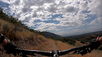
Trail climbs up from the Fort Canyon Road trailhead parking lot, providing a connection from Fort Canyon to the saddle between it and Dry Creek Canyon. Take this trail to form a tighter loop with Corner Canyon (less paved road).

The trail itself is pretty typical smooth singeltrack that slowly winds up to the Nephs Lake connection. There are a lot of turns, but really no berms to speak of. In fact, some turns are off camber and even fall away a bit. It works well as an uphill grind to make a loop with other Corner Canyon trails, but I would generally use this for uphill, as the downhill is slow. In the spring the trail tends to get post holed by horses.

Trail Supporters
Traditionally Indigenous Territory

Recent Activity on Trail

Past Week
  • 3 rides
  • 22.0 km average
6 Months
  • 24 rides
  • 23.1 km avg distance
All
  • 301 rides
  • Last: Jun 25, 2026
c1c2c3c4
January
February
March
April
May
June
July
August
September
October
November
December
update trails status or condition

Fort Canyon Trail Reports

statusdatedescription
Apr 23, 2025 @ 7:22pm
Apr 23, 2025
Apr 7, 2025 @ 3:05pm
Apr 7, 2025
All good
Mar 27, 2025 @ 12:09pm
Mar 27, 2025
Still some mud /snow on North facing slope. Other than about 4 or 5 short patches of snow/mud the trail was ideal.
Aug 22, 2024 @ 4:39pm
Aug 22, 2024
May 16, 2024 @ 9:32am
May 16, 2024
more »
Status:
on Apr 23, 2025
Ideal
Avg: 3.74 (10 votes)
Your vote: 0

view (3,326)
close
3D
Trail Conditions
  • Unknown
  • Snow Groomed
  • Snow Packed
  • Snow Covered
  • Snow Cover Partial
  • Freeze/thaw Cycle
  • Icy
  • Prevalent Mud
  • Wet
  • Variable
  • Ideal
  • Dry
  • Very Dry
Trail Flow (Ridden Direction)
Trailforks scans users ridelogs to determine the most popular direction each trail is ridden. A good flowing trail network will have most trails flowing in a single direction according to their intension.
The colour categories are based on what percentage of riders are riding a trail in its intended direction.
  • > 96%
  • > 90%
  • > 80%
  • > 70%
  • > 50%
  • < 50%
  • bi-directional trail
  • no data
Trail Last Ridden
Trailforks scans ridelogs to determine the last time a trail was ridden.
  • < 2 days
  • < 1 week
  • < 2 weeks
  • < 1 month
  • < 6 months
  • > 6 months
Trail Ridden Direction
The intended direction a trail should be ridden.
  • Downhill Only
  • Downhill Primary
  • Both Directions
  • Uphill Primary
  • Uphill Only
  • One Direction
Contribute Details
Colors indicate trail is missing specified detail.
  • Description
  • Photos
  • Description & Photos
  • Videos
Trail Popularity ?
Trailforks scans ridelogs to determine which trails are ridden the most in the last 9 months. Trails are compared with nearby trails in the same city region with a possible 25 colour shades. Think of this as a heatmap, more rides = more kinetic energy = warmer colors.
  • most popular
  • popular
  • less popular
  • not popular
ATV/ORV/OHV Filter
Max Vehicle Width
inches
US Cell Coverage
Legend
cell carrier legend

Radar Time
Activity Recordings
Trailforks uses anonymized public activity data. ?
Activity Recordings
Trailforks uses anonymized public activity data. ?
Personal Heatmap
Activity Types
all / none
Options
2
Date range month
Winter Trails
Warning A routing network for winter maps does not exist. Selecting trails using the winter trails layer has been disabled.
Missing Trails
Most Popular
Least Popular
Trails are colored based on popularity. The more popular a trail is, the more red. Less popular trails trend towards green.
Jump Magnitude Heatmap
Heatmap of where riders jump on trails. Zoom in to see individual jumps, click circles to view jump details.
BC Backroad Status

Service Road Atlas is a free to use, community-driven service for viewing and creating reports on the numerous back-country service roads around B.C. and Alberta.

map legend
Slope Aspect
Direction the slope faces
Flat N NE E SE S SW W NW
Trails Deemphasized
Trails are shown in grey.
disable
Only show trails with no bike usage.
Enable
Suggested Layers
Based on selected activity type

    Save the current map location and zoom level as your default home location whenever this page is loaded.

    Save
        Directions to fort-canyon trailhead (40.478860, -111.780460)

        Photos

        28 more »
        120 |
        Aug 20, 2018 @ 4:23pm
        Aug 20, 2018
        134 |
        May 8, 2018 @ 1:33pm
        May 8, 2018
        28 |
        Aug 18, 2024 @ 8:21pm
        Aug 18, 2024
        29 |
        Aug 18, 2024 @ 8:21pm
        Aug 18, 2024

        Videos

        1 more »
        2:23 | 108 | Aug 23, 2019 , Alpine

        Trail Lists

        Routes with this trail

        10 miles 1,642 ft 7 Loop
        Route around the new Alpine area trails.
        20 miles 3,299 ft 10
        Riding from Alpine to Corner Canyon and back
        16 miles 2,219 ft 6 Loop
        Mercer Fango 3 Falls Ft Canyon - loop back

        4 Reviews & Comments


        We hope you've been enjoying Trailforks!

        Create a FREE account to view trail comments and much more.

        • By toddTF Pro Trailforks & contributors
        • #128025 - 4,512 views

        Frequently Asked Questions About Fort Canyon

        Where is Fort Canyon located?
        Fort Canyon is located in Lambert Park, Alpine, Utah, United States. It is part of the Lambert Park trail network. The trailhead is located at coordinates 40.47886, -111.78046.
        How hard is Fort Canyon?
        Fort Canyon is rated as Green difficulty. The physical rating is Moderate. The average grade is 7.6%. The climb difficulty is rated Green.
        What is the elevation gain for Fort Canyon?
        Fort Canyon has 178 m of elevation gain. The trail has 5 m of elevation descent. The elevation ranges from 1,616 m to 1,789 m.
        Is Fort Canyon a point to point trail?
        Fort Canyon is not a point to point trail. The direction is Both Directions. The trail type is singletrack.

        Hit the Trail

        Open in App

        Get this trail on your phone instantly.
        open trail in app

        Download Trail

        Save to wishlist, Garmin & download.
        save the trail

        Find Related Routes

        Find routes and users activities that include this trail.
        find routes for this trail

        You must enter a description before submitting.