
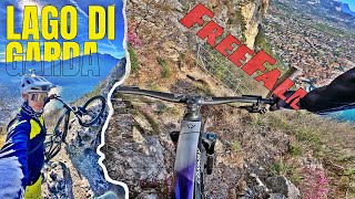
![Freefall and Pylon Trail [April 2019]](https://ev1.pinkbike.org/tf/vt/1/yvt-30081-4.jpg)
Open in App
Get this trail on your phone instantly.

This is popular hiking trail, so stop for hikers
Trail goes up and down for some hundred meters, then shifts steeply downward in switchbacks in loose gravel. Some short rock faces and stairs are difficult, but you can carry your bike down.
Very exposed but always secure and with a fascinating view over Riva and the Mt. Brione.
Watch out for the gps-route, the trails that lead off the route are extremely dangerous (the 418 or the really high ladders of the via ferratas) - you dont want to go up all the way back...
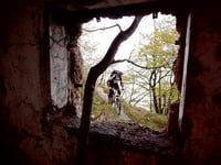
Forest road to Bocca Giumella from Campi

Service Road Atlas is a free to use, community-driven service for viewing and creating reports on the numerous back-country service roads around B.C. and Alberta.
Save the current map location and zoom level as your default home location whenever this page is loaded.
SaveWe hope you've been enjoying Trailforks!
Create a FREE account to view trail comments and much more.
You must enter a description before submitting.

