TRAIL DATA QUALITY ERROR

C3 This trail potentially overlaps an existing trail. Trails should not overlap, the trail should be cropped or broken into multiple trails to avoid overlaps. In some cases trails parallel each other closely, falsely trigging this error.

#203299
more stats
1.1 miles
Distance
170 ft
Climb
-179 ft
Descent
00:14:21
Avg time
-9 ft
Altitude change
4,611 ft
Altitude min
4,778 ft
Altitude max
4,732 ft
Altitude start
4,724 ft
Altitude end
-0.1%
Grade
-29.6%
Grade max
20%
Grade min
3,448 ft
Distance climb
1,870 ft
Distance down
663 ft
Distance flat
00:14:21
Avg time

G8 Details

  • Activities
    • Mountain Bike
    • Horse
    • Hike
    • Trail Running
  • Riding Area
    Horseshoe / G8
    Canmore, Alberta
  • Difficulty Rating
  • Local Popularity
    80 in Mountain Biking [+]
    • 90 in Trail Running
    • 40 in Hiking
    • 5 in Horseback
  • Global Ranking
    #32463 in Mountain Biking [+]
    • #1243 in Trail Running
    • #106996 in Hiking
    • #974 in Horseback
  • Trail Type
    Singletrack
  • Bike Type
    XC
  • Direction
    Both Directions
  • Climb Difficulty
    Blue
  • Physical Rating
    Easy
  • Season
    May 15 - Nov
  • Dogs Allowed
    Yes

Commonly ridden clockwise, the trail travels through open meadows and birch forests. The loop has been shortened due to trail closures at the Graymont lease boundary.

Access Info

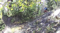
Head down to the creek from the east end of upper horseshoe

This trail is unsanctioned.

Recent Activity on Trail

Past Week
  • 2 rides
  • 7 miles average
6 Months
  • 29 rides
  • 9 miles avg distance
All
  • 640 rides
  • Last: Jun 18, 2026
c1c2c3c4
January
February
March
April
May
June
July
August
September
October
November
December
update trails status or condition

G8 Trail Reports

statusdatedescription
May 1, 2025 @ 3:43pm
May 1, 2025
Multiple signs posted for bombing and logging activity—trail is now out-and-back. Everything from the G8 shortcut onward is marked closed.
Dec 14, 2024 @ 12:35pm
Dec 14, 2024
Icy. Studs are needed.
Sep 2, 2024 @ 10:22am
Sep 2, 2024
Jul 30, 2024 @ 7:59am
Jul 30, 2024
May 26, 2024 @ 11:53am
May 26, 2024
more »
Status:
on May 1, 2025
Dry
Avg: 3.86 (9 votes)
Your vote: 0

view (4,331)
close
3D
Trail Conditions
  • Unknown
  • Snow Groomed
  • Snow Packed
  • Snow Covered
  • Snow Cover Partial
  • Freeze/thaw Cycle
  • Icy
  • Prevalent Mud
  • Wet
  • Variable
  • Ideal
  • Dry
  • Very Dry
Trail Flow (Ridden Direction)
Trailforks scans users ridelogs to determine the most popular direction each trail is ridden. A good flowing trail network will have most trails flowing in a single direction according to their intension.
The colour categories are based on what percentage of riders are riding a trail in its intended direction.
  • > 96%
  • > 90%
  • > 80%
  • > 70%
  • > 50%
  • < 50%
  • bi-directional trail
  • no data
Trail Last Ridden
Trailforks scans ridelogs to determine the last time a trail was ridden.
  • < 2 days
  • < 1 week
  • < 2 weeks
  • < 1 month
  • < 6 months
  • > 6 months
Trail Ridden Direction
The intended direction a trail should be ridden.
  • Downhill Only
  • Downhill Primary
  • Both Directions
  • Uphill Primary
  • Uphill Only
  • One Direction
Contribute Details
Colors indicate trail is missing specified detail.
  • Description
  • Photos
  • Description & Photos
  • Videos
Trail Popularity ?
Trailforks scans ridelogs to determine which trails are ridden the most in the last 9 months. Trails are compared with nearby trails in the same city region with a possible 25 colour shades. Think of this as a heatmap, more rides = more kinetic energy = warmer colors.
  • most popular
  • popular
  • less popular
  • not popular
ATV/ORV/OHV Filter
Max Vehicle Width
inches
US Cell Coverage
Legend
cell carrier legend

Radar Time
Activity Recordings
Trailforks uses anonymized public activity data. ?
Activity Recordings
Trailforks uses anonymized public activity data. ?
Personal Heatmap
Activity Types
all / none
Options
2
Date range month
Winter Trails
Warning A routing network for winter maps does not exist. Selecting trails using the winter trails layer has been disabled.
Missing Trails
Most Popular
Least Popular
Trails are colored based on popularity. The more popular a trail is, the more red. Less popular trails trend towards green.
Jump Magnitude Heatmap
Heatmap of where riders jump on trails. Zoom in to see individual jumps, click circles to view jump details.
BC Backroad Status

Service Road Atlas is a free to use, community-driven service for viewing and creating reports on the numerous back-country service roads around B.C. and Alberta.

map legend
Slope Aspect
Direction the slope faces
Flat N NE E SE S SW W NW
Trails Deemphasized
Trails are shown in grey.
disable
Only show trails with no bike usage.
Enable
Suggested Layers
Based on selected activity type

    Save the current map location and zoom level as your default home location whenever this page is loaded.

    Save
        Directions to g8 trailhead (51.078580, -115.300900)

        Photos

        26 more »
        255 |
        Apr 14, 2019 @ 8:34pm
        Apr 14, 2019
        194 |
        Jul 6, 2018 @ 2:51pm
        Jul 6, 2018
        249 |
        Jul 6, 2018 @ 2:51pm
        Jul 6, 2018
        190 |
        Jul 6, 2018 @ 2:51pm
        Jul 6, 2018

        Videos

        1 more »
        G8 Canmore
        7:30 | 962 | Sep 18, 2012 , Canmore

        Routes with this trail

        4.5 6 miles 943 ft 12 Loop
        Start from Parking Lot area across from Iron Goat Restaurant in Canmore at Benchland Tr and Elk Run Blvd...
        3.4 16 miles 2,180 ft 16
        The classic Pedal for Pints loop starting and ending at Sheepdog Brewing. It takes you up the Montane...
        1.0 162 miles 19,314 ft 106 Loop
        Think you've got what it takes to tackle this monster ride? This is the ultimate link-up of single track...

        7 Reviews & Comments


        We hope you've been enjoying Trailforks!

        Create a FREE account to view trail comments and much more.

        • #32888 - 9,242 views

        Frequently Asked Questions About G8

        Where is G8 located?
        G8 is located in Horseshoe / G8, Canmore, Alberta, Canada. It is part of the Horseshoe / G8 trail network. The trailhead is located at coordinates 51.07858, -115.3009.
        How hard is G8?
        G8 is rated as Blue difficulty. The physical rating is Easy. The average grade is 0.1%. The climb difficulty is rated Blue.
        What is the elevation gain for G8?
        G8 has 52 m of elevation gain. The trail has 55 m of elevation descent. The elevation ranges from 1,405 m to 1,456 m.
        Is G8 a point to point trail?
        G8 is not a point to point trail. The direction is Both Directions. The trail type is singletrack.

        Hit the Trail

        Open in App

        Get this trail on your phone instantly.
        open trail in app

        Download Trail

        Save to wishlist, Garmin & download.
        save the trail

        Find Related Routes

        Find routes and users activities that include this trail.
        find routes for this trail

        You must enter a description before submitting.