more stats
4,480 ft
Distance
25 ft
Climb
-1,022 ft
Descent
00:03:27
Avg time
-997 ft
Altitude change
1,674 ft
Altitude min
2,670 ft
Altitude max
2,670 ft
Altitude start
1,674 ft
Altitude end
-22.247%
Grade
-73.809%
Grade max
10.34%
Grade min
190 ft
Distance climb
4,105 ft
Distance down
185 ft
Distance flat
00:03:27
Avg time

Gaiki Details

  • Activities
    • Hike
    • Mountain Bike
    • Trail Running
  • Riding Area
  • Difficulty Rating
  • Local Popularity
    30 in Mountain Biking [+]
    • 90 in Trail Running
    • 60 in Hiking
  • Global Ranking
    #116154 in Mountain Biking [+]
    • #37041 in Trail Running
    • #90044 in Hiking
  • Hiking SAC Scale
    T1 Hiking
  • Trail Type
    Singletrack
  • Bike Type
    DH, AM
  • Direction
    Downhill Only
    Popular Direction Shown
  • Dogs Allowed
    Yes
  • TTFs on Trail
    Rock Garden

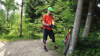
Ciasna naturalna ścieżka z paoma agrafkami, rozmyta przez wodę. Uwaga jest to przde wszystkim szlak pieszy
Fully natural path without manmade obstacles. Upper part loose and drained by water, overgrown vegetation. Mind the tourists, it is a walking path!

This trail is unsanctioned.

Recent Activity on Trail

Past Week
  • 0 rides
  •  
6 Months
  • 0 rides
  •  
All
  • 9 rides
  • Last: Nov 9, 2025
c1c2c3c4
January
February
March
April
May
June
July
August
September
October
November
December
update trails status or condition

Gaiki Trail Reports

statusdatedescription
Jan 4, 2025 @ 10:30am
Jan 4, 2025
Jun 25, 2022 @ 5:25am
Jun 25, 2022
Jun 9, 2019 @ 11:29pm
Jun 9, 2019
Large tree down across trail, blocking trail. Drzewo na początku Gaików, trzeba obejść. Później pięknie, ciasno i sypko :)
Oct 22, 2018 @ 6:01am
Oct 22, 2018
Nov 16, 2017 @ 11:13am
Nov 16, 2017
dobre warunki, cienka warstwa topniejącego śniegu
more »
Status:
on Jan 4, 2025
Snow Covered
Avg: 3.88 (3 votes)
Your vote: 0

view (84)
close
3D
Trail Conditions
  • Unknown
  • Snow Groomed
  • Snow Packed
  • Snow Covered
  • Snow Cover Partial
  • Freeze/thaw Cycle
  • Icy
  • Prevalent Mud
  • Wet
  • Variable
  • Ideal
  • Dry
  • Very Dry
Trail Flow (Ridden Direction)
Trailforks scans users ridelogs to determine the most popular direction each trail is ridden. A good flowing trail network will have most trails flowing in a single direction according to their intension.
The colour categories are based on what percentage of riders are riding a trail in its intended direction.
  • > 96%
  • > 90%
  • > 80%
  • > 70%
  • > 50%
  • < 50%
  • bi-directional trail
  • no data
Trail Last Ridden
Trailforks scans ridelogs to determine the last time a trail was ridden.
  • < 2 days
  • < 1 week
  • < 2 weeks
  • < 1 month
  • < 6 months
  • > 6 months
Trail Ridden Direction
The intended direction a trail should be ridden.
  • Downhill Only
  • Downhill Primary
  • Both Directions
  • Uphill Primary
  • Uphill Only
  • One Direction
Contribute Details
Colors indicate trail is missing specified detail.
  • Description
  • Photos
  • Description & Photos
  • Videos
Trail Popularity ?
Trailforks scans ridelogs to determine which trails are ridden the most in the last 9 months. Trails are compared with nearby trails in the same city region with a possible 25 colour shades. Think of this as a heatmap, more rides = more kinetic energy = warmer colors.
  • most popular
  • popular
  • less popular
  • not popular
ATV/ORV/OHV Filter
Max Vehicle Width
inches
US Cell Coverage
Legend
cell carrier legend

Radar Time
Activity Recordings
Trailforks uses anonymized public activity data. ?
Activity Recordings
Trailforks uses anonymized public activity data. ?
Personal Heatmap
Activity Types
all / none
Options
2
Date range month
Winter Trails
Warning A routing network for winter maps does not exist. Selecting trails using the winter trails layer has been disabled.
Missing Trails
Most Popular
Least Popular
Trails are colored based on popularity. The more popular a trail is, the more red. Less popular trails trend towards green.
Jump Magnitude Heatmap
Heatmap of where riders jump on trails. Zoom in to see individual jumps, click circles to view jump details.
BC Backroad Status

Service Road Atlas is a free to use, community-driven service for viewing and creating reports on the numerous back-country service roads around B.C. and Alberta.

map legend
Slope Aspect
Direction the slope faces
Flat N NE E SE S SW W NW
Trails Deemphasized
Trails are shown in grey.
disable
Only show trails with no bike usage.
Enable
Suggested Layers
Based on selected activity type

    Save the current map location and zoom level as your default home location whenever this page is loaded.

    Save
        Directions to gaiki trailhead (49.808801, 19.123110)

        Photos

        19 more »
        492 |
        Jun 14, 2008 @ 12:48pm
        Jun 14, 2008
        354 |
        May 3, 2009 @ 11:19am
        May 3, 2009
        275 |
        May 3, 2009 @ 11:19am
        May 3, 2009
        360 |
        May 3, 2009 @ 11:19am
        May 3, 2009

        Videos

        1 more »
        Gaiki
        4:21 | 373 | Jun 25, 2022 , Bielsko-Biała

        Routes with this trail

        18 miles 4,585 ft 3
        trzy OS’y zjazdowe: z Gaików niebieskim szlakiem do Lipnika – to głównie techniczny, kręty...

        Reviews / Comments

        No reviews yet, be the first to write a review or ask a question.
        Use trail reports to comment on trail conditions.


        We hope you've been enjoying Trailforks!

        Create a FREE account to view trail comments and much more.

        • #61772 - 4,333 views

        Frequently Asked Questions About Gaiki

        Where is Gaiki located?
        Gaiki is located in Bielsko-Biała, Poland. It is part of the Bielsko-Biała trail network. The trailhead is located at coordinates 49.8088, 19.12311.
        How hard is Gaiki?
        Gaiki is rated as Red difficulty. The average grade is 22.247%.
        What is the elevation gain for Gaiki?
        Gaiki has 8 m of elevation gain. The trail has 311 m of elevation descent. The elevation ranges from 510 m to 814 m.
        Is Gaiki a point to point trail?
        Yes, Gaiki is a point to point trail. The direction is Downhill Only. The trail type is singletrack.

        Hit the Trail

        Open in App

        Get this trail on your phone instantly.
        open trail in app

        Download Trail

        Save to wishlist, Garmin & download.
        save the trail

        Find Related Routes

        Find routes and users activities that include this trail.
        find routes for this trail

        You must enter a description before submitting.