more stats
3.3 miles
Distance
921 ft
Climb
-1,497 ft
Descent
00:35:03
Avg time
-575 ft
Altitude change
1,321 ft
Altitude min
2,087 ft
Altitude max
2,085 ft
Altitude start
1,510 ft
Altitude end
-3.259%
Grade
-51.366%
Grade max
47.899%
Grade min
1 mile
Distance climb
2 miles
Distance down
2,712 ft
Distance flat
00:35:03
Avg time

Gem Mine Details

  • Activities
    • Mountain Bike
    • Hike
    • Trail Running
  • Riding Area
    Boone Fork Area
    Lenoir, North Carolina
  • Difficulty Rating
  • Local Popularity
    5 in Mountain Biking [+]
    • 5 in Trail Running
    • 5 in Hiking
  • Global Ranking
    #141750 in Mountain Biking [+]
    • #275153 in Trail Running
    • #292367 in Hiking
  • Trail Type
    Singletrack
  • Bike Type
    XC
  • Direction
    Downhill Primary
    Popular Direction Shown
  • Climb Difficulty
    Blue
  • Physical Rating
    Moderate
  • Dogs Allowed
    Yes
  • TTFs on Trail
    Jump, Rock Garden
  • Land Owner
    Grandfather Ranger District

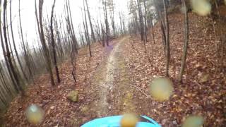
Fun Pisgah back country style descent with rocks, high speed turns, creek crossings and jumps. Two uphill sections are easily ridden. Trail finishes back on Spencer Branch Rd. (left to go to where you parked, right to go up and hit Gem Mine again).

Access Info

After climbing Spencer Branch Rd. for 3ish miles, there will be a sharp left hand turn. Look for a large mound with a trail to the left of it on the right side of the road. Stay right at any split that looks like a fork

Disclaimer

This trail is also used by horseback riders. Be respectful!

Trail Supporters

  • USFS
    Land Manager
Traditionally Indigenous Territory

Recent Activity on Trail

Past Week
  • 0 rides
  •  
6 Months
  • 0 rides
  •  
All
  • 10 rides
  • Last: Jun 6, 2025
c1c2c3c4
January
February
March
April
May
June
July
August
September
October
November
December
update trails status or condition

Gem Mine Trail Reports

statusdatedescription
Mar 23, 2025 @ 2:09pm
Mar 23, 2025
Cleared post-Hurricane Helene after having been overgrown and strewn with fallen trees & deadfall. Hallelujah!
Jul 13, 2024 @ 6:03am
Jul 13, 2024
Cleared! No significant downed trees or branches, just some thick weeds in a couple of places. Nicely remote. Quiet and cool(ish) on a hot day!
Oct 1, 2023 @ 10:02am
Oct 1, 2023
Extremely overgrown and downed trees
Jan 6, 2023 @ 1:19pm
Jan 6, 2023
Branches down
Mar 9, 2020 @ 6:48pm
Mar 9, 2020
reporter
more »
Status:
on Mar 23, 2025
Ideal
Avg: 3.65 (3 votes)
Your vote: 0

view (84)
close
3D
Trail Conditions
  • Unknown
  • Snow Groomed
  • Snow Packed
  • Snow Covered
  • Snow Cover Partial
  • Freeze/thaw Cycle
  • Icy
  • Prevalent Mud
  • Wet
  • Variable
  • Ideal
  • Dry
  • Very Dry
Trail Flow (Ridden Direction)
Trailforks scans users ridelogs to determine the most popular direction each trail is ridden. A good flowing trail network will have most trails flowing in a single direction according to their intension.
The colour categories are based on what percentage of riders are riding a trail in its intended direction.
  • > 96%
  • > 90%
  • > 80%
  • > 70%
  • > 50%
  • < 50%
  • bi-directional trail
  • no data
Trail Last Ridden
Trailforks scans ridelogs to determine the last time a trail was ridden.
  • < 2 days
  • < 1 week
  • < 2 weeks
  • < 1 month
  • < 6 months
  • > 6 months
Trail Ridden Direction
The intended direction a trail should be ridden.
  • Downhill Only
  • Downhill Primary
  • Both Directions
  • Uphill Primary
  • Uphill Only
  • One Direction
Contribute Details
Colors indicate trail is missing specified detail.
  • Description
  • Photos
  • Description & Photos
  • Videos
Trail Popularity ?
Trailforks scans ridelogs to determine which trails are ridden the most in the last 9 months. Trails are compared with nearby trails in the same city region with a possible 25 colour shades. Think of this as a heatmap, more rides = more kinetic energy = warmer colors.
  • most popular
  • popular
  • less popular
  • not popular
ATV/ORV/OHV Filter
Max Vehicle Width
inches
US Cell Coverage
Legend
cell carrier legend

Radar Time
Activity Recordings
Trailforks uses anonymized public activity data. ?
Activity Recordings
Trailforks uses anonymized public activity data. ?
Personal Heatmap
Activity Types
all / none
Options
2
Date range month
Winter Trails
Warning A routing network for winter maps does not exist. Selecting trails using the winter trails layer has been disabled.
Missing Trails
Most Popular
Least Popular
Trails are colored based on popularity. The more popular a trail is, the more red. Less popular trails trend towards green.
Jump Magnitude Heatmap
Heatmap of where riders jump on trails. Zoom in to see individual jumps, click circles to view jump details.
BC Backroad Status

Service Road Atlas is a free to use, community-driven service for viewing and creating reports on the numerous back-country service roads around B.C. and Alberta.

map legend
Slope Aspect
Direction the slope faces
Flat N NE E SE S SW W NW
Trails Deemphasized
Trails are shown in grey.
disable
Only show trails with no bike usage.
Enable
Suggested Layers
Based on selected activity type

    Save the current map location and zoom level as your default home location whenever this page is loaded.

    Save
        Directions to gem-mine trailhead (35.996678, -81.594641)

        Photos

        8 more »
        100 |
        Feb 18, 2023 @ 10:28am
        Feb 18, 2023
        77 |
        Jan 6, 2023 @ 12:44pm
        Jan 6, 2023
        71 |
        Jan 6, 2023 @ 1:20pm
        Jan 6, 2023
        115 |
        Jul 14, 2019 @ 8:47pm
        Jul 14, 2019

        Videos

        1 more »
        Opening descent of Gem Mine
        839 | Apr 29, 2017 , Lenoir

        Trail Lists

        2 Reviews & Comments


        We hope you've been enjoying Trailforks!

        Create a FREE account to view trail comments and much more.

        • By thehappyhuckerTF Pro NWNC.MTBA & contributors
        • #88881 - 3,625 views

        Frequently Asked Questions About Gem Mine

        Where is Gem Mine located?
        Gem Mine is located in Boone Fork Area, Lenoir, North Carolina, United States. It is part of the Boone Fork Area trail network. The trailhead is located at coordinates 35.99668, -81.59464.
        How hard is Gem Mine?
        Gem Mine is rated as Blue difficulty. The physical rating is Moderate. The average grade is 3.259%. The climb difficulty is rated Blue.
        What is the elevation gain for Gem Mine?
        Gem Mine has 921 ft of elevation gain. The trail has 1,497 ft of elevation descent. The elevation ranges from 1,321 ft to 2,087 ft.
        Is Gem Mine a point to point trail?
        Gem Mine is not a point to point trail. The direction is Downhill Primary. The trail type is singletrack.

        Hit the Trail

        Open in App

        Get this trail on your phone instantly.
        open trail in app

        Download Trail

        Save to wishlist, Garmin & download.
        save the trail

        Find Related Routes

        Find routes and users activities that include this trail.
        find routes for this trail

        You must enter a description before submitting.