more stats
1.8 miles
Distance
144 ft
Climb
-389 ft
Descent
00:18:22
Avg time
-245 ft
Altitude change
6,338 ft
Altitude min
6,583 ft
Altitude max
6,583 ft
Altitude start
6,338 ft
Altitude end
-2.58%
Grade
-90.399%
Grade max
58.81%
Grade min
2,112 ft
Distance climb
1 mile
Distance down
643 ft
Distance flat
00:18:22
Avg time

Grandview Details

  • Activities
    • Mountain Bike
    • Hike
    • Trail Running
  • Riding Area
    Palmer Park
    Colorado Springs, Colorado
  • Difficulty Rating
  • Local Popularity
    80 in Mountain Biking [+]
    • 40 in Trail Running
    • 55 in Hiking
  • Global Ranking
    #72010 in Mountain Biking [+]
    • #124783 in Trail Running
    • #105434 in Hiking
  • Trail Type
    Singletrack
  • Bike Type
    XC
  • Direction
    Both Directions
    Popular In Reverse
  • Physical Rating
    Moderate
  • Dogs Allowed
    Yes

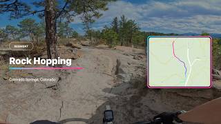
Grandview can be ridden in both directions but maximum enjoyment it's best ridden from the lookout down to the horse corrals. The trail from the lookout down to the hairpin turn at the road is a fun trail with a number of small technical features. The trail after the turn steepens but also rides along and through a wash which is loose sand most of the year. A very popular section of trail so always be watchful around blind turns.

Local Trail Association

Recent Activity on Trail

Past Week
  • 5 rides
  • 8 miles average
6 Months
  • 65 rides
  • 10 miles avg distance
All
  • 436 rides
  • Last: Jun 18, 2026
c1c2c3c4
January
February
March
April
May
June
July
August
September
October
November
December
update trails status or condition

Grandview Trail Reports

Status:
on Nov 3, 2025
Dry
Avg: 4.24 (3 votes)
Your vote: 0

view (2,984)
close
3D
Trail Conditions
  • Unknown
  • Snow Groomed
  • Snow Packed
  • Snow Covered
  • Snow Cover Partial
  • Freeze/thaw Cycle
  • Icy
  • Prevalent Mud
  • Wet
  • Variable
  • Ideal
  • Dry
  • Very Dry
Trail Flow (Ridden Direction)
Trailforks scans users ridelogs to determine the most popular direction each trail is ridden. A good flowing trail network will have most trails flowing in a single direction according to their intension.
The colour categories are based on what percentage of riders are riding a trail in its intended direction.
  • > 96%
  • > 90%
  • > 80%
  • > 70%
  • > 50%
  • < 50%
  • bi-directional trail
  • no data
Trail Last Ridden
Trailforks scans ridelogs to determine the last time a trail was ridden.
  • < 2 days
  • < 1 week
  • < 2 weeks
  • < 1 month
  • < 6 months
  • > 6 months
Trail Ridden Direction
The intended direction a trail should be ridden.
  • Downhill Only
  • Downhill Primary
  • Both Directions
  • Uphill Primary
  • Uphill Only
  • One Direction
Contribute Details
Colors indicate trail is missing specified detail.
  • Description
  • Photos
  • Description & Photos
  • Videos
Trail Popularity ?
Trailforks scans ridelogs to determine which trails are ridden the most in the last 9 months. Trails are compared with nearby trails in the same city region with a possible 25 colour shades. Think of this as a heatmap, more rides = more kinetic energy = warmer colors.
  • most popular
  • popular
  • less popular
  • not popular
ATV/ORV/OHV Filter
Max Vehicle Width
inches
US Cell Coverage
Legend
cell carrier legend

Radar Time
Activity Recordings
Trailforks uses anonymized public activity data. ?
Activity Recordings
Trailforks uses anonymized public activity data. ?
Personal Heatmap
Activity Types
all / none
Options
2
Date range month
Winter Trails
Warning A routing network for winter maps does not exist. Selecting trails using the winter trails layer has been disabled.
Missing Trails
Most Popular
Least Popular
Trails are colored based on popularity. The more popular a trail is, the more red. Less popular trails trend towards green.
Jump Magnitude Heatmap
Heatmap of where riders jump on trails. Zoom in to see individual jumps, click circles to view jump details.
BC Backroad Status

Service Road Atlas is a free to use, community-driven service for viewing and creating reports on the numerous back-country service roads around B.C. and Alberta.

map legend
Slope Aspect
Direction the slope faces
Flat N NE E SE S SW W NW
Trails Deemphasized
Trails are shown in grey.
disable
Only show trails with no bike usage.
Enable
Suggested Layers
Based on selected activity type

    Save the current map location and zoom level as your default home location whenever this page is loaded.

    Save
        Directions to grandview trailhead (38.873380, -104.776940)

        Photos

        8 more »
        81 |
        Jun 6, 2020 @ 2:02pm
        Jun 6, 2020
        173 |
        Jun 6, 2020 @ 2:02pm
        Jun 6, 2020
        174 |
        Oct 4, 2018 @ 9:37pm
        Oct 4, 2018
        180 |
        Oct 4, 2018 @ 9:37pm
        Oct 4, 2018

        Videos

        3 more »
        Strava Segment: Rock Hopping | Colorado...
        0:48 | 9 | May 21, 2026 , Colorado Springs
        Mountain Biking Snippets | Palmer Park,...
        3:20 | 302 | Dec 23, 2020 , Colorado Springs
        RAD Apparel | Daydreamer Jersey
        0:37 | 72 | May 25, 2021 , Colorado Springs

        Routes with this trail

        3.0 6 miles 689 ft 25 Loop
        This is a fun route to ride with a mixed skill group. Takes less than an hour with intermediate skill.

        1 Review & Comments


        We hope you've been enjoying Trailforks!

        Create a FREE account to view trail comments and much more.

        • By toddTF Pro Trailforks & contributors
        • #12589 - 1,914 views

        Frequently Asked Questions About Grandview

        Where is Grandview located?
        Grandview is located in Palmer Park, Colorado Springs, Colorado, United States. It is part of the Palmer Park trail network. The trailhead is located at coordinates 38.87338, -104.77694.
        How hard is Grandview?
        Grandview is rated as Green difficulty. The physical rating is Moderate. The average grade is 2.58%.
        What is the elevation gain for Grandview?
        Grandview has 144 ft of elevation gain. The trail has 389 ft of elevation descent. The elevation ranges from 6,338 ft to 6,583 ft.
        Is Grandview a point to point trail?
        Grandview is not a point to point trail. The direction is Both Directions. The trail type is singletrack.

        Hit the Trail

        Open in App

        Get this trail on your phone instantly.
        open trail in app

        Download Trail

        Save to wishlist, Garmin & download.
        save the trail

        Find Related Routes

        Find routes and users activities that include this trail.
        find routes for this trail

        You must enter a description before submitting.