

Open in App
Get this trail on your phone instantly.

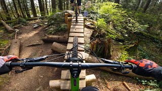
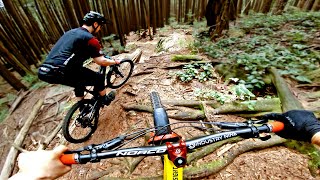
Steep, rocky & rooty, it is an old school trail that is raw and natural. A challenging descent, at times awkward, you'll need to create your own flow on this one.
The trail is not easy to find and sees little traffic, so it's easy to lose the trail. Ride the chunder chute for the first 100m then take the hard right uphill. You'll pass Upper Crippler in the first 100m on your left (after taking the uphill right)- there is no sign but an arrow points you in the right direction to stay on Grannies.
The end of the trail, just before the BP trail, a series of gap jumps and other stunts have all but disappeared over time.The trail drops you out on the Baden Powell Trail, with Digger on you right, and Lower Crippler on your left.
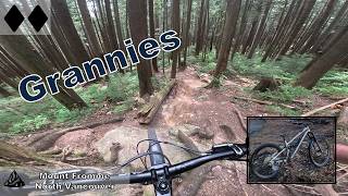
Accessed off Mountain Hwy through a wide washed out chunder chute.
| c1 | c2 | c3 | c4 |
|---|---|---|---|
January | February | March | April |
May | June | July | August |
September | October | November | December |

Service Road Atlas is a free to use, community-driven service for viewing and creating reports on the numerous back-country service roads around B.C. and Alberta.
Save the current map location and zoom level as your default home location whenever this page is loaded.
SaveWe hope you've been enjoying Trailforks!
Create a FREE account to view trail comments and much more.
You must enter a description before submitting.

