more stats
1.1 miles
Distance
-425 ft
Descent
00:05:54
Avg time
-425 ft
Altitude change
1,113 ft
Altitude min
1,538 ft
Altitude max
1,538 ft
Altitude start
1,112 ft
Altitude end
-7.3%
Grade
-25.6%
Grade max
-0.7%
Grade min
1 mile
Distance down
138 ft
Distance flat
00:05:54
Avg time

HARE-TIME Details

  • Activities
    • Mountain Bike
    • E-Bike
    • Winter Fat Bike
  • Riding Area
  • Difficulty Rating
  • Local Popularity
    85 in Mountain Biking [+]
    • 85 in E-Biking
  • Global Ranking
    #31672 in Mountain Biking [+]
    • #25239 in E-Biking
  • Trail Type
    Machine Groomed
  • Bike Type
    DH, AM, XC, DJ, Fat
  • Direction
    Downhill Only
    Popular Direction Shown
  • Trail Visibility
    Always easy to follow
  • eBike Allowed
    Yes up to Class 1
  • TTFs on Trail
    Berm, Drop, Jump

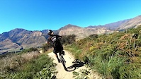
Jump trail with over 50 jumps and lots of berms, rollers and shark fins.

Access Info

Private bike park. Get passes on site or at https://bikeglendhu.co.nz/

Traditionally Indigenous Territory

Recent Activity on Trail

Past Week
  • 0 rides
  •  
6 Months
  • 59 rides
  • 17 miles avg distance
All
  • 257 rides
  • Last: May 29, 2026
c1c2c3c4
January
February
March
April
May
June
July
August
September
October
November
December
Status:
on Jun 8, 2026
Avg: 4.56 (8 votes)
Your vote: 0

view (2,988)
close
3D
Trail Conditions
  • Unknown
  • Snow Groomed
  • Snow Packed
  • Snow Covered
  • Snow Cover Partial
  • Freeze/thaw Cycle
  • Icy
  • Prevalent Mud
  • Wet
  • Variable
  • Ideal
  • Dry
  • Very Dry
Trail Flow (Ridden Direction)
Trailforks scans users ridelogs to determine the most popular direction each trail is ridden. A good flowing trail network will have most trails flowing in a single direction according to their intension.
The colour categories are based on what percentage of riders are riding a trail in its intended direction.
  • > 96%
  • > 90%
  • > 80%
  • > 70%
  • > 50%
  • < 50%
  • bi-directional trail
  • no data
Trail Last Ridden
Trailforks scans ridelogs to determine the last time a trail was ridden.
  • < 2 days
  • < 1 week
  • < 2 weeks
  • < 1 month
  • < 6 months
  • > 6 months
Trail Ridden Direction
The intended direction a trail should be ridden.
  • Downhill Only
  • Downhill Primary
  • Both Directions
  • Uphill Primary
  • Uphill Only
  • One Direction
Contribute Details
Colors indicate trail is missing specified detail.
  • Description
  • Photos
  • Description & Photos
  • Videos
Trail Popularity ?
Trailforks scans ridelogs to determine which trails are ridden the most in the last 9 months. Trails are compared with nearby trails in the same city region with a possible 25 colour shades. Think of this as a heatmap, more rides = more kinetic energy = warmer colors.
  • most popular
  • popular
  • less popular
  • not popular
ATV/ORV/OHV Filter
Max Vehicle Width
inches
US Cell Coverage
Legend
cell carrier legend

Radar Time
Activity Recordings
Trailforks uses anonymized public activity data. ?
Activity Recordings
Trailforks uses anonymized public activity data. ?
Personal Heatmap
Activity Types
all / none
Options
2
Date range month
Winter Trails
Warning A routing network for winter maps does not exist. Selecting trails using the winter trails layer has been disabled.
Missing Trails
Most Popular
Least Popular
Trails are colored based on popularity. The more popular a trail is, the more red. Less popular trails trend towards green.
Jump Magnitude Heatmap
Heatmap of where riders jump on trails. Zoom in to see individual jumps, click circles to view jump details.
BC Backroad Status

Service Road Atlas is a free to use, community-driven service for viewing and creating reports on the numerous back-country service roads around B.C. and Alberta.

map legend
Slope Aspect
Direction the slope faces
Flat N NE E SE S SW W NW
Trails Deemphasized
Trails are shown in grey.
disable
Only show trails with no bike usage.
Enable
Suggested Layers
Based on selected activity type

    Save the current map location and zoom level as your default home location whenever this page is loaded.

    Save
        Directions to haretime trailhead (-44.678380, 168.979620)

        Photos

        3 more »
        143 |
        Apr 25, 2021 @ 2:37pm
        Apr 25, 2021
        140 |
        Apr 25, 2021 @ 2:37pm
        Apr 25, 2021
        1,331 |
        Feb 1, 2021 @ 2:11pm
        Feb 1, 2021

        Videos

        5 more »
        featured Welcome to Bike Glendhu
        2:10 | 240 | Feb 10, 2022 , Wānaka
        Breathtaking MTB Scenery! Bike Glendhu Wanaka...
        16:07 | 62 | May 11, 2025 , Wānaka
        youtuber A slice of paradise! HARE TIME | Glendhu Bike...
        4:19 | 625 | Oct 22, 2020 , Wānaka
        HareTime - Bike Glendhu trail POV
        3:25 | 165 | Jun 1, 2022 , Wānaka

        3 Reviews & Comments


        We hope you've been enjoying Trailforks!

        Create a FREE account to view trail comments and much more.

        • By bikeglendhubikeparkTF Pro & contributors
        • #242661 - 2,797 views

        Frequently Asked Questions About HARE-TIME

        Where is HARE-TIME located?
        HARE-TIME is located in Bike Glendhu Bike Park, Wānaka, New Zealand. It is part of the Bike Glendhu Bike Park trail network. The trailhead is located at coordinates -44.67838, 168.97962.
        How hard is HARE-TIME?
        HARE-TIME is rated as Advanced difficulty. The average grade is 7.3%.
        What is the elevation gain for HARE-TIME?
        The trail has 129 m of elevation descent. The elevation ranges from 339 m to 469 m.
        Is HARE-TIME a point to point trail?
        Yes, HARE-TIME is a point to point trail. The direction is Downhill Only. The trail type is machine groomed.

        Hit the Trail

        Open in App

        Get this trail on your phone instantly.
        open trail in app

        Download Trail

        Save to wishlist, Garmin & download.
        save the trail

        Find Related Routes

        Find routes and users activities that include this trail.
        find routes for this trail

        You must enter a description before submitting.