more stats
1,549 ft
Distance
-291 ft
Descent
00:01:51
Avg time
-291 ft
Altitude change
525 ft
Altitude min
816 ft
Altitude max
816 ft
Altitude start
525 ft
Altitude end
-18.8%
Grade
-34.4%
Grade max
-2.2%
Grade min
1,549 ft
Distance down
00:01:51
Avg time

Flow Hawk Details

  • Activities
    • Mountain Bike
    • Horse
    • Hike
    • Trail Running
  • Riding Area
    Santiago Oaks
    Orange, California
  • Difficulty Rating
  • Voted Difficulty
    Black Diamond (4 votes)
  • Local Popularity
    95 in Mountain Biking [+]
    • 65 in Trail Running
    • 60 in Hiking
    • 5 in Horseback
  • Global Ranking
    #37431 in Mountain Biking [+]
    • #82000 in Trail Running
    • #96106 in Hiking
    • #1219 in Horseback
  • Trail Type
    Sandy
  • Bike Type
    DH, AM, XC
  • Physical Rating
    Hard
  • Dogs Allowed
    Yes
  • TTFs on Trail
    Drop, Rock Face

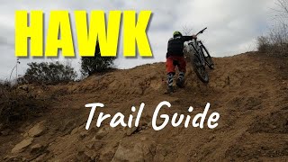
Very rocky loose steep single track downhill.

Access Info

Starts at the turn off at the top of the second bee near where Bumblebee comes in. If you see a trail called Grasshopper you have gone to far.

Local Trail Association
Traditionally Indigenous Territory

Recent Activity on Trail

Past Week
  • 12 rides
  • 12 miles average
6 Months
  • 135 rides
  • 11 miles avg distance
All
  • 947 rides
  • Last: Jun 23, 2026
c1c2c3c4
January
February
March
April
May
June
July
August
September
October
November
December
update trails status or condition

Flow Hawk Trail Reports

statusdatedescription
Apr 27, 2026 @ 4:52pm (America/Los_Angeles)
Apr 27, 2026
The newly dumbed down Hawk trail was transformed from loose deep sandy conditions into hard packed by the recent rain. Good for intermediate riders.
Apr 19, 2026 @ 8:27pm (America/Los_Angeles)
Apr 19, 2026
Very sandy throughout, watch your grip.
Mar 20, 2026 @ 6:49pm (America/Los_Angeles)
Mar 20, 2026
Mar 18, 2026 @ 3:22pm (America/Los_Angeles)
Mar 18, 2026
Aug 25, 2025 @ 5:23pm
Aug 25, 2025
The top is way rowdier than it’s been in a while. Braking bumps, loose and blown out. Quite fun!
more »
Status:
on Apr 27, 2026
Ideal
Avg: 4.32 (20 votes)
Your vote: 0

view (15,057)
close
3D
Trail Conditions
  • Unknown
  • Snow Groomed
  • Snow Packed
  • Snow Covered
  • Snow Cover Partial
  • Freeze/thaw Cycle
  • Icy
  • Prevalent Mud
  • Wet
  • Variable
  • Ideal
  • Dry
  • Very Dry
Trail Flow (Ridden Direction)
Trailforks scans users ridelogs to determine the most popular direction each trail is ridden. A good flowing trail network will have most trails flowing in a single direction according to their intension.
The colour categories are based on what percentage of riders are riding a trail in its intended direction.
  • > 96%
  • > 90%
  • > 80%
  • > 70%
  • > 50%
  • < 50%
  • bi-directional trail
  • no data
Trail Last Ridden
Trailforks scans ridelogs to determine the last time a trail was ridden.
  • < 2 days
  • < 1 week
  • < 2 weeks
  • < 1 month
  • < 6 months
  • > 6 months
Trail Ridden Direction
The intended direction a trail should be ridden.
  • Downhill Only
  • Downhill Primary
  • Both Directions
  • Uphill Primary
  • Uphill Only
  • One Direction
Contribute Details
Colors indicate trail is missing specified detail.
  • Description
  • Photos
  • Description & Photos
  • Videos
Trail Popularity ?
Trailforks scans ridelogs to determine which trails are ridden the most in the last 9 months. Trails are compared with nearby trails in the same city region with a possible 25 colour shades. Think of this as a heatmap, more rides = more kinetic energy = warmer colors.
  • most popular
  • popular
  • less popular
  • not popular
ATV/ORV/OHV Filter
Max Vehicle Width
inches
US Cell Coverage
Legend
cell carrier legend

Radar Time
Activity Recordings
Trailforks uses anonymized public activity data. ?
Activity Recordings
Trailforks uses anonymized public activity data. ?
Personal Heatmap
Activity Types
all / none
Options
2
Date range month
Winter Trails
Warning A routing network for winter maps does not exist. Selecting trails using the winter trails layer has been disabled.
Missing Trails
Most Popular
Least Popular
Trails are colored based on popularity. The more popular a trail is, the more red. Less popular trails trend towards green.
Jump Magnitude Heatmap
Heatmap of where riders jump on trails. Zoom in to see individual jumps, click circles to view jump details.
BC Backroad Status

Service Road Atlas is a free to use, community-driven service for viewing and creating reports on the numerous back-country service roads around B.C. and Alberta.

map legend
Slope Aspect
Direction the slope faces
Flat N NE E SE S SW W NW
Trails Deemphasized
Trails are shown in grey.
disable
Only show trails with no bike usage.
Enable
Suggested Layers
Based on selected activity type

    Save the current map location and zoom level as your default home location whenever this page is loaded.

    Save
        Directions to flow-hawk trailhead (33.821290, -117.765270)

        Photos

        8 more »
        88 |
        Sep 2, 2025 @ 5:36am
        Sep 2, 2025
        418 |
        Nov 26, 2018 @ 9:00pm
        Nov 26, 2018
        430 |
        Nov 15, 2016 @ 9:53am
        Nov 15, 2016
        415 |
        Mar 19, 2015 @ 7:48pm
        Mar 19, 2015

        Videos

        26 more »
        youtuber Hawk / Santiago Oaks, CA / MTB
        0:53 | 90 | Nov 19, 2024 , Orange
        youtuber Best expert mountain bike trails in Orange, CA...
        8:10 | 199 | May 6, 2025 , Orange
        youtuber MTB Hawk Trail | Santiago Oaks Mountain Biking...
        8:42 | 288 | Oct 19, 2022 , Orange
        youtuber Hawk and Peralta Hills
        8:10 | 72 | May 6, 2025 , Orange

        Trail Lists

        Routes with this trail

        5.0 8 miles 1,232 ft 35 Loop
        Santiago Oaks is a well-known trail network located in Orange County. The park has multiple options for...
        5.0 8 miles 1,696 ft 11 Loop
        Route hitting most of the good stuff at Santiago Oaks, without waterfall.
        4.0 10 miles 1,817 ft 36 Loop
        Santiago Oaks is a well-known trail network located in Orange County. The park has multiple options for...

        1 Review & Comments


        We hope you've been enjoying Trailforks!

        Create a FREE account to view trail comments and much more.

        • By Desertrat3511 & contributors
        • #7462 - 6,443 views

        Frequently Asked Questions About Flow Hawk

        Where is Flow Hawk located?
        Flow Hawk is located in Santiago Oaks, Orange, California, United States. It is part of the Santiago Oaks trail network. The trailhead is located at coordinates 33.82129, -117.76527.
        How hard is Flow Hawk?
        Flow Hawk is rated as Blue difficulty. The physical rating is Hard. The average grade is 18.8%.
        What is the elevation gain for Flow Hawk?
        The trail has 291 ft of elevation descent. The elevation ranges from 525 ft to 816 ft.
        How long is Flow Hawk?
        Flow Hawk is 1,549 ft long. The trail type is sandy.

        Hit the Trail

        Open in App

        Get this trail on your phone instantly.
        open trail in app

        Download Trail

        Save to wishlist, Garmin & download.
        save the trail

        Find Related Routes

        Find routes and users activities that include this trail.
        find routes for this trail

        You must enter a description before submitting.