more stats
3,163 ft
Distance
6 ft
Climb
-312 ft
Descent
00:03:33
Avg time
-308 ft
Altitude change
2,272 ft
Altitude min
2,581 ft
Altitude max
2,580 ft
Altitude start
2,274 ft
Altitude end
-9.7%
Grade
-38.6%
Grade max
8.5%
Grade min
217 ft
Distance climb
2,379 ft
Distance down
571 ft
Distance flat
00:03:33
Avg time

Heart of Darkness Details

  • Activities
    • Mountain Bike
  • Riding Area
    Whistler Mountain Bike Park
    Whistler, British Columbia
  • AKA
    HOD
  • Difficulty Rating
  • Local Popularity
    95 in Mountain Biking
  • Global Ranking
    #182 in Mountain Biking
  • Trail Type
    Machine Groomed
  • Bike Type
    DH, AM
  • Direction
    Downhill Only
    Popular Direction Shown
  • Season
    May - October
  • TTFs on Trail
    Berm, Jump
  • Land Owner

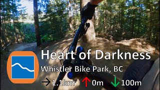
Long freeride trail in the Fitzsimmons area of the Bike Park. Rated between Family Cross and Crank it up on Whistler's freeride progression chart, in the top half of the blues. Heavily used flowy, bermy trail. Big air or roll over – your speed will determine which.

Access Info

Starts at the lowest Trail Hub before the village. There are blue and black trails leading to this Hub; Lower B-Line offers more freeride trail at an easier difficulty level. Alternatively, you can join the trail at the bottom of Crank it Up or C-More (both long blue freeride trails).

Bike Park

Recent Activity on Trail

Past Week
  • 78 rides
  • 25 miles average
6 Months
  • 466 rides
  • 23 miles avg distance
All
  • 6,105 rides
  • Last: Jun 21, 2026
c1c2c3c4
January
February
March
April
May
June
July
August
September
October
November
December
Status:
on Jun 21, 2026
Dry
Avg: 3.9 (130 votes)
Your vote: 0

view (42,190)
close
3D
Trail Conditions
  • Unknown
  • Snow Groomed
  • Snow Packed
  • Snow Covered
  • Snow Cover Partial
  • Freeze/thaw Cycle
  • Icy
  • Prevalent Mud
  • Wet
  • Variable
  • Ideal
  • Dry
  • Very Dry
Trail Flow (Ridden Direction)
Trailforks scans users ridelogs to determine the most popular direction each trail is ridden. A good flowing trail network will have most trails flowing in a single direction according to their intension.
The colour categories are based on what percentage of riders are riding a trail in its intended direction.
  • > 96%
  • > 90%
  • > 80%
  • > 70%
  • > 50%
  • < 50%
  • bi-directional trail
  • no data
Trail Last Ridden
Trailforks scans ridelogs to determine the last time a trail was ridden.
  • < 2 days
  • < 1 week
  • < 2 weeks
  • < 1 month
  • < 6 months
  • > 6 months
Trail Ridden Direction
The intended direction a trail should be ridden.
  • Downhill Only
  • Downhill Primary
  • Both Directions
  • Uphill Primary
  • Uphill Only
  • One Direction
Contribute Details
Colors indicate trail is missing specified detail.
  • Description
  • Photos
  • Description & Photos
  • Videos
Trail Popularity ?
Trailforks scans ridelogs to determine which trails are ridden the most in the last 9 months. Trails are compared with nearby trails in the same city region with a possible 25 colour shades. Think of this as a heatmap, more rides = more kinetic energy = warmer colors.
  • most popular
  • popular
  • less popular
  • not popular
ATV/ORV/OHV Filter
Max Vehicle Width
inches
US Cell Coverage
Legend
cell carrier legend

Radar Time
Activity Recordings
Trailforks uses anonymized public activity data. ?
Activity Recordings
Trailforks uses anonymized public activity data. ?
Personal Heatmap
Activity Types
all / none
Options
2
Date range month
Winter Trails
Warning A routing network for winter maps does not exist. Selecting trails using the winter trails layer has been disabled.
Missing Trails
Most Popular
Least Popular
Trails are colored based on popularity. The more popular a trail is, the more red. Less popular trails trend towards green.
Jump Magnitude Heatmap
Heatmap of where riders jump on trails. Zoom in to see individual jumps, click circles to view jump details.
BC Backroad Status

Service Road Atlas is a free to use, community-driven service for viewing and creating reports on the numerous back-country service roads around B.C. and Alberta.

map legend
Slope Aspect
Direction the slope faces
Flat N NE E SE S SW W NW
Trails Deemphasized
Trails are shown in grey.
disable
Only show trails with no bike usage.
Enable
Suggested Layers
Based on selected activity type

    Save the current map location and zoom level as your default home location whenever this page is loaded.

    Save
        Directions to heart-darkness trailhead (50.108150, -122.956330)

        Photos

        137 more »
        480 |
        Jul 11, 2017 @ 11:05am
        Jul 11, 2017
        314 |
        Jun 11, 2016 @ 8:00pm
        Jun 11, 2016
        616 |
        Feb 7, 2017 @ 1:34pm
        Feb 7, 2017
        45 |
        Aug 7, 2024 @ 6:37am
        Aug 7, 2024

        Videos

        41 more »
        youtuber Quick and Dirty at Whistler // Heart of Darkness
        2:47 | 760 | Apr 19, 2020 , Whistler
        youtuber Heart of Darkness - Whistler Bike Park -...
        2:19 | 338 | Sep 19, 2022 , Whistler
        youtuber ELBOWS UP!! A Lesson on Whistler's Heart of...
        0:44 | 416 | Sep 5, 2022 , Whistler
        youtuber Best Blue Trails to Warm Up at Whistler Bike Park
        12:24 | 37 | May 22, 2026 , Whistler

        Routes with this trail

        3.5 5 miles 1,113 ft 24 Point to Point
        Start your Whistler Bike Park day off by warming up on some mellower trails before dropping into the more...
        4 miles 898 ft 8
        Sponsored by Whistler Mountain Bike Park, GLC, Labatt - Register online before 5 PM on race day -...
        1,588 ft 3 Point to Point
        Lap used for timed testing of the trail bike category during the 2020 Pinkbike Field Test

        5 Reviews & Comments


        We hope you've been enjoying Trailforks!

        Create a FREE account to view trail comments and much more.

        • By Tekmisfit & contributors
        • #2481 - 14,215 views

        Frequently Asked Questions About Heart of Darkness

        Where is Heart of Darkness located?
        Heart of Darkness is located in Whistler Mountain Bike Park, Whistler, British Columbia, Canada. It is part of the Whistler Mountain Bike Park trail network. The trailhead is located at coordinates 50.10815, -122.95633.
        How hard is Heart of Darkness?
        Heart of Darkness is rated as Blue difficulty. The average grade is 9.7%.
        What is the elevation gain for Heart of Darkness?
        Heart of Darkness has 2 m of elevation gain. The trail has 95 m of elevation descent. The elevation ranges from 693 m to 787 m.
        Is Heart of Darkness a point to point trail?
        Yes, Heart of Darkness is a point to point trail. The direction is Downhill Only. The trail type is machine groomed.

        Hit the Trail

        Open in App

        Get this trail on your phone instantly.
        open trail in app

        Download Trail

        Save to wishlist, Garmin & download.
        save the trail

        Find Related Routes

        Find routes and users activities that include this trail.
        find routes for this trail

        You must enter a description before submitting.