more stats
1,135 ft
Distance
-73 ft
Descent
00:01:07
Avg time
-75 ft
Altitude change
222 ft
Altitude min
298 ft
Altitude max
298 ft
Altitude start
223 ft
Altitude end
-6.6%
Grade
-22.8%
Grade max
1%
Grade min
1,024 ft
Distance down
72 ft
Distance flat
00:01:07
Avg time

Heavy Nettle Details

  • Activities
    • Mountain Bike
    • Adaptive Bike
  • Riding Area
  • Difficulty Rating
  • Local Popularity
    60 in Mountain Biking
  • Global Ranking
    #29692 in Mountain Biking
  • Trail Type
    Singletrack
  • Bike Type
    AM, XC, Adaptive MTB
  • Direction
    Downhill Only
    Popular Direction Shown
  • Season
    Late spring through late fall
  • eBike Allowed
  • TTFs on Trail
    Berm, Jump
  • Year Opened
    2022
  • Land Owner

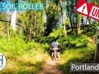
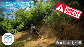
Splitting off from Red Soil Roller, this trail takes it to the next level with bigger berms, small tables, and some fun tree slaloming. The more you ride Heavy Nettle, the more you'll feel in the groove on this descending-only trail.

Ride in control at all times, we're all outside, hoping to enjoy ourselves Do not ride soil trails when they are wet, the damage can be difficult and costly to repair. The site has several improved-surface trails that can handle the rain so ride them when the other trails are muddy.

Metro parks do not allow dogs because unfortunately our canine friends are perceived as predators; impacting wildlife behavior, nesting, and feeding patterns. Please leave your pooch at home when riding at Newell Creek Canyon Nature Park. Thank you!

Adaptive Bike Info
aMTB Green Rating: Beginner features and moderate terrain.
Trail Supporters
Local Trail Association
Traditionally Indigenous Territory

Recent Activity on Trail

Past Week
  • 0 rides
  •  
6 Months
  • 13 rides
  • 23.1 km avg distance
All
  • 101 rides
  • Last: Jun 12, 2026
c1c2c3c4
January
February
March
April
May
June
July
August
September
October
November
December
update trails status or condition

Heavy Nettle Trail Reports

statusdatedescription
Jun 12, 2026 @ 12:03pm (America/Los_Angeles)
Jun 12, 2026
May 7, 2026 @ 11:22am (America/Los_Angeles)
May 7, 2026
Jan 17, 2026 @ 7:33am (America/Los_Angeles)
Jan 17, 2026
NWTA tuned up the big right hander into the wall ride berm, cleared some trees and fixed drainage. Running really well.
Nov 29, 2025 @ 4:19pm (America/Los_Angeles)
Nov 29, 2025
Leaves are mostly raked but there are a few sections that are complete mud pits. Can be slick and dangerous.
Nov 15, 2025 @ 8:27am (America/Los_Angeles)
Nov 15, 2025
Leaves galore! Needs a raking.
more »
Status:
on Jun 12, 2026
Ideal
Avg: 3.99 (4 votes)
Your vote: 0

view (1,045)
close
3D
Trail Conditions
  • Unknown
  • Snow Groomed
  • Snow Packed
  • Snow Covered
  • Snow Cover Partial
  • Freeze/thaw Cycle
  • Icy
  • Prevalent Mud
  • Wet
  • Variable
  • Ideal
  • Dry
  • Very Dry
Trail Flow (Ridden Direction)
Trailforks scans users ridelogs to determine the most popular direction each trail is ridden. A good flowing trail network will have most trails flowing in a single direction according to their intension.
The colour categories are based on what percentage of riders are riding a trail in its intended direction.
  • > 96%
  • > 90%
  • > 80%
  • > 70%
  • > 50%
  • < 50%
  • bi-directional trail
  • no data
Trail Last Ridden
Trailforks scans ridelogs to determine the last time a trail was ridden.
  • < 2 days
  • < 1 week
  • < 2 weeks
  • < 1 month
  • < 6 months
  • > 6 months
Trail Ridden Direction
The intended direction a trail should be ridden.
  • Downhill Only
  • Downhill Primary
  • Both Directions
  • Uphill Primary
  • Uphill Only
  • One Direction
Contribute Details
Colors indicate trail is missing specified detail.
  • Description
  • Photos
  • Description & Photos
  • Videos
Trail Popularity ?
Trailforks scans ridelogs to determine which trails are ridden the most in the last 9 months. Trails are compared with nearby trails in the same city region with a possible 25 colour shades. Think of this as a heatmap, more rides = more kinetic energy = warmer colors.
  • most popular
  • popular
  • less popular
  • not popular
ATV/ORV/OHV Filter
Max Vehicle Width
inches
US Cell Coverage
Legend
cell carrier legend

Radar Time
Activity Recordings
Trailforks uses anonymized public activity data. ?
Activity Recordings
Trailforks uses anonymized public activity data. ?
Personal Heatmap
Activity Types
all / none
Options
2
Date range month
Winter Trails
Warning A routing network for winter maps does not exist. Selecting trails using the winter trails layer has been disabled.
Missing Trails
Most Popular
Least Popular
Trails are colored based on popularity. The more popular a trail is, the more red. Less popular trails trend towards green.
Jump Magnitude Heatmap
Heatmap of where riders jump on trails. Zoom in to see individual jumps, click circles to view jump details.
BC Backroad Status

Service Road Atlas is a free to use, community-driven service for viewing and creating reports on the numerous back-country service roads around B.C. and Alberta.

map legend
Slope Aspect
Direction the slope faces
Flat N NE E SE S SW W NW
Trails Deemphasized
Trails are shown in grey.
disable
Only show trails with no bike usage.
Enable
Suggested Layers
Based on selected activity type

    Save the current map location and zoom level as your default home location whenever this page is loaded.

    Save
        Directions to heavy-nettle trailhead (45.336100, -122.579850)

        Photos

        7 more »
        118 |
        Apr 9, 2023 @ 7:45pm
        Apr 9, 2023
        179 |
        Nov 10, 2022 @ 3:27pm
        Nov 10, 2022
        159 |
        Jun 11, 2022 @ 11:01am
        Jun 11, 2022
        183 |
        May 29, 2022 @ 1:07am
        May 29, 2022

        Videos

        3 more »
        UNCUT Red Soil Roller - Adaptive MTB - Newell...
        2:33 | 248 | Aug 8, 2022 , Portland
        UNCUT Heavy Nettle - Adaptive MTB - Newell...
        0:13 | 377 | Aug 8, 2022 , Portland
        0:33 | 29 | Jan 26, 2025 , Portland

        Routes with this trail

        4.0 3 miles 485 ft 9 Loop
        Mileage does not include multiple laps on the gravity trails

        2 Reviews & Comments


        We hope you've been enjoying Trailforks!

        Create a FREE account to view trail comments and much more.

        • By TheBikeNerdTF Pro NWTA & contributors
        • #508923 - 1,112 views

        Frequently Asked Questions About Heavy Nettle

        Where is Heavy Nettle located?
        Heavy Nettle is located in Newell Creek Canyon Nature Park, Portland, Oregon, United States. It is part of the Newell Creek Canyon Nature Park trail network. The trailhead is located at coordinates 45.3361, -122.57985.
        How hard is Heavy Nettle?
        Heavy Nettle is rated as Blue difficulty. The average grade is 6.6%.
        What is the elevation gain for Heavy Nettle?
        The trail has 73 ft of elevation descent. The elevation ranges from 222 ft to 298 ft.
        Is Heavy Nettle a point to point trail?
        Yes, Heavy Nettle is a point to point trail. The direction is Downhill Only. The trail type is singletrack.

        Hit the Trail

        Open in App

        Get this trail on your phone instantly.
        open trail in app

        Download Trail

        Save to wishlist, Garmin & download.
        save the trail

        Find Related Routes

        Find routes and users activities that include this trail.
        find routes for this trail

        You must enter a description before submitting.