more stats
5.1 miles
Distance
717 ft
Climb
-575 ft
Descent
00:48:14
Avg time
141 ft
Altitude change
1,299 ft
Altitude min
1,641 ft
Altitude max
1,299 ft
Altitude start
1,440 ft
Altitude end
0.5%
Grade
-34.2%
Grade max
29.5%
Grade min
2 miles
Distance climb
2 miles
Distance down
1 mile
Distance flat
00:48:14
Avg time

High Climber Details

  • Activities
    • Mountain Bike
    • Winter Fat Bike
    • Hike
    • Trail Running
  • Riding Area
    Tofte
    , Minnesota
  • Difficulty Rating
  • Voted Difficulty
    Blue (4 votes)
  • Local Popularity
    75 in Mountain Biking [+]
    • 5 in Trail Running
    • 5 in Hiking
  • Global Ranking
    #43035 in Mountain Biking [+]
    • #128982 in Trail Running
    • #121979 in Hiking
  • Trail Type
    Singletrack
  • Bike Type
    AM, Fat
  • Direction
    Both Directions
  • Climb Difficulty
    Green
  • Physical Rating
    Easy
  • Trail Visibility
    Always easy to follow
  • Dogs Allowed
    Yes
  • TTFs on Trail
    Berm, Bridge, Drop, Jump, Gap Jump, Rock Face, Rock Garden
  • Year Opened
    2020

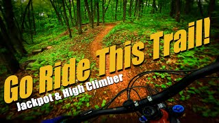
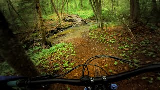
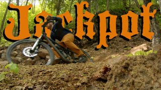
High Climber runs from Skihill Rd at Lutsen to the Onion River road. the trail continues as Jackpot trial on the other side of Onion River road, for a total distance between trailheads of about 15 miles.
This side is slightly easier than the Jackpot side: the rock gardens and armored sections a fewer, and smoother.

Access Info

Drive up Ski Hill road in Lutsen, past the ski lifts until the road turns to gravel. Park here. Follow the rough gravel road onwards, and follow the signs for Highclimber MTB trail. Do not start on the Superior Hiking trail.

Local Trail Association

Recent Activity on Trail

Past Week
  • 2 rides
  • 11 miles average
6 Months
  • 2 rides
  • 11 miles avg distance
All
  • 114 rides
  • Last: Jun 14, 2026
c1c2c3c4
January
February
March
April
May
June
July
August
September
October
November
December
update trails status or condition

High Climber Trail Reports

statusdatedescription
Oct 30, 2025 @ 11:59am (America/Chicago)
Oct 30, 2025
Fall riding couldn't be better, get some!
Aug 17, 2025 @ 6:08pm
Aug 17, 2025
Superb work rejuvenating this trail!
Aug 11, 2025 @ 8:18am
Aug 11, 2025
excellent!!!!
Jul 31, 2025 @ 7:29am
Jul 31, 2025
Opened today per SCA
Jun 25, 2025 @ 1:55pm
Jun 25, 2025
more »
Status:
on Oct 30, 2025
Ideal
Avg: 4.33 (10 votes)
Your vote: 0

view (804)
close
3D
Trail Conditions
  • Unknown
  • Snow Groomed
  • Snow Packed
  • Snow Covered
  • Snow Cover Partial
  • Freeze/thaw Cycle
  • Icy
  • Prevalent Mud
  • Wet
  • Variable
  • Ideal
  • Dry
  • Very Dry
Trail Flow (Ridden Direction)
Trailforks scans users ridelogs to determine the most popular direction each trail is ridden. A good flowing trail network will have most trails flowing in a single direction according to their intension.
The colour categories are based on what percentage of riders are riding a trail in its intended direction.
  • > 96%
  • > 90%
  • > 80%
  • > 70%
  • > 50%
  • < 50%
  • bi-directional trail
  • no data
Trail Last Ridden
Trailforks scans ridelogs to determine the last time a trail was ridden.
  • < 2 days
  • < 1 week
  • < 2 weeks
  • < 1 month
  • < 6 months
  • > 6 months
Trail Ridden Direction
The intended direction a trail should be ridden.
  • Downhill Only
  • Downhill Primary
  • Both Directions
  • Uphill Primary
  • Uphill Only
  • One Direction
Contribute Details
Colors indicate trail is missing specified detail.
  • Description
  • Photos
  • Description & Photos
  • Videos
Trail Popularity ?
Trailforks scans ridelogs to determine which trails are ridden the most in the last 9 months. Trails are compared with nearby trails in the same city region with a possible 25 colour shades. Think of this as a heatmap, more rides = more kinetic energy = warmer colors.
  • most popular
  • popular
  • less popular
  • not popular
ATV/ORV/OHV Filter
Max Vehicle Width
inches
US Cell Coverage
Legend
cell carrier legend

Radar Time
Activity Recordings
Trailforks uses anonymized public activity data. ?
Activity Recordings
Trailforks uses anonymized public activity data. ?
Personal Heatmap
Activity Types
all / none
Options
2
Date range month
Winter Trails
Warning A routing network for winter maps does not exist. Selecting trails using the winter trails layer has been disabled.
Missing Trails
Most Popular
Least Popular
Trails are colored based on popularity. The more popular a trail is, the more red. Less popular trails trend towards green.
Jump Magnitude Heatmap
Heatmap of where riders jump on trails. Zoom in to see individual jumps, click circles to view jump details.
BC Backroad Status

Service Road Atlas is a free to use, community-driven service for viewing and creating reports on the numerous back-country service roads around B.C. and Alberta.

map legend
Slope Aspect
Direction the slope faces
Flat N NE E SE S SW W NW
Trails Deemphasized
Trails are shown in grey.
disable
Only show trails with no bike usage.
Enable
Suggested Layers
Based on selected activity type

    Save the current map location and zoom level as your default home location whenever this page is loaded.

    Save
        Directions to high-climber trailhead (47.667410, -90.724470)

        Photos

        12 more »
        120 |
        Sep 4, 2023 @ 2:57pm
        Sep 4, 2023
        121 |
        Sep 4, 2023 @ 2:57pm
        Sep 4, 2023
        108 |
        Aug 21, 2023 @ 1:14pm
        Aug 21, 2023
        125 |
        Aug 21, 2023 @ 1:14pm
        Aug 21, 2023

        Videos

        3 more »
        youtuber The BEST flow trail in Minnesota? || Jackpot...
        16:23 | 945 | Jul 4, 2022 , Tofte
        youtuber I might have hit the Jackpot! || High Climber...
        17:31 | 364 | Jun 27, 2022 , Tofte
        Jackpot & HighClimber | Tofte &...
        18:40 | 590 | Jun 10, 2021 , Tofte

        Routes with this trail

        27 miles 2,176 ft 3 Loop
        Easy/flat paved bike trail (Gitchee-Gami State Trail) running along Hwy 61 connecting endpoints of epic...
        32 miles 2,948 ft 5 Out & Back
        Out and back double-track trail, starting at the lutsen resort.

        7 Reviews & Comments


        We hope you've been enjoying Trailforks!

        Create a FREE account to view trail comments and much more.

        • By nedersotanTF Pro & contributors
        • #317654 - 8,062 views

        Frequently Asked Questions About High Climber

        Where is High Climber located?
        High Climber is located in Tofte, Minnesota, United States. It is part of the Tofte trail network. The trailhead is located at coordinates 47.66741, -90.72447.
        How hard is High Climber?
        High Climber is rated as Blue difficulty. The physical rating is Easy. The average grade is 0.5%. The climb difficulty is rated Green.
        What is the elevation gain for High Climber?
        High Climber has 717 ft of elevation gain. The trail has 575 ft of elevation descent. The elevation ranges from 1,299 ft to 1,641 ft.
        Is High Climber a point to point trail?
        High Climber is not a point to point trail. The direction is Both Directions. The trail type is singletrack.

        Hit the Trail

        Open in App

        Get this trail on your phone instantly.
        open trail in app

        Download Trail

        Save to wishlist, Garmin & download.
        save the trail

        Find Related Routes

        Find routes and users activities that include this trail.
        find routes for this trail

        You must enter a description before submitting.