more stats
3.6 miles
Distance
1,401 ft
Climb
-194 ft
Descent
00:59:41
Avg time
1,206 ft
Altitude change
6,544 ft
Altitude min
7,846 ft
Altitude max
6,544 ft
Altitude start
7,749 ft
Altitude end
6.3%
Grade
-13.9%
Grade max
38.5%
Grade min
2 miles
Distance climb
1 mile
Distance down
807 ft
Distance flat
00:59:41
Avg time

High Meadows Road Details

  • Activities
    • Mountain Bike
    • E-Bike
    • Gravel Bike
    • Adaptive Bike
    • Horse
    • Hike
    • Trail Running
  • Riding Area
    Powerline
    South Lake Tahoe, California
  • Ref Number
    12N21
  • Difficulty Rating
  • Local Popularity
    80 in Mountain Biking [+]
    • 75 in E-Biking
    • 75 in Trail Running
    • 45 in Hiking
    • 5 in Horseback
  • Hiking SAC Scale
    T1 Hiking
  • Trail Type
    Dirt/Gravel Road
  • Bike Type
    AM, XC, Adaptive MTB, Gravel
  • Direction
    Both Directions[+]
    Popular Direction Shown
    • Both Directions for Gravel Biking
  • Climb Difficulty
    Green
  • Physical Rating
    Hard
  • Trail Visibility
    Always easy to follow
  • Season
    May-November
  • Dogs Allowed
    Yes
  • eBike Allowed
  • Land Owner
    USFS Lake Tahoe Basin Management Unit

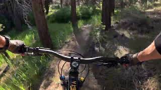
This forest access road is usually used by riders who want access to the Star Lake Trail without the bother of the technical uphill of Upper Cold Creek Trail. This road is very steep - shortly after the motor vehicle closure gate, the grade averages 15%+, with many short sections in excess of 25%.

Riding down this road is highly discouraged because the combination of the gravel surface, water bars, and steep incline makes it easy to lose control.

Access Info

From the end of High Meadow Road continue on the forest access road to High Meadow.

Disclaimer

Motorized vehicles, OHV, and eBikes are not allowed passed the parking area and gate.

Adaptive Bike Info
aMTB Green Rating: Beginner features and moderate terrain.

road climb up to a meadow, with steep sections.

Trail Supporters

  • USFS
    Land Manager
Local Trail Association
Traditionally Indigenous Territory

Recent Activity on Trail

Past Week
  • 0 rides
  •  
6 Months
  • 27 rides
  • 13 miles avg distance
All
  • 220 rides
  • Last: Jun 21, 2026
c1c2c3c4
January
February
March
April
May
June
July
August
September
October
November
December
update trails status or condition

High Meadows Road Trail Reports

statusdatedescription
May 31, 2025 @ 12:04pm
May 31, 2025
May 24, 2024 @ 6:24pm
May 24, 2024
Snow’s all gone.
Aug 23, 2023 @ 8:09am
Aug 23, 2023
Jul 10, 2021 @ 7:47am
Jul 10, 2021
May 1, 2021 @ 10:48am
May 1, 2021
Couple snowy patches, especially east of Star Lake trailhead, but almost clear.
more »
Status:
on May 31, 2025
Dry
Avg: 3.99 (6 votes)
Your vote: 0

view (992)
close
3D
Trail Conditions
  • Unknown
  • Snow Groomed
  • Snow Packed
  • Snow Covered
  • Snow Cover Partial
  • Freeze/thaw Cycle
  • Icy
  • Prevalent Mud
  • Wet
  • Variable
  • Ideal
  • Dry
  • Very Dry
Trail Flow (Ridden Direction)
Trailforks scans users ridelogs to determine the most popular direction each trail is ridden. A good flowing trail network will have most trails flowing in a single direction according to their intension.
The colour categories are based on what percentage of riders are riding a trail in its intended direction.
  • > 96%
  • > 90%
  • > 80%
  • > 70%
  • > 50%
  • < 50%
  • bi-directional trail
  • no data
Trail Last Ridden
Trailforks scans ridelogs to determine the last time a trail was ridden.
  • < 2 days
  • < 1 week
  • < 2 weeks
  • < 1 month
  • < 6 months
  • > 6 months
Trail Ridden Direction
The intended direction a trail should be ridden.
  • Downhill Only
  • Downhill Primary
  • Both Directions
  • Uphill Primary
  • Uphill Only
  • One Direction
Contribute Details
Colors indicate trail is missing specified detail.
  • Description
  • Photos
  • Description & Photos
  • Videos
Trail Popularity ?
Trailforks scans ridelogs to determine which trails are ridden the most in the last 9 months. Trails are compared with nearby trails in the same city region with a possible 25 colour shades. Think of this as a heatmap, more rides = more kinetic energy = warmer colors.
  • most popular
  • popular
  • less popular
  • not popular
ATV/ORV/OHV Filter
Max Vehicle Width
inches
US Cell Coverage
Legend
cell carrier legend

Radar Time
Activity Recordings
Trailforks uses anonymized public activity data. ?
Activity Recordings
Trailforks uses anonymized public activity data. ?
Personal Heatmap
Activity Types
all / none
Options
2
Date range month
Winter Trails
Warning A routing network for winter maps does not exist. Selecting trails using the winter trails layer has been disabled.
Missing Trails
Most Popular
Least Popular
Trails are colored based on popularity. The more popular a trail is, the more red. Less popular trails trend towards green.
Jump Magnitude Heatmap
Heatmap of where riders jump on trails. Zoom in to see individual jumps, click circles to view jump details.
BC Backroad Status

Service Road Atlas is a free to use, community-driven service for viewing and creating reports on the numerous back-country service roads around B.C. and Alberta.

map legend
Slope Aspect
Direction the slope faces
Flat N NE E SE S SW W NW
Trails Deemphasized
Trails are shown in grey.
disable
Only show trails with no bike usage.
Enable
Suggested Layers
Based on selected activity type

    Save the current map location and zoom level as your default home location whenever this page is loaded.

    Save
        Directions to high-meadows-road trailhead (38.898030, -119.957610)

        Photos

        8 more »
        133 |
        Aug 1, 2021 @ 10:16pm
        Aug 1, 2021
        143 |
        Jul 27, 2020 @ 12:51pm
        Jul 27, 2020
        137 |
        Jul 14, 2020 @ 9:03pm
        Jul 14, 2020
        144 |
        Jul 14, 2020 @ 9:03pm
        Jul 14, 2020

        Videos

        1 more »
        RAW High Meadow UPHIIL - 1300ft climb  - South...
        56:44 | 124 | Jun 25, 2024 , South Lake Tahoe

        Routes with this trail

        4.5 26 miles 4,490 ft 13 Loop
        26-mile ride with almost 100% singletrack, two summits and amazing descents. Lots of tecnical singletrack...
        4.0 20 miles 3,223 ft 26
        For 2019, the Tahoe Triple Crown Ride has transformed into a butterfly. TAMBA & USFS have been monitoring...
        3.0 24 miles 3,184 ft 9 Point to Point
        Ride the Tahoe Rim Trail from the Stagecoach base area to Star Lake. From Star Lake we will ride descend...

        5 Reviews & Comments


        We hope you've been enjoying Trailforks!

        Create a FREE account to view trail comments and much more.

        • By TheAngryTomatoTF Pro TRAILFORKS & contributors
        • #23530 - 9,014 views

        Frequently Asked Questions About High Meadows Road

        Where is High Meadows Road located?
        High Meadows Road is located in Powerline, South Lake Tahoe, California, United States. It is part of the Powerline trail network. The trailhead is located at coordinates 38.89803, -119.95761.
        What is the elevation gain for High Meadows Road?
        High Meadows Road has 1,401 ft of elevation gain. The trail has 194 ft of elevation descent. The elevation ranges from 6,544 ft to 7,846 ft.
        Is High Meadows Road a point to point trail?
        High Meadows Road is not a point to point trail. The direction is Both Directions. The trail type is dirt/gravel road.
        How long is High Meadows Road?
        High Meadows Road is 3.6 miles long. The trail type is dirt/gravel road.

        Hit the Trail

        Open in App

        Get this trail on your phone instantly.
        open trail in app

        Download Trail

        Save to wishlist, Garmin & download.
        save the trail

        Find Related Routes

        Find routes and users activities that include this trail.
        find routes for this trail

        You must enter a description before submitting.