more stats
3,468 ft
Distance
8 ft
Climb
-473 ft
Descent
00:13:11
Avg time
-465 ft
Altitude change
2,749 ft
Altitude min
3,213 ft
Altitude max
3,213 ft
Altitude start
2,749 ft
Altitude end
-13.4%
Grade
-44.4%
Grade max
7.6%
Grade min
243 ft
Distance climb
3,015 ft
Distance down
213 ft
Distance flat
00:13:11
Avg time

High Society Details

  • Activities
    • Mountain Bike
    • E-Bike
    • Hike
    • Trail Running
  • Riding Area
    Westside - Sproatt
    Whistler, British Columbia
  • Difficulty Rating
  • Voted Difficulty
    Double Black Diamond (3 votes)
  • Local Popularity
    55 in Mountain Biking [+]
    • 50 in E-Biking
    • 35 in Trail Running
    • 5 in Hiking
  • Global Ranking
    #61542 in Mountain Biking [+]
    • #75232 in E-Biking
    • #125641 in Trail Running
    • #130490 in Hiking
  • Trail Type
    Singletrack
  • Bike Type
    AM
  • Direction
    Downhill Primary
    Popular Direction Shown
  • Climb Difficulty
    Blue
  • Physical Rating
    Hard
  • Dogs Allowed
    Yes
  • eBike Allowed
    Yes up to Class 1
  • TTFs on Trail
    Drop, Rock Face, Skinny

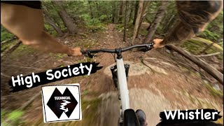
High Society is a trail that descends steeply from the Flank trail, offering some great views. The trail could be considered a double-black, but is more accurately rated a hard black. Several rooty and rocky drops line the route along with rockfaces, including High Society's signature. High Society is a great trail with great views.

Access Info

The trail descends off the Flank trail in between Working Class and [L=https://www.trailforks.com/trails/legalize-it/Legalize It[/L]. There are a couple of options for accessing the Flank: either ride up the normal entrance from Function or 21 Mile Creek, or more directly via Stonebridge Drive. For the latter, ride up Stonebridge Drive and turn left on Stonebridge Place. At the end of this road, follow an access road up a steep climb. At a water tower veer right onto single track and climb relentlessly until to hit the Flank trail.

Trail Supporters
Local Trail Association

Recent Activity on Trail

Past Week
  • 1 rides
  • 4 miles average
6 Months
  • 12 rides
  • 10 miles avg distance
All
  • 323 rides
  • Last: Jun 17, 2026
c1c2c3c4
January
February
March
April
May
June
July
August
September
October
November
December
Status:
on Apr 29, 2026
Variable
Avg: 4.19 (36 votes)
Your vote: 0

view (1,773)
close
3D
Trail Conditions
  • Unknown
  • Snow Groomed
  • Snow Packed
  • Snow Covered
  • Snow Cover Partial
  • Freeze/thaw Cycle
  • Icy
  • Prevalent Mud
  • Wet
  • Variable
  • Ideal
  • Dry
  • Very Dry
Trail Flow (Ridden Direction)
Trailforks scans users ridelogs to determine the most popular direction each trail is ridden. A good flowing trail network will have most trails flowing in a single direction according to their intension.
The colour categories are based on what percentage of riders are riding a trail in its intended direction.
  • > 96%
  • > 90%
  • > 80%
  • > 70%
  • > 50%
  • < 50%
  • bi-directional trail
  • no data
Trail Last Ridden
Trailforks scans ridelogs to determine the last time a trail was ridden.
  • < 2 days
  • < 1 week
  • < 2 weeks
  • < 1 month
  • < 6 months
  • > 6 months
Trail Ridden Direction
The intended direction a trail should be ridden.
  • Downhill Only
  • Downhill Primary
  • Both Directions
  • Uphill Primary
  • Uphill Only
  • One Direction
Contribute Details
Colors indicate trail is missing specified detail.
  • Description
  • Photos
  • Description & Photos
  • Videos
Trail Popularity ?
Trailforks scans ridelogs to determine which trails are ridden the most in the last 9 months. Trails are compared with nearby trails in the same city region with a possible 25 colour shades. Think of this as a heatmap, more rides = more kinetic energy = warmer colors.
  • most popular
  • popular
  • less popular
  • not popular
ATV/ORV/OHV Filter
Max Vehicle Width
inches
US Cell Coverage
Legend
cell carrier legend

Radar Time
Activity Recordings
Trailforks uses anonymized public activity data. ?
Activity Recordings
Trailforks uses anonymized public activity data. ?
Personal Heatmap
Activity Types
all / none
Options
2
Date range month
Winter Trails
Warning A routing network for winter maps does not exist. Selecting trails using the winter trails layer has been disabled.
Missing Trails
Most Popular
Least Popular
Trails are colored based on popularity. The more popular a trail is, the more red. Less popular trails trend towards green.
Jump Magnitude Heatmap
Heatmap of where riders jump on trails. Zoom in to see individual jumps, click circles to view jump details.
BC Backroad Status

Service Road Atlas is a free to use, community-driven service for viewing and creating reports on the numerous back-country service roads around B.C. and Alberta.

map legend
Slope Aspect
Direction the slope faces
Flat N NE E SE S SW W NW
Trails Deemphasized
Trails are shown in grey.
disable
Only show trails with no bike usage.
Enable
Suggested Layers
Based on selected activity type

    Save the current map location and zoom level as your default home location whenever this page is loaded.

    Save
        Directions to high-society trailhead (50.107630, -123.011240)

        Photos

        38 more »
        1,118 |
        May 25, 2016 @ 11:15am
        May 25, 2016
        1,228 |
        Jun 24, 2015 @ 10:28pm
        Jun 24, 2015
        167 |
        Sep 27, 2022 @ 3:33am
        Sep 27, 2022
        316 |
        Nov 11, 2019 @ 8:53am
        Nov 11, 2019

        Videos

        8 more »
        youtuber HIGH SOCIETY | Double Black Trail | Whistler 2024
        4:56 | 390 | Jun 28, 2024 , Whistler
        youtuber High Society, Whistler West Side Trails, ...
        8:15 | 1825 | Jun 16, 2017 , Whistler
        HIGH SOCIETY 4K - NEW JERRYS ON THE BLOCK
        2:51 | 813 | Aug 11, 2020 , Whistler
        [4K] Classic Whistler Westside GNAR!!! | High...
        5:31 | 971 | Aug 6, 2018 , Whistler

        Trail Lists

        Routes with this trail

        3.3 17 miles 4,508 ft 13
        This loop is an absolute gem and is definitely worth the 5000 foot climb (with the reward of a 5000 foot...
        4.2 13 miles 1,896 ft 41 Loop
        A Sample of Whistler's Westside is an advanced technical trail featuring several rockfaces, difficult...
        3.0 1 mile 19 ft 5
        WORCA Virtual Thriller Monday, August 12- Saturday, August 17 Collect your badge to earn your Apres deal...

        Trail Products

        5 Reviews & Comments


        We hope you've been enjoying Trailforks!

        Create a FREE account to view trail comments and much more.

        • By canadakaTF Pro Trailforks & contributors
        • #1677 - 14,117 views

        Frequently Asked Questions About High Society

        Where is High Society located?
        High Society is located in Westside - Sproatt, Whistler, British Columbia, Canada. It is part of the Westside - Sproatt trail network. The trailhead is located at coordinates 50.10763, -123.01124.
        How hard is High Society?
        High Society is rated as Double Black Diamond difficulty. The physical rating is Hard. The average grade is 13.4%. The climb difficulty is rated Blue.
        What is the elevation gain for High Society?
        High Society has 8 ft of elevation gain. The trail has 473 ft of elevation descent. The elevation ranges from 2,749 ft to 3,213 ft.
        Is High Society a point to point trail?
        High Society is not a point to point trail. The direction is Downhill Primary. The trail type is singletrack.

        Hit the Trail

        Open in App

        Get this trail on your phone instantly.
        open trail in app

        Download Trail

        Save to wishlist, Garmin & download.
        save the trail

        Find Related Routes

        Find routes and users activities that include this trail.
        find routes for this trail

        You must enter a description before submitting.