more stats
1,325 ft
Distance
-175 ft
Descent
00:02:46
Avg time
-176 ft
Altitude change
602 ft
Altitude min
778 ft
Altitude max
778 ft
Altitude start
604 ft
Altitude end
-13.3%
Grade
-46.4%
Grade max
-1.3%
Grade min
1,230 ft
Distance down
46 ft
Distance flat
00:02:46
Avg time

Hippy lower Details

  • Activities
    • Mountain Bike
    • E-Bike
  • Riding Area
    Balquhidder
    Strathyre
  • Difficulty Rating
  • Local Popularity
    75 in Mountain Biking [+]
    • 95 in E-Biking
  • Global Ranking
    #43670 in Mountain Biking [+]
    • #23508 in E-Biking
  • Trail Type
    Singletrack
  • Bike Type
    AM, XC
  • Climb Difficulty
    Blue
  • Physical Rating
    Moderate
  • Trail Visibility
    Always easy to follow
  • eBike Allowed
    Yes up to Class 1
  • TTFs on Trail
    Berm, Drop
  • Ride in Rain
    Yes
  • Land Owner
    Forestry And Land Scotland

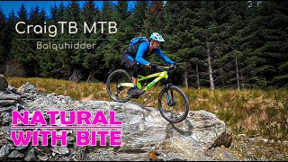
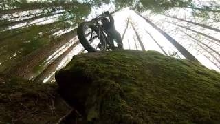
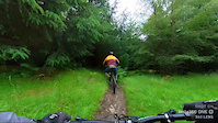
The "Hippy lower" is the bottom section of a series of 3 continuous trails, the UPPER, MID and LOWER HIPPY, all totalling about 950m. The "lower" section is the fastest of the three with a flowy line, berms and log drops. It just gets quicker the further down you get, so let off those brakes In the last 100metres the trail forks - keep left for the flowy line or if you prefer there's also "Le Big Mac" a huge 2.5metre boulder with a steep tecky roll over the edge to challenge you. Choose with care :-)

Access Info

Park at Balquhidder Hall or Kirk and use forestry roads.

Local Trail Association

Recent Activity on Trail

Past Week
  • 0 rides
  •  
6 Months
  • 9 rides
  • 12 miles avg distance
All
  • 54 rides
  • Last: Jun 21, 2026
c1c2c3c4
January
February
March
April
May
June
July
August
September
October
November
December
update trails status or condition

Hippy lower Trail Reports

statusdatedescription
Feb 15, 2025 @ 4:49am
Feb 15, 2025
all clear except for one tree beside Ramsey's rock which is passable
Dec 27, 2024 @ 10:19am
Dec 27, 2024
Slippery fun.
Nov 3, 2024 @ 8:10am
Nov 3, 2024
Nov 3, 2024 @ 8:09am
Nov 3, 2024
running really well. lots of leaves down hiding roots and rocks.
Jun 22, 2024 @ 3:12am
Jun 22, 2024
more »
Status:
on Feb 15, 2025
Variable
Avg: 4.62 (10 votes)
Your vote: 0

view (873)
close
3D
Trail Conditions
  • Unknown
  • Snow Groomed
  • Snow Packed
  • Snow Covered
  • Snow Cover Partial
  • Freeze/thaw Cycle
  • Icy
  • Prevalent Mud
  • Wet
  • Variable
  • Ideal
  • Dry
  • Very Dry
Trail Flow (Ridden Direction)
Trailforks scans users ridelogs to determine the most popular direction each trail is ridden. A good flowing trail network will have most trails flowing in a single direction according to their intension.
The colour categories are based on what percentage of riders are riding a trail in its intended direction.
  • > 96%
  • > 90%
  • > 80%
  • > 70%
  • > 50%
  • < 50%
  • bi-directional trail
  • no data
Trail Last Ridden
Trailforks scans ridelogs to determine the last time a trail was ridden.
  • < 2 days
  • < 1 week
  • < 2 weeks
  • < 1 month
  • < 6 months
  • > 6 months
Trail Ridden Direction
The intended direction a trail should be ridden.
  • Downhill Only
  • Downhill Primary
  • Both Directions
  • Uphill Primary
  • Uphill Only
  • One Direction
Contribute Details
Colors indicate trail is missing specified detail.
  • Description
  • Photos
  • Description & Photos
  • Videos
Trail Popularity ?
Trailforks scans ridelogs to determine which trails are ridden the most in the last 9 months. Trails are compared with nearby trails in the same city region with a possible 25 colour shades. Think of this as a heatmap, more rides = more kinetic energy = warmer colors.
  • most popular
  • popular
  • less popular
  • not popular
ATV/ORV/OHV Filter
Max Vehicle Width
inches
US Cell Coverage
Legend
cell carrier legend

Radar Time
Activity Recordings
Trailforks uses anonymized public activity data. ?
Activity Recordings
Trailforks uses anonymized public activity data. ?
Personal Heatmap
Activity Types
all / none
Options
2
Date range month
Winter Trails
Warning A routing network for winter maps does not exist. Selecting trails using the winter trails layer has been disabled.
Missing Trails
Most Popular
Least Popular
Trails are colored based on popularity. The more popular a trail is, the more red. Less popular trails trend towards green.
Jump Magnitude Heatmap
Heatmap of where riders jump on trails. Zoom in to see individual jumps, click circles to view jump details.
BC Backroad Status

Service Road Atlas is a free to use, community-driven service for viewing and creating reports on the numerous back-country service roads around B.C. and Alberta.

map legend
Slope Aspect
Direction the slope faces
Flat N NE E SE S SW W NW
Trails Deemphasized
Trails are shown in grey.
disable
Only show trails with no bike usage.
Enable
Suggested Layers
Based on selected activity type

    Save the current map location and zoom level as your default home location whenever this page is loaded.

    Save
        Directions to hippy-lower-101207 trailhead (56.361610, -4.372170)

        Photos

        8 more »
        45 |
        Feb 5, 2021 @ 5:45am
        Feb 5, 2021
        58 |
        Feb 5, 2021 @ 5:45am
        Feb 5, 2021
        43 |
        Feb 5, 2021 @ 5:45am
        Feb 5, 2021
        87 |
        May 3, 2019 @ 7:26am
        May 3, 2019

        Videos

        3 more »
        NATURAL MTB TRAILS - Balquhidder
        6:55 | 151 | Oct 18, 2020 , Strathyre
        Balquhidder MTB Trails - The HIPPY Singletrack
        2:32 | 175 | Sep 11, 2020 , Strathyre
        Hippy Lower on hardtail XC
        2:24 | 12 | Jun 24, 2024 , Strathyre

        1 Review & Comments


        We hope you've been enjoying Trailforks!

        Create a FREE account to view trail comments and much more.

        Nearby Trails

        • By gav-sTF Pro & contributors
        • #101207 - 1,598 views

        Frequently Asked Questions About Hippy lower

        Where is Hippy lower located?
        Hippy lower is located in Balquhidder, Strathyre, United Kingdom. It is part of the Balquhidder trail network. The trailhead is located at coordinates 56.36161, -4.37217.
        How hard is Hippy lower?
        Hippy lower is rated as Red difficulty. The physical rating is Moderate. The average grade is 13.3%. The climb difficulty is rated Blue.
        What is the elevation gain for Hippy lower?
        The trail has 175 ft of elevation descent. The elevation ranges from 602 ft to 778 ft.
        How long is Hippy lower?
        Hippy lower is 1,325 ft long. The trail type is singletrack.

        Hit the Trail

        Open in App

        Get this trail on your phone instantly.
        open trail in app

        Download Trail

        Save to wishlist, Garmin & download.
        save the trail

        Find Related Routes

        Find routes and users activities that include this trail.
        find routes for this trail

        You must enter a description before submitting.