more stats
4.0 miles
Distance
745 ft
Climb
-702 ft
Descent
00:58:41
Avg time
41 ft
Altitude change
2,873 ft
Altitude min
3,455 ft
Altitude max
2,982 ft
Altitude start
3,025 ft
Altitude end
0.2%
Grade
-63.6%
Grade max
32.9%
Grade min
2 miles
Distance climb
2 miles
Distance down
1,867 ft
Distance flat
00:58:41
Avg time

Hogs Back Details

  • Activities
    • Mountain Bike
    • E-Bike
    • Hike
    • Trail Running
  • Riding Area
    Craigieburn Trails
    Craigieburn Forest Park
  • Difficulty Rating
  • Local Popularity
    60 in Mountain Biking [+]
    • 95 in E-Biking
    • 95 in Trail Running
    • 65 in Hiking
  • Global Ranking
    #34508 in Mountain Biking [+]
    • #2616 in E-Biking
    • #436 in Trail Running
    • #62536 in Hiking
  • Hiking SAC Scale
    T2 Mountain Hiking
  • Trail Type
    Singletrack
  • Bike Type
    AM, XC
  • Direction
    Both Directions
    Popular Direction Shown
  • Climb Difficulty
    Blue
  • Physical Rating
    Moderate
  • Trail Visibility
    Always easy to follow
  • Season
    Oct - Apr
  • Alpine Trail
    Yes
  • eBike Allowed
    Yes up to Class 1
  • TTFs on Trail
    Berm, Bridge, Jump, Rock Garden
  • Year Opened
    2010
  • Land Owner
    Department of Conservation

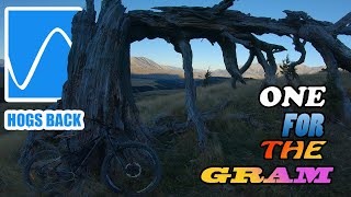
A flowing single track with a mars-scape scenery up the top of Hogs Back. Check whether it's open on the Craigieburn Trails website here.

Access Info

Parking by the entrance of the Track at both ends, one in Castle Hill village and the other at Texas Flat on the Cheeseman Ski Field road.

Local Trail Association
Traditionally Indigenous Territory

Recent Activity on Trail

Past Week
  • 0 rides
  •  
6 Months
  • 44 rides
  • 35 miles avg distance
All
  • 125 rides
  • Last: Apr 27, 2026
c1c2c3c4
January
February
March
April
May
June
July
August
September
October
November
December
update trails status or condition

Hogs Back Trail Reports

statusdatedescription
May 18, 2026 @ 5:39pm (America/Los_Angeles)
May 18, 2026
reporter
reroute of steep section on picnic rock side of Waterfall creek
May 4, 2026 @ 8:58pm (Pacific/Auckland)
May 4, 2026
reporter Closed for Winter 2026
May 4, 2026 @ 8:51pm (Pacific/Auckland)
May 4, 2026
reporter
Feb 22, 2026 @ 8:30am (Pacific/Auckland)
Feb 21, 2026
Jan 30, 2026 @ 8:12pm (Pacific/Auckland)
Jan 29, 2026
Long Creek had been washed out and it's difficult to cross the river with bikes
more »
Status:
on May 18, 2026
Freeze/thaw Cycle
Avg: 4.36 (19 votes)
Your vote: 0

view (1,310)
close
3D
Trail Conditions
  • Unknown
  • Snow Groomed
  • Snow Packed
  • Snow Covered
  • Snow Cover Partial
  • Freeze/thaw Cycle
  • Icy
  • Prevalent Mud
  • Wet
  • Variable
  • Ideal
  • Dry
  • Very Dry
Trail Flow (Ridden Direction)
Trailforks scans users ridelogs to determine the most popular direction each trail is ridden. A good flowing trail network will have most trails flowing in a single direction according to their intension.
The colour categories are based on what percentage of riders are riding a trail in its intended direction.
  • > 96%
  • > 90%
  • > 80%
  • > 70%
  • > 50%
  • < 50%
  • bi-directional trail
  • no data
Trail Last Ridden
Trailforks scans ridelogs to determine the last time a trail was ridden.
  • < 2 days
  • < 1 week
  • < 2 weeks
  • < 1 month
  • < 6 months
  • > 6 months
Trail Ridden Direction
The intended direction a trail should be ridden.
  • Downhill Only
  • Downhill Primary
  • Both Directions
  • Uphill Primary
  • Uphill Only
  • One Direction
Contribute Details
Colors indicate trail is missing specified detail.
  • Description
  • Photos
  • Description & Photos
  • Videos
Trail Popularity ?
Trailforks scans ridelogs to determine which trails are ridden the most in the last 9 months. Trails are compared with nearby trails in the same city region with a possible 25 colour shades. Think of this as a heatmap, more rides = more kinetic energy = warmer colors.
  • most popular
  • popular
  • less popular
  • not popular
ATV/ORV/OHV Filter
Max Vehicle Width
inches
US Cell Coverage
Legend
cell carrier legend

Radar Time
Activity Recordings
Trailforks uses anonymized public activity data. ?
Activity Recordings
Trailforks uses anonymized public activity data. ?
Personal Heatmap
Activity Types
all / none
Options
2
Date range month
Winter Trails
Warning A routing network for winter maps does not exist. Selecting trails using the winter trails layer has been disabled.
Missing Trails
Most Popular
Least Popular
Trails are colored based on popularity. The more popular a trail is, the more red. Less popular trails trend towards green.
Jump Magnitude Heatmap
Heatmap of where riders jump on trails. Zoom in to see individual jumps, click circles to view jump details.
BC Backroad Status

Service Road Atlas is a free to use, community-driven service for viewing and creating reports on the numerous back-country service roads around B.C. and Alberta.

map legend
Slope Aspect
Direction the slope faces
Flat N NE E SE S SW W NW
Trails Deemphasized
Trails are shown in grey.
disable
Only show trails with no bike usage.
Enable
Suggested Layers
Based on selected activity type

    Save the current map location and zoom level as your default home location whenever this page is loaded.

    Save
        Directions to hogs-back trailhead (-43.178580, 171.688230)

        Photos

        47 more »
        18 |
        Feb 20, 2026 @ 1:18pm
        Feb 20, 2026
        137 |
        Oct 2, 2022 @ 12:55pm
        Oct 2, 2022
        104 |
        Oct 1, 2022 @ 3:40pm
        Oct 1, 2022
        92 |
        Oct 1, 2022 @ 3:18pm
        Oct 1, 2022

        Videos

        2 more »
        youtuber HOGS BACK TRAIL|Craigieburn Mountain Biking...
        12:16 | 503 | Oct 4, 2022 , Craigieburn Forest Park
        Cam Cole - another side episode 2
        4:16 | 13512 | Apr 7, 2013 , Craigieburn Forest Park

        Routes with this trail

        5.0 15 miles 3,413 ft 8 Point to Point
        The Craigieburn Trail is around 24 kilometres of sweet, off-road, scenic single-track from “Hill to...
        4.0 17 miles 3,755 ft 7 Point to Point
        Modified route of the recommended Craigieburn trail with the incorporated
        8 miles 1,039 ft 4 Shuttled
        The Cuckoo Creek trail is a classic natural NZ beech forest Enduro trail. Etched out by dedicated locals...

        1 Review & Comments


        We hope you've been enjoying Trailforks!

        Create a FREE account to view trail comments and much more.

        • By enduro86 & contributors
        • #5338 - 15,235 views

        Frequently Asked Questions About Hogs Back

        Where is Hogs Back located?
        Hogs Back is located in Craigieburn Trails, Craigieburn Forest Park, New Zealand. It is part of the Craigieburn Trails trail network. The trailhead is located at coordinates -43.17858, 171.68823.
        How hard is Hogs Back?
        Hogs Back is rated as Blue difficulty. The physical rating is Moderate. The average grade is 0.2%. The climb difficulty is rated Blue.
        What is the elevation gain for Hogs Back?
        Hogs Back has 745 ft of elevation gain. The trail has 702 ft of elevation descent. The elevation ranges from 2,873 ft to 3,455 ft.
        Is Hogs Back a point to point trail?
        Hogs Back is not a point to point trail. The direction is Both Directions. The trail type is singletrack.

        Hit the Trail

        Open in App

        Get this trail on your phone instantly.
        open trail in app

        Download Trail

        Save to wishlist, Garmin & download.
        save the trail

        Find Related Routes

        Find routes and users activities that include this trail.
        find routes for this trail

        You must enter a description before submitting.