more stats
5,200 ft
Distance
42 ft
Climb
-296 ft
Descent
00:08:52
Avg time
-253 ft
Altitude change
162 ft
Altitude min
423 ft
Altitude max
422 ft
Altitude start
171 ft
Altitude end
-4.9%
Grade
-31.1%
Grade max
27.6%
Grade min
709 ft
Distance climb
3,087 ft
Distance down
1,404 ft
Distance flat
00:08:52
Avg time

Holeshot Details

  • Activities
    • Mountain Bike
    • E-Bike
    • Hike
    • Trail Running
  • Riding Area
    San Onofre
    San Clemente, California
  • Difficulty Rating
  • Voted Difficulty
    Blue (2 votes)
  • Local Popularity
    65 in Mountain Biking [+]
    • 55 in E-Biking
    • 5 in Trail Running
    • 40 in Hiking
  • Global Ranking
    #75505 in Mountain Biking [+]
    • #62607 in E-Biking
    • #130111 in Trail Running
    • #117221 in Hiking
  • Trail Type
    Singletrack
  • Bike Type
    DH, AM, XC
  • Climb Difficulty
    Green
  • Physical Rating
    Easy
  • Trail Visibility
    Always easy to follow
  • Season
    Year Round
  • eBike Allowed
    Yes up to Class 1
  • TTFs on Trail
    Berm, Jump, Gap Jump, Ladder Bridge
  • Land Owner
    SHARE Mountain Bike Club

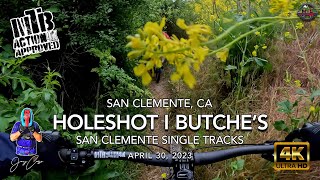
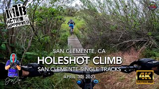
One of the first trails developed in the area. Good fast DH with some fun bermed turns near the bottom. Also an easy climb

Disclaimer

Watch out for riders coming up

Local Trail Association
Traditionally Indigenous Territory

Recent Activity on Trail

Past Week
  • 2 rides
  • 13 miles average
6 Months
  • 64 rides
  • 9 miles avg distance
All
  • 822 rides
  • Last: Jun 22, 2026
c1c2c3c4
January
February
March
April
May
June
July
August
September
October
November
December
update trails status or condition

Holeshot Trail Reports

statusdatedescription
May 12, 2026 @ 4:19pm (America/Los_Angeles)
May 12, 2026
clear
Mar 7, 2026 @ 2:25pm (America/Los_Angeles)
Mar 7, 2026
way overgrown
Nov 30, 2025 @ 7:37am (America/Los_Angeles)
Nov 30, 2025
Jul 22, 2025 @ 4:01pm
Jul 22, 2025
Keep an eye out for loose nails on the bridges...
Jan 19, 2025 @ 3:14pm
Jan 19, 2025
Trail clear BUT - Did this twice and did not get credit in ride log
more »
Status:
on May 12, 2026
Dry
Avg: 4.05 (13 votes)
Your vote: 0

view (6,187)
close
3D
Trail Conditions
  • Unknown
  • Snow Groomed
  • Snow Packed
  • Snow Covered
  • Snow Cover Partial
  • Freeze/thaw Cycle
  • Icy
  • Prevalent Mud
  • Wet
  • Variable
  • Ideal
  • Dry
  • Very Dry
Trail Flow (Ridden Direction)
Trailforks scans users ridelogs to determine the most popular direction each trail is ridden. A good flowing trail network will have most trails flowing in a single direction according to their intension.
The colour categories are based on what percentage of riders are riding a trail in its intended direction.
  • > 96%
  • > 90%
  • > 80%
  • > 70%
  • > 50%
  • < 50%
  • bi-directional trail
  • no data
Trail Last Ridden
Trailforks scans ridelogs to determine the last time a trail was ridden.
  • < 2 days
  • < 1 week
  • < 2 weeks
  • < 1 month
  • < 6 months
  • > 6 months
Trail Ridden Direction
The intended direction a trail should be ridden.
  • Downhill Only
  • Downhill Primary
  • Both Directions
  • Uphill Primary
  • Uphill Only
  • One Direction
Contribute Details
Colors indicate trail is missing specified detail.
  • Description
  • Photos
  • Description & Photos
  • Videos
Trail Popularity ?
Trailforks scans ridelogs to determine which trails are ridden the most in the last 9 months. Trails are compared with nearby trails in the same city region with a possible 25 colour shades. Think of this as a heatmap, more rides = more kinetic energy = warmer colors.
  • most popular
  • popular
  • less popular
  • not popular
ATV/ORV/OHV Filter
Max Vehicle Width
inches
US Cell Coverage
Legend
cell carrier legend

Radar Time
Activity Recordings
Trailforks uses anonymized public activity data. ?
Activity Recordings
Trailforks uses anonymized public activity data. ?
Personal Heatmap
Activity Types
all / none
Options
2
Date range month
Winter Trails
Warning A routing network for winter maps does not exist. Selecting trails using the winter trails layer has been disabled.
Missing Trails
Most Popular
Least Popular
Trails are colored based on popularity. The more popular a trail is, the more red. Less popular trails trend towards green.
Jump Magnitude Heatmap
Heatmap of where riders jump on trails. Zoom in to see individual jumps, click circles to view jump details.
BC Backroad Status

Service Road Atlas is a free to use, community-driven service for viewing and creating reports on the numerous back-country service roads around B.C. and Alberta.

map legend
Slope Aspect
Direction the slope faces
Flat N NE E SE S SW W NW
Trails Deemphasized
Trails are shown in grey.
disable
Only show trails with no bike usage.
Enable
Suggested Layers
Based on selected activity type

    Save the current map location and zoom level as your default home location whenever this page is loaded.

    Save
        Directions to holeshot trailhead (33.445590, -117.580620)

        Photos

        4 more »
        74 |
        Oct 28, 2023 @ 4:32pm
        Oct 28, 2023
        427 |
        Jan 29, 2019 @ 12:29pm
        Jan 29, 2019
        369 |
        Jan 7, 2016 @ 8:00pm
        Jan 7, 2016
        524 |
        Dec 29, 2015 @ 7:18am
        Dec 29, 2015

        Videos

        11 more »
        youtuber MTB Riding Holeshot & Butche's at San...
        12:08 | 333 | May 1, 2023 , San Clemente
        youtuber Orange County Mountain Bike Trails: Young...
        8:47 | 710 | Jan 1, 2020 , San Clemente
        youtuber MTB Riding Holeshot Climb at San Clemente...
        7:55 | 227 | May 2, 2023 , San Clemente
        youtuber San Clemente MTB Take Over | YT Group Ride 2022
        9:36 | 454 | Jan 24, 2022 , San Clemente

        Trail Lists

        Routes with this trail

        2.0 7 miles 927 ft 4 Loop
        Head down to South County to explore San Clemente Singletracks, a trail network that has been around for...
        10 miles 1,264 ft 14
        10 miler Intermediate Green/Blue
        10 miles 1,721 ft 10
        Holeshot, Blue Chair, Sloppy Seconds, , Dia, Bronco, Dan's, Bottom's Up, No Tools, and Butches all in a...

        5 Reviews & Comments


        We hope you've been enjoying Trailforks!

        Create a FREE account to view trail comments and much more.

        • By ericfoltzTF Pro TRAILFORKS & contributors
        • #45750 - 7,471 views

        Frequently Asked Questions About Holeshot

        Where is Holeshot located?
        Holeshot is located in San Onofre, San Clemente, California, United States. It is part of the San Onofre trail network. The trailhead is located at coordinates 33.44559, -117.58062.
        How hard is Holeshot?
        Holeshot is rated as Green difficulty. The physical rating is Easy. The average grade is 4.9%. The climb difficulty is rated Green.
        What is the elevation gain for Holeshot?
        Holeshot has 42 ft of elevation gain. The trail has 296 ft of elevation descent. The elevation ranges from 162 ft to 423 ft.
        How long is Holeshot?
        Holeshot is 5,200 ft long. The trail type is singletrack.

        Hit the Trail

        Open in App

        Get this trail on your phone instantly.
        open trail in app

        Download Trail

        Save to wishlist, Garmin & download.
        save the trail

        Find Related Routes

        Find routes and users activities that include this trail.
        find routes for this trail

        You must enter a description before submitting.